Streatley Place
Introduction
The photograph on this page of Streatley Place by Martin Addison as part of the Geograph project.
The Geograph project started in 2005 with the aim of publishing, organising and preserving representative images for every square kilometre of Great Britain, Ireland and the Isle of Man.

There are currently over 7.5m images from over 14,400 individuals and you can help contribute to the project by visiting https://www.geograph.org.uk
Streatley Place
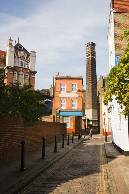
Image: © Martin Addison Taken: 10 Oct 2008
Looking along this narrow cobbled street towards the junction with New End. A pedestrian crosses into New End from Boad's Mews. The chimney beyond is the surviving remnant of New End Hospital. The large building on the Left is New End Primary School. The building on the corner of Streatley Place and Boad's Mews was once a public house, now in use a private dwelling.
Images are licensed for reuse under creativecommons.org/licenses/by-sa/2.0
Image Location
Latitude
51.558247
Longitude
-0.176042