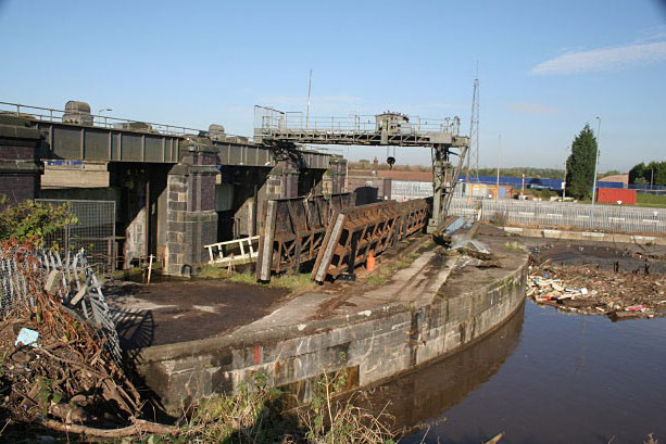
Sluices, Latchford Locks
Introduction
The photograph on this page of Sluices, Latchford Locks by Alan Murray-Rust as part of the Geograph project.
The Geograph project started in 2005 with the aim of publishing, organising and preserving representative images for every square kilometre of Great Britain, Ireland and the Isle of Man.
There are currently over 7.5m images from over 14,400 individuals and you can help contribute to the project by visiting https://www.geograph.org.uk

Image: © Alan Murray-Rust Taken: 6 Oct 2008
The top side of the sluices with spare gates and the gantry crane that would enable them to be manoeuvred into position. For each gate there is also a stop gate which will be lowered into the water channel to cut off the flow when the main gate needs to be maintained. These are underflow sluices which means that floating debris does not interfere with the gates and can be collected as and when necessary; this can be seen building up to the right. The large object is not in fact debris, but a spare lock gate. Keeping them afloat means that it is easy to tow them round to where they are needed, and the wooden meeting faces are also kept moist so that the timber does not split.

