Tenement
Introduction
The photograph on this page of Tenement by Bill Harrison as part of the Geograph project.
The Geograph project started in 2005 with the aim of publishing, organising and preserving representative images for every square kilometre of Great Britain, Ireland and the Isle of Man.

There are currently over 7.5m images from over 14,400 individuals and you can help contribute to the project by visiting https://www.geograph.org.uk
Tenement
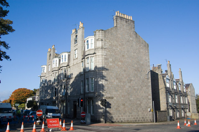
Image: © Bill Harrison Taken: 11 Oct 2008
A typical Aberdeen tenement block at the very busy junction of Berryden Road (heading off to the right) and Westburn Road (heading to the centre left). The niche in the nearer chimney breast has found a new use as a home for satellite dishes. The date-stone in the corner reads "Loyal Order (of) Ancient Shepherds 1904 A. U." where A. U. means Ashton Unity. Founded in Ashton-under-Lyne (a suburb of Manchester) in 1826 as a "sick and burial club," the Shepherds are still functioning today as a friendly society. For more on their history, see: http://www.historyshelf.org/shelf/friend/10.php
Images are licensed for reuse under creativecommons.org/licenses/by-sa/2.0
Image Location
Latitude
57.153015
Longitude
-2.112545