Clan Cancer Support Centre
Introduction
The photograph on this page of Clan Cancer Support Centre by Bill Harrison as part of the Geograph project.
The Geograph project started in 2005 with the aim of publishing, organising and preserving representative images for every square kilometre of Great Britain, Ireland and the Isle of Man.

There are currently over 7.5m images from over 14,400 individuals and you can help contribute to the project by visiting https://www.geograph.org.uk
Clan Cancer Support Centre
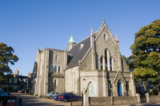
Image: © Bill Harrison Taken: 11 Oct 2008
Housed in the former Rosemount Parish Church with its unfinished tower and C-listed (see: http://www.britishlistedbuildings.co.uk/sc-19949-rosemount-church-c-of-s-rosemount-terrace ), the centre is threatened with demolition in the name of road "improvements."
Images are licensed for reuse under creativecommons.org/licenses/by-sa/2.0
Image Location
Latitude
57.152656
Longitude
-2.112709