Overview for North Road, SHETLAND, ZE1 0PQ
Introduction
Shetland, also called the Shetland Islands and formerly Zetland, is an archipelago in Scotland lying between Orkney, the Faroe Islands, and Norway. It is the northernmost region of the United Kingdom.
The islands lie about 80 km (50 mi) to the northeast of Orkney, 170 km (110 mi) from mainland Scotland and 220 km (140 mi) west of Norway. They form part of the border between the Atlantic Ocean to the west and the North Sea to the east. Their total area is 1,466 km2 (566 sq mi), and the population totalled 22,920 in 2019. The islands comprise the Shetland constituency of the Scottish Parliament. The local authority, the Shetland Islands Council, is one of the 32 council areas of Scotland. The islands' administrative centre, largest settlement and only burgh is Lerwick, which has been the capital of Shetland since 1708, before which time the capital was Scalloway.
The archipelago has an oceanic climate, complex geology, rugged coastline, and many low, rolling hills.
The largest island, known as "the Mainland", has an area of 967 km2 (373 sq mi), and is the fifth-largest island in the British Isles. It is one of 16 inhabited islands in Shetland.
Humans have lived in Shetland since the Mesolithic period. Picts are known to have been the original inhabitants of the islands, before the Norse conquest and subsequent colonisation in the Early Middle Ages. During the 10th to 15th centuries, the islands formed part of the Kingdom of Norway until they were annexed into the Kingdom of Scotland due to a royal dispute involving the payment of a dowry. In 1707, when Scotland and England united to form the Kingdom of Great Britain, trade between Shetland and continental Northern Europe decreased. The discovery of North Sea oil in the 1970s significantly boosted Shetland's economy, employment and public-sector revenues. Fishing has always been an important part of the islands' economy.
The local way of life reflects the Norse heritage of the isles, including the Up Helly Aa fire festivals and a strong musical tradition, especially the traditional fiddle style. Almost all place names in the islands have Norse origin. The islands have produced a variety of prose writers and poets, who have often written in the distinctive Shetland dialect. Numerous areas on the islands have been set aside to protect the local fauna and flora, including a number of important seabird nesting sites. The Shetland pony and Shetland Sheepdog are two well-known Shetland animal breeds. Other animals with local breeds include the Shetland sheep, cow, goose, and duck. The Shetland pig, or grice, has been extinct since about 1930.
The islands' motto, which appears on the Council's coat of arms, is "Með lögum skal land byggja" ("By law shall the land be built"). The phrase is of Old Norse origin, is mentioned in Njáls saga, and was likely borrowed from provincial Norwegian laws such as the Frostathing Law.
Summary for North Road, SHETLAND, ZE1 0PQ
Roadworks near ZE1 0PQ
Road Safety near ZE1 0PQ
Details of personal injury accidents in and around North Road, ZE1 0PQ that have been reported to over the past 20 years.
Traffic Levels near ZE1 0PQ
View traffic levels near North Road, ZE1 0PQ from official Department for Transport counts.
Images taken near to North Road, ZE1 0PQ and the surrounding area
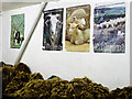
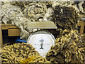
Please click the More button for more images, licensing and image copyright information.
Member of UK Parliament
This postcode is in the Orkney and Shetland parliamentary constituency.
Orkney and Shetland is a constituency in Scotland. The seat has been held by Mr Alistair Carmichael (Liberal Democrat) since May 2005.

Most Recent House Sales for North Road, ZE1 0PQ
No recorded house sales or transfers for this postcode.
Local Petrol Station Prices
Coordinates for ZE1 0PQ
Sunrise and Sunset at ZE1 0PQ
Traffic Emission and Congestion Zones
Historical Weather Summary
| Clear | 3.93% |
| Cloudy | 27.93% |
| Rain | 11.79% |
| Windy | 56.15% |
| Other | 0.20% |
Average Energy Performance
Companies Registered at ZE1 0PQ
Postcode Details for ZE1 0PQ
Recent Updates
|
18 Apr 2024 Added Traffic Camera Views from Traffic Scotland to Roadworks within Scotland |
|
15 Apr 2024 Schools Data updated for April 2024 |
|
10 Apr 2024 Companies Data updated for March 2024 |
|
7 Apr 2024 New option to receive automatic updates to roadworks that affect you |
|
7 Apr 2024 Police and Crime data updated for February 2024 |
|
3 Apr 2024 Sold House Price data updated for February 2024 |
|
30 Mar 2024 Energy Performance Certificates (England and Wales) updated February 2024 |
|
28 Mar 2024 New feature to use Geolocating functions to detect your current location |
Random Postcodes
Want an idea of what is in our extensive website? Try somewhere completely random!
The Rural/Urban classification is based upon data collected during the 2011 Census and released in August 2013 and is categorised into 6 distinct classes.
[A] Urban Major conurbation: A built up area with a population of 10,000 (3,000 in Scotland) or more and is assigned to the major conurbation settlement category.
[B] Urban Minor conurbation: A built up area with a population of 10,000 (3,000 in Scotland) or more and is assigned to the minor conurbation settlement category.
[C] Urban City and town: A built up area with a population of 10,000 (3,000 in Scotland) or more and is assigned to the city and town settlement category.
[D] Rural Town and fringe
[E] Rural Village
[F] Rural Hamlet and isolated dwelling
The Index of Multiple Deprivation (IMD) is the official measure of relative deprivation.
The index is based on 39 separate indicators across seven distinct domains (Income; Employment; Health and Disability; Education, Skills and Training; Crime; Barriers to Housing and Services; Living Environment) to provide an overall measure of multiple deprivation and is calculated for every neighbourhood.
The index is relative rather than an absolute scale and so a neighbourhood with a score of 10 is more deprived than one rated 20, but this does not equate to being twice as deprived.
Please note: Different indices are used in England, Scotland, Wales and Northern Ireland and so comparison of scores from neighbourhoods in different countries should not be undertaken.
These figures report on incorporated UK companies only that are registered at this postcode and do not include sole-traders, partnerships or overseas organisations.
The population figure shown for your area are an estimate provided by the Office for National Statistics and is rounded to the nearest 1,000.
The estimates are derived from the Annual Population Survey (APS) which is the Labour Force Survey (LFS) plus various sample boosts.
There are 55 unitary authorities. They provide all local government services in their areas. These are mainly in the cities, urban areas and larger towns although there are now 6 shire county councils that are unitary (ie have no district councils beneath them).