Overview for Back Lane, YORK, YO42 4PE
Introduction
York is a cathedral city in North Yorkshire, England, with Roman origins, sited at the confluence of the rivers Ouse and Foss. It is the historic county town of Yorkshire. The city has many historic buildings and other structures, such as a minster, castle, and city walls. It is the largest settlement and the administrative centre of the wider City of York district.
The city was founded under the name of Eboracum in 71 AD. It then became the capital of the Roman province of Britannia Inferior, and later of the kingdoms of Deira, Northumbria, and Scandinavian York. In the Middle Ages, it became the northern England ecclesiastical province's centre, and grew as a wool-trading centre. In the 19th century, it became a major railway network hub and confectionery manufacturing centre. During the Second World War, part of the Baedeker Blitz bombed the city; it was less affected by the war than other northern cities, with several historic buildings being gutted and restored up to the 1960s.
The city is one of 15 in England to have a lord mayor, and one of three to have "The Right Honourable" title affixed, the others being London's and Bristol's. Historic governance of the city was as a county corporate, not included in the county's riding system. The city has since been covered by a municipal borough, county borough, and since 1996 a non-metropolitan district (the City of York), which also includes surrounding villages and rural areas, and the town of Haxby. The current district's local council is responsible for providing all local services and facilities throughout this area. York's city proper area had a population of 141,685 at the 2021 UK census. The wider district had a population of 198,100. According to 2021 census data, the wider district has a population of 202,800, a 2.4% increase compared to the 2011 census.
Summary for Back Lane, YORK, YO42 4PE
Roadworks near YO42 4PE
Road Safety near YO42 4PE
Details of personal injury accidents in and around Back Lane, YO42 4PE that have been reported to Humberside Police over the past 20 years.
Traffic Levels near YO42 4PE
View traffic levels near Back Lane, YO42 4PE from official Department for Transport counts.
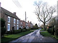
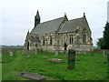
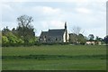
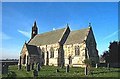
Images taken near to Back Lane, YO42 4PE and the surrounding area
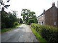
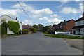
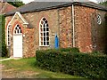
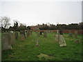
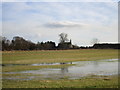
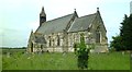
Please click the More button for more images, licensing and image copyright information.
York and nearby Videos From YouTube
DJI MINI 2 | 4K SINGLE SHOT FLOW | Lendal Bridge To Skeldergate Bridge | York, England, UK
Channel: MAtt W - Drone Vids (View Channel)
Published: 14 Jun 2022
Police
This area is policed by Humberside Police.
Humberside Police split their policing area into 81 separate neighbourhoods and this postcode is in the Howdenshire neighbourhood.

Howdenshire Neighbourhood Crime
Top 3 Categories
For full details of all categories together with more crime information, click on the Details button.
Member of UK Parliament
This postcode is in the Haltemprice and Howden parliamentary constituency.
Haltemprice and Howden is a constituency in the Yorkshire and The Humber region of England. The seat has been held by Sir David Davis (Conservative) since May 2010.

Most Recent House Sales for Back Lane, YO42 4PE
21 Nov 2014
27 Apr 2010
30 Aug 2007
18 Jun 2001
Local Petrol Station Prices
Coordinates for YO42 4PE
Residents at YO42 4PE
Sunrise and Sunset at YO42 4PE
Traffic Emission and Congestion Zones
Historical Weather Summary
| Clear | 10.20% |
| Cloudy | 59.23% |
| Rain | 8.93% |
| Windy | 21.63% |
| Other | 0.01% |
Population
Deprivation Index
the more deprived the postcode
Average Energy Performance
Companies Registered at YO42 4PE
Postcode Details for YO42 4PE
Recent Updates
|
18 Apr 2024 Added Traffic Camera Views from Traffic Scotland to Roadworks within Scotland |
|
15 Apr 2024 Schools Data updated for April 2024 |
|
10 Apr 2024 Companies Data updated for March 2024 |
|
7 Apr 2024 New option to receive automatic updates to roadworks that affect you |
|
7 Apr 2024 Police and Crime data updated for February 2024 |
|
3 Apr 2024 Sold House Price data updated for February 2024 |
|
30 Mar 2024 Energy Performance Certificates (England and Wales) updated February 2024 |
|
28 Mar 2024 New feature to use Geolocating functions to detect your current location |
Random Postcodes
Want an idea of what is in our extensive website? Try somewhere completely random!
The Rural/Urban classification is based upon data collected during the 2011 Census and released in August 2013 and is categorised into 6 distinct classes.
[A] Urban Major conurbation: A built up area with a population of 10,000 (3,000 in Scotland) or more and is assigned to the major conurbation settlement category.
[B] Urban Minor conurbation: A built up area with a population of 10,000 (3,000 in Scotland) or more and is assigned to the minor conurbation settlement category.
[C] Urban City and town: A built up area with a population of 10,000 (3,000 in Scotland) or more and is assigned to the city and town settlement category.
[D] Rural Town and fringe
[E] Rural Village
[F] Rural Hamlet and isolated dwelling
The Index of Multiple Deprivation (IMD) is the official measure of relative deprivation.
The index is based on 39 separate indicators across seven distinct domains (Income; Employment; Health and Disability; Education, Skills and Training; Crime; Barriers to Housing and Services; Living Environment) to provide an overall measure of multiple deprivation and is calculated for every neighbourhood.
The index is relative rather than an absolute scale and so a neighbourhood with a score of 10 is more deprived than one rated 20, but this does not equate to being twice as deprived.
Please note: Different indices are used in England, Scotland, Wales and Northern Ireland and so comparison of scores from neighbourhoods in different countries should not be undertaken.
These figures report on incorporated UK companies only that are registered at this postcode and do not include sole-traders, partnerships or overseas organisations.
The population figure shown for your area are an estimate provided by the Office for National Statistics and is rounded to the nearest 1,000.
The estimates are derived from the Annual Population Survey (APS) which is the Labour Force Survey (LFS) plus various sample boosts.
There are 55 unitary authorities. They provide all local government services in their areas. These are mainly in the cities, urban areas and larger towns although there are now 6 shire county councils that are unitary (ie have no district councils beneath them).