Overview for Manor Lane, MALTON, YO17 8DL
Introduction
Malton is a market town, civil parish and electoral ward in North Yorkshire, England. Historically part of the North Riding of Yorkshire, the town has a population measured for both the civil parish and the electoral ward at the 2011 Census as 4,888.
The town is located to the north of the River Derwent which forms the historic boundary between the North and East Ridings of Yorkshire.
Until 2023 the town was part of the Ryedale district and was the location of the headquarters of the district council.
Facing Malton on the other side of the Derwent is Norton. The Karro Food Group (formerly known as Malton Bacon Factory), Malton bus station and Malton railway station are located in Norton-on-Derwent.
Malton is the local area's commercial and retail centre. In the town centre there are small traditional independent shops and high street names. The market place has recently become a meeting area with a number of coffee bars and cafés opening all day to complement the public houses.
Malton has been described as "the food capital of Yorkshire", and was voted one of the best places to live in Britain by The Sunday Times in both the 2017 and 2018 lists.
Malton was named the dog-friendliest town in the UK at the annual Dog Friendly Awards, in association with the Kennel Club in 2018/19. In 2020 Malton was named as one of the most dog-friendly staycation spots in the UK and the best in Yorkshire.
Summary for Manor Lane, MALTON, YO17 8DL
Roadworks near YO17 8DL
Road Safety near YO17 8DL
Details of personal injury accidents in and around Manor Lane, YO17 8DL that have been reported to North Yorkshire Police over the past 20 years.
Traffic Levels near YO17 8DL
View traffic levels near Manor Lane, YO17 8DL from official Department for Transport counts.
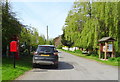
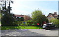
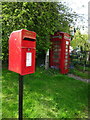
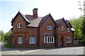
Images taken near to Manor Lane, YO17 8DL and the surrounding area
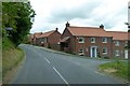
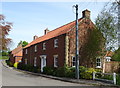
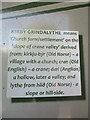
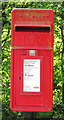

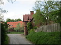
Please click the More button for more images, licensing and image copyright information.
Member of UK Parliament
This postcode is in the Thirsk and Malton parliamentary constituency.
Thirsk and Malton is a constituency in the Yorkshire and The Humber region of England. The seat has been held by Kevin Hollinrake (Conservative) since May 2015.

Most Recent House Sales for Manor Lane, YO17 8DL
18 Apr 2019
15 Mar 2013
Local Petrol Station Prices
Coordinates for YO17 8DL
Residents at YO17 8DL
Sunrise and Sunset at YO17 8DL
Traffic Emission and Congestion Zones
Historical Weather Summary
| Clear | 10.79% |
| Cloudy | 60.40% |
| Rain | 8.19% |
| Windy | 20.21% |
| Other | 0.41% |
Deprivation Index
the more deprived the postcode
Average Energy Performance
Companies Registered at YO17 8DL
Postcode Details for YO17 8DL
Recent Updates
|
18 Apr 2024 Added Traffic Camera Views from Traffic Scotland to Roadworks within Scotland |
|
15 Apr 2024 Schools Data updated for April 2024 |
|
10 Apr 2024 Companies Data updated for March 2024 |
|
7 Apr 2024 New option to receive automatic updates to roadworks that affect you |
|
7 Apr 2024 Police and Crime data updated for February 2024 |
|
3 Apr 2024 Sold House Price data updated for February 2024 |
|
30 Mar 2024 Energy Performance Certificates (England and Wales) updated February 2024 |
|
28 Mar 2024 New feature to use Geolocating functions to detect your current location |
Random Postcodes
Want an idea of what is in our extensive website? Try somewhere completely random!
The Rural/Urban classification is based upon data collected during the 2011 Census and released in August 2013 and is categorised into 6 distinct classes.
[A] Urban Major conurbation: A built up area with a population of 10,000 (3,000 in Scotland) or more and is assigned to the major conurbation settlement category.
[B] Urban Minor conurbation: A built up area with a population of 10,000 (3,000 in Scotland) or more and is assigned to the minor conurbation settlement category.
[C] Urban City and town: A built up area with a population of 10,000 (3,000 in Scotland) or more and is assigned to the city and town settlement category.
[D] Rural Town and fringe
[E] Rural Village
[F] Rural Hamlet and isolated dwelling
The Index of Multiple Deprivation (IMD) is the official measure of relative deprivation.
The index is based on 39 separate indicators across seven distinct domains (Income; Employment; Health and Disability; Education, Skills and Training; Crime; Barriers to Housing and Services; Living Environment) to provide an overall measure of multiple deprivation and is calculated for every neighbourhood.
The index is relative rather than an absolute scale and so a neighbourhood with a score of 10 is more deprived than one rated 20, but this does not equate to being twice as deprived.
Please note: Different indices are used in England, Scotland, Wales and Northern Ireland and so comparison of scores from neighbourhoods in different countries should not be undertaken.
These figures report on incorporated UK companies only that are registered at this postcode and do not include sole-traders, partnerships or overseas organisations.
The population figure shown for your area are an estimate provided by the Office for National Statistics and is rounded to the nearest 1,000.
The estimates are derived from the Annual Population Survey (APS) which is the Labour Force Survey (LFS) plus various sample boosts.
There are 55 unitary authorities. They provide all local government services in their areas. These are mainly in the cities, urban areas and larger towns although there are now 6 shire county councils that are unitary (ie have no district councils beneath them).