Overview for Newtown Road, WORCESTER, WR5 1HL
Introduction
Worcester (WUSS-tər) is a cathedral city in Worcestershire, England, of which it is the county town. It is 30 mi (48 km) south-west of Birmingham, 27 mi (43 km) north of Gloucester and 23 mi (37 km) north-east of Hereford. The population was 103,872 in the 2021 census.
The River Severn flanks the western side of the city centre, overlooked by Worcester Cathedral. Worcester is the home of Royal Worcester Porcelain, Lea & Perrins (makers of traditional Worcestershire sauce), the University of Worcester, and Berrow's Worcester Journal, claimed as the world's oldest newspaper. The composer Edward Elgar (1857–1934) grew up in the city.
The Battle of Worcester in 1651 was the final battle of the English Civil War, during which Oliver Cromwell's New Model Army defeated King Charles II's Royalists.
Summary for Newtown Road, WORCESTER, WR5 1HL
Roadworks near WR5 1HL
Road Safety near WR5 1HL
Details of personal injury accidents in and around Newtown Road, WR5 1HL that have been reported to West Mercia Police over the past 20 years.
Traffic Levels near WR5 1HL
View traffic levels near Newtown Road, WR5 1HL from official Department for Transport counts.
Images taken near to Newtown Road, WR5 1HL and the surrounding area
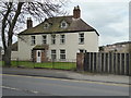
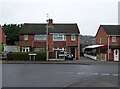
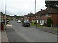
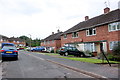
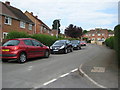
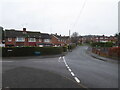
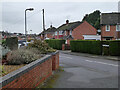
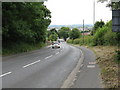
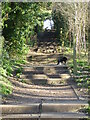
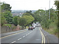
Please click the More button for more images, licensing and image copyright information.
Worcester and nearby Videos From YouTube
River Severn flood december 2020, drone footage
River Severn Flood Drone footage (very windy day) from Hawford lock where the canal meets the River severn in Worcestershire, ...
Channel: Photomondo (View Channel)
Published: 7 Jan 2021
Police
This area is policed by West Mercia Police.
West Mercia Police split their policing area into 82 separate neighbourhoods and this postcode is in the Battenhall and Nunnery neighbourhood.

Battenhall and Nunnery Neighbourhood Crime
Top 3 Categories
For full details of all categories together with more crime information, click on the Details button.
Member of UK Parliament
This postcode is in the Worcester parliamentary constituency.
Worcester is a constituency in the West Midlands region of England. The seat has been held by Mr Robin Walker (Conservative) since May 2010.

Most Recent House Sales for Newtown Road, WR5 1HL
20 Aug 2018
3 Nov 2017
20 Nov 2013
3 Nov 2010
Local Petrol Station Prices
Coordinates for WR5 1HL
Residents at WR5 1HL
Sunrise and Sunset at WR5 1HL
Traffic Emission and Congestion Zones
Historical Weather Summary
| Clear | 19.57% |
| Cloudy | 67.49% |
| Rain | 6.37% |
| Windy | 6.49% |
| Other | 0.08% |
Population
Deprivation Index
the more deprived the postcode
Average Energy Performance
Companies Registered at WR5 1HL
Postcode Details for WR5 1HL
Recent Updates
|
18 Apr 2024 Added Traffic Camera Views from Traffic Scotland to Roadworks within Scotland |
|
15 Apr 2024 Schools Data updated for April 2024 |
|
10 Apr 2024 Companies Data updated for March 2024 |
|
7 Apr 2024 New option to receive automatic updates to roadworks that affect you |
|
7 Apr 2024 Police and Crime data updated for February 2024 |
|
3 Apr 2024 Sold House Price data updated for February 2024 |
|
30 Mar 2024 Energy Performance Certificates (England and Wales) updated February 2024 |
|
28 Mar 2024 New feature to use Geolocating functions to detect your current location |
Random Postcodes
Want an idea of what is in our extensive website? Try somewhere completely random!
The Rural/Urban classification is based upon data collected during the 2011 Census and released in August 2013 and is categorised into 6 distinct classes.
[A] Urban Major conurbation: A built up area with a population of 10,000 (3,000 in Scotland) or more and is assigned to the major conurbation settlement category.
[B] Urban Minor conurbation: A built up area with a population of 10,000 (3,000 in Scotland) or more and is assigned to the minor conurbation settlement category.
[C] Urban City and town: A built up area with a population of 10,000 (3,000 in Scotland) or more and is assigned to the city and town settlement category.
[D] Rural Town and fringe
[E] Rural Village
[F] Rural Hamlet and isolated dwelling
The Index of Multiple Deprivation (IMD) is the official measure of relative deprivation.
The index is based on 39 separate indicators across seven distinct domains (Income; Employment; Health and Disability; Education, Skills and Training; Crime; Barriers to Housing and Services; Living Environment) to provide an overall measure of multiple deprivation and is calculated for every neighbourhood.
The index is relative rather than an absolute scale and so a neighbourhood with a score of 10 is more deprived than one rated 20, but this does not equate to being twice as deprived.
Please note: Different indices are used in England, Scotland, Wales and Northern Ireland and so comparison of scores from neighbourhoods in different countries should not be undertaken.
These figures report on incorporated UK companies only that are registered at this postcode and do not include sole-traders, partnerships or overseas organisations.
The population figure shown for your area are an estimate provided by the Office for National Statistics and is rounded to the nearest 1,000.
The estimates are derived from the Annual Population Survey (APS) which is the Labour Force Survey (LFS) plus various sample boosts.
There are 26 county councils in 2-tier areas, providing services such as education, social services and waste disposal.
In 2-tier areas, each county council area is subdivided into districts, for which there is an independent district council. There are 192 district councils.
District councils are responsible for local services such as rubbish collection, housing and planning applications.