Overview for West Malvern Road, MALVERN, WR13 5NZ
Introduction
Malvern is a spa town and civil parish in Worcestershire, England. It lies at the foot of the Malvern Hills, a designated Area of Outstanding Natural Beauty. The centre of Malvern, Great Malvern, is a historic conservation area, which grew dramatically in Victorian times due to the natural mineral water springs in the vicinity, including Malvern Water.
At the 2021 census it had a population of 30,462. It includes Great Malvern on the steep eastern flank of the Malvern Hills, as well as the former independent urban district of Malvern Link. Many of the major suburbs and settlements that comprise the town are separated by large tracts of open common land and fields, and together with smaller civil parishes adjoining the town's boundaries and the hills, the built up area is often referred to collectively as The Malverns.
Archaeological evidence suggests that Bronze Age people had settled in the area around 1000 BC, although it is not known whether these settlements were permanent or temporary. The town itself was founded in the 11th century when Benedictine monks established a priory at the foot of the highest peak of Malvern Hills.: 17–24 During the 19th century Malvern developed rapidly from a village to a sprawling conurbation owing to its popularity as a hydrotherapy spa based on its spring waters.: 197–198 Immediately following the decline of spa tourism towards the end of the 19th century, the town's focus shifted to education with the establishment of several private boarding schools in former hotels and large villas. A further major expansion was the result of the relocation of the Telecommunications Research Establishment (TRE) to Malvern in 1942. QinetiQ, TRE's successor company, remained the town's largest local employer in 2009.
Malvern is the largest place in the parliamentary constituency of West Worcestershire and the district of Malvern Hills, being also the district's administrative seat. It lies adjacent to the Malvern Hills Area of Outstanding Natural Beauty. The civil parish is governed by Malvern Town Council from its offices in Great Malvern.
Summary for West Malvern Road, MALVERN, WR13 5NZ
Roadworks near WR13 5NZ
Road Safety near WR13 5NZ
Details of personal injury accidents in and around West Malvern Road, WR13 5NZ that have been reported to West Mercia Police over the past 20 years.
Traffic Levels near WR13 5NZ
View traffic levels near West Malvern Road, WR13 5NZ from official Department for Transport counts.
Images taken near to West Malvern Road, WR13 5NZ and the surrounding area
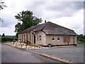
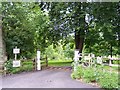
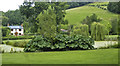
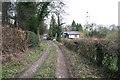
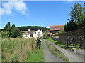
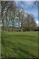
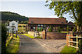
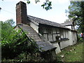
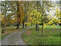
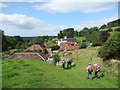
Please click the More button for more images, licensing and image copyright information.
Police
This area is policed by West Mercia Police.
West Mercia Police split their policing area into 82 separate neighbourhoods and this postcode is in the Ledbury SNT neighbourhood.

Ledbury SNT Neighbourhood Crime
Top 3 Categories
For full details of all categories together with more crime information, click on the Details button.
Member of UK Parliament
This postcode is in the North Herefordshire parliamentary constituency.
North Herefordshire is a constituency in the West Midlands region of England. The seat has been held by Sir Bill Wiggin (Conservative) since May 2010.

Most Recent House Sales for West Malvern Road, WR13 5NZ
4 Dec 2009
21 Dec 2006
24 Mar 2006
18 Jan 2005
Local Petrol Station Prices
Coordinates for WR13 5NZ
Residents at WR13 5NZ
Sunrise and Sunset at WR13 5NZ
Traffic Emission and Congestion Zones
Historical Weather Summary
| Clear | 19.41% |
| Cloudy | 71.02% |
| Rain | 6.64% |
| Windy | 2.82% |
| Other | 0.11% |
Population
Deprivation Index
the more deprived the postcode
Average Energy Performance
Companies Registered at WR13 5NZ
Postcode Details for WR13 5NZ
Recent Updates
|
18 Apr 2024 Added Traffic Camera Views from Traffic Scotland to Roadworks within Scotland |
|
15 Apr 2024 Schools Data updated for April 2024 |
|
10 Apr 2024 Companies Data updated for March 2024 |
|
7 Apr 2024 New option to receive automatic updates to roadworks that affect you |
|
7 Apr 2024 Police and Crime data updated for February 2024 |
|
3 Apr 2024 Sold House Price data updated for February 2024 |
|
30 Mar 2024 Energy Performance Certificates (England and Wales) updated February 2024 |
|
28 Mar 2024 New feature to use Geolocating functions to detect your current location |
Random Postcodes
Want an idea of what is in our extensive website? Try somewhere completely random!
The Rural/Urban classification is based upon data collected during the 2011 Census and released in August 2013 and is categorised into 6 distinct classes.
[A] Urban Major conurbation: A built up area with a population of 10,000 (3,000 in Scotland) or more and is assigned to the major conurbation settlement category.
[B] Urban Minor conurbation: A built up area with a population of 10,000 (3,000 in Scotland) or more and is assigned to the minor conurbation settlement category.
[C] Urban City and town: A built up area with a population of 10,000 (3,000 in Scotland) or more and is assigned to the city and town settlement category.
[D] Rural Town and fringe
[E] Rural Village
[F] Rural Hamlet and isolated dwelling
The Index of Multiple Deprivation (IMD) is the official measure of relative deprivation.
The index is based on 39 separate indicators across seven distinct domains (Income; Employment; Health and Disability; Education, Skills and Training; Crime; Barriers to Housing and Services; Living Environment) to provide an overall measure of multiple deprivation and is calculated for every neighbourhood.
The index is relative rather than an absolute scale and so a neighbourhood with a score of 10 is more deprived than one rated 20, but this does not equate to being twice as deprived.
Please note: Different indices are used in England, Scotland, Wales and Northern Ireland and so comparison of scores from neighbourhoods in different countries should not be undertaken.
These figures report on incorporated UK companies only that are registered at this postcode and do not include sole-traders, partnerships or overseas organisations.
The population figure shown for your area are an estimate provided by the Office for National Statistics and is rounded to the nearest 1,000.
The estimates are derived from the Annual Population Survey (APS) which is the Labour Force Survey (LFS) plus various sample boosts.
There are 55 unitary authorities. They provide all local government services in their areas. These are mainly in the cities, urban areas and larger towns although there are now 6 shire county councils that are unitary (ie have no district councils beneath them).