Overview for Beech Walk, LEIGH, WN7 3LH
Introduction
Leigh is a town in the Metropolitan Borough of Wigan, Greater Manchester, England, on low-lying land northwest of Chat Moss.
Within the boundaries of the historic county of Lancashire, Leigh was originally the centre of a large ecclesiastical parish covering six vills or townships. When the three townships of Pennington, Westleigh and Bedford merged in 1875, forming the Leigh Local Board District, Leigh became the official name for the town, although it had been applied to the area of Pennington and Westleigh around the parish church for many centuries.
The town became an urban district in 1894 when part of Atherton was added. In 1899 Leigh became a municipal borough. The first town hall was built on King Street and replaced by the present building in 1907.
Originally an agricultural area (noted for dairy farming), domestic spinning and weaving led to a considerable silk industry and, in the 20th century, the cotton industry. Leigh also exploited the underlying coal measures, particularly after the town was connected to the canals and railways. Leigh had an important engineering base. The legacy of Leigh's industrial past can be seen in the remaining red brick mills – some of which are listed buildings – although it is now a mainly residential town, with Edwardian and Victorian terraced housing packed around the town centre. Leigh's present-day economy is based largely on the retail sector.
Summary for Beech Walk, LEIGH, WN7 3LH
Roadworks near WN7 3LH
Road Safety near WN7 3LH
Details of personal injury accidents in and around Beech Walk, WN7 3LH that have been reported to Greater Manchester Police over the past 20 years.
Traffic Levels near WN7 3LH
View traffic levels near Beech Walk, WN7 3LH from official Department for Transport counts.
Images taken near to Beech Walk, WN7 3LH and the surrounding area
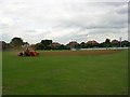
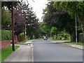
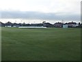
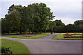
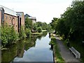
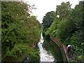
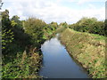
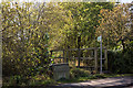
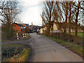
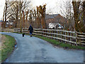
Please click the More button for more images, licensing and image copyright information.
Member of UK Parliament
This postcode is in the Leigh parliamentary constituency.
Leigh is a constituency in the North West region of England. The seat has been held by James Grundy (Conservative) since December 2019.

Most Recent House Sales for Beech Walk, WN7 3LH
11 Dec 2009
19 Nov 2009
27 Mar 2009
27 Nov 1998
Local Petrol Station Prices
Coordinates for WN7 3LH
Residents at WN7 3LH
Sunrise and Sunset at WN7 3LH
Traffic Emission and Congestion Zones
Historical Weather Summary
| Clear | 17.80% |
| Cloudy | 60.65% |
| Rain | 7.84% |
| Windy | 13.58% |
| Other | 0.13% |
Population
Deprivation Index
the more deprived the postcode
Average Energy Performance
Companies Registered at WN7 3LH
Postcode Details for WN7 3LH
Recent Updates
|
18 Apr 2024 Added Traffic Camera Views from Traffic Scotland to Roadworks within Scotland |
|
15 Apr 2024 Schools Data updated for April 2024 |
|
10 Apr 2024 Companies Data updated for March 2024 |
|
7 Apr 2024 New option to receive automatic updates to roadworks that affect you |
|
7 Apr 2024 Police and Crime data updated for February 2024 |
|
3 Apr 2024 Sold House Price data updated for February 2024 |
|
30 Mar 2024 Energy Performance Certificates (England and Wales) updated February 2024 |
|
28 Mar 2024 New feature to use Geolocating functions to detect your current location |
Random Postcodes
Want an idea of what is in our extensive website? Try somewhere completely random!
The Rural/Urban classification is based upon data collected during the 2011 Census and released in August 2013 and is categorised into 6 distinct classes.
[A] Urban Major conurbation: A built up area with a population of 10,000 (3,000 in Scotland) or more and is assigned to the major conurbation settlement category.
[B] Urban Minor conurbation: A built up area with a population of 10,000 (3,000 in Scotland) or more and is assigned to the minor conurbation settlement category.
[C] Urban City and town: A built up area with a population of 10,000 (3,000 in Scotland) or more and is assigned to the city and town settlement category.
[D] Rural Town and fringe
[E] Rural Village
[F] Rural Hamlet and isolated dwelling
The Index of Multiple Deprivation (IMD) is the official measure of relative deprivation.
The index is based on 39 separate indicators across seven distinct domains (Income; Employment; Health and Disability; Education, Skills and Training; Crime; Barriers to Housing and Services; Living Environment) to provide an overall measure of multiple deprivation and is calculated for every neighbourhood.
The index is relative rather than an absolute scale and so a neighbourhood with a score of 10 is more deprived than one rated 20, but this does not equate to being twice as deprived.
Please note: Different indices are used in England, Scotland, Wales and Northern Ireland and so comparison of scores from neighbourhoods in different countries should not be undertaken.
These figures report on incorporated UK companies only that are registered at this postcode and do not include sole-traders, partnerships or overseas organisations.
The population figure shown for your area are an estimate provided by the Office for National Statistics and is rounded to the nearest 1,000.
The estimates are derived from the Annual Population Survey (APS) which is the Labour Force Survey (LFS) plus various sample boosts.
There are 36 metropolitan district councils which together cover 6 large urban areas: the counties of Greater Manchester, Merseyside, South Yorkshire, Tyne and Wear, West Midlands, and West Yorkshire.
Metropolitan districts are responsible for all services in their area, although certain conurbation wide services such as fire and civil defence, police, waste disposal and passenger transport are provided through joint authorities (the districts acting jointly).