Overview for Alder Avenue, WIGAN, WN5 7PY
Introduction
Wigan (WIG-ən) is a town in Greater Manchester, England, on the River Douglas. The town is midway between the two cities of Manchester, 16 miles (25.7 km) to the south-east, and Liverpool, 17 miles (27 km) to the south-west. Bolton lies 10 miles (16 km) to the north-east and Warrington 12 miles (19 km) to the south. It is the largest settlement in the Metropolitan Borough of Wigan and is its administrative centre. The town has a population of 107,732 and the wider borough of 330,714. Wigan is part of the historic county of Lancashire.
Wigan was in the territory of the Brigantes, an ancient Celtic tribe that ruled much of what is now Northern England. The Brigantes were subjugated in the Roman conquest of Britain and the Roman settlement of Coccium was established where Wigan lies.
Wigan was incorporated as a borough in 1246, following the issue of a charter by King Henry III of England. At the end of the Middle Ages, it was one of four boroughs in Lancashire established by royal charter.
The Industrial Revolution saw a dramatic economic expansion and rapid rise in population. Wigan became a major mill town and coal mining district; at its peak, there were 1,000 pit shafts within 5 miles (8 km) of the town centre. Coal mining ceased in the later 20th century.
Wigan Pier, a wharf on the Leeds and Liverpool Canal, was made famous by the writer George Orwell. In his book The Road to Wigan Pier (1937), Orwell highlighted the poor working and living conditions of inhabitants in the 1930s. Following the decline of heavy industry, Wigan Pier's warehouses and wharves became a local heritage centre and cultural quarter. The DW Stadium is home to Wigan Athletic Football Club and Wigan Warriors Rugby League Football Club.
Summary for Alder Avenue, WIGAN, WN5 7PY
Roadworks near WN5 7PY
Road Safety near WN5 7PY
Details of personal injury accidents in and around Alder Avenue, WN5 7PY that have been reported to Merseyside Police over the past 20 years.
Traffic Levels near WN5 7PY
View traffic levels near Alder Avenue, WN5 7PY from official Department for Transport counts.
Images taken near to Alder Avenue, WN5 7PY and the surrounding area
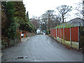
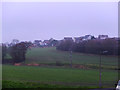


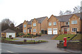
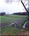
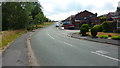
Please click the More button for more images, licensing and image copyright information.
Wigan and nearby Videos From YouTube
St Helena Island, a world within a world apart
St Helena Island: A history treasure trove. Walk in the footsteps of Napoleon, the Duke of Wellington, Edmund Halley, Charles ...
Channel: St Helena Tourism (View Channel)
Published: 13 Jan 2022
Police
This area is policed by Merseyside Police.
Merseyside Police split their policing area into 139 separate neighbourhoods and this postcode is in the Billinge and Seneley Green neighbourhood.

Billinge and Seneley Green Neighbourhood Crime
Top 3 Categories
For full details of all categories together with more crime information, click on the Details button.
Member of UK Parliament
Unfortunately, Parliamentary details are not available for this postcode.
Most Recent House Sales for Alder Avenue, WN5 7PY
28 Feb 1995
28 Feb 1995
Local Petrol Station Prices
Coordinates for WN5 7PY
Residents at WN5 7PY
Sunrise and Sunset at WN5 7PY
Traffic Emission and Congestion Zones
Historical Weather Summary
| Clear | 17.46% |
| Cloudy | 61.04% |
| Rain | 7.63% |
| Windy | 13.77% |
| Other | 0.10% |
Population
Deprivation Index
the more deprived the postcode
Companies Registered at WN5 7PY
Postcode Details for WN5 7PY
Recent Updates
|
18 Apr 2024 Added Traffic Camera Views from Traffic Scotland to Roadworks within Scotland |
|
15 Apr 2024 Schools Data updated for April 2024 |
|
10 Apr 2024 Companies Data updated for March 2024 |
|
7 Apr 2024 New option to receive automatic updates to roadworks that affect you |
|
7 Apr 2024 Police and Crime data updated for February 2024 |
|
3 Apr 2024 Sold House Price data updated for February 2024 |
|
30 Mar 2024 Energy Performance Certificates (England and Wales) updated February 2024 |
|
28 Mar 2024 New feature to use Geolocating functions to detect your current location |
Random Postcodes
Want an idea of what is in our extensive website? Try somewhere completely random!
The Rural/Urban classification is based upon data collected during the 2011 Census and released in August 2013 and is categorised into 6 distinct classes.
[A] Urban Major conurbation: A built up area with a population of 10,000 (3,000 in Scotland) or more and is assigned to the major conurbation settlement category.
[B] Urban Minor conurbation: A built up area with a population of 10,000 (3,000 in Scotland) or more and is assigned to the minor conurbation settlement category.
[C] Urban City and town: A built up area with a population of 10,000 (3,000 in Scotland) or more and is assigned to the city and town settlement category.
[D] Rural Town and fringe
[E] Rural Village
[F] Rural Hamlet and isolated dwelling
The Index of Multiple Deprivation (IMD) is the official measure of relative deprivation.
The index is based on 39 separate indicators across seven distinct domains (Income; Employment; Health and Disability; Education, Skills and Training; Crime; Barriers to Housing and Services; Living Environment) to provide an overall measure of multiple deprivation and is calculated for every neighbourhood.
The index is relative rather than an absolute scale and so a neighbourhood with a score of 10 is more deprived than one rated 20, but this does not equate to being twice as deprived.
Please note: Different indices are used in England, Scotland, Wales and Northern Ireland and so comparison of scores from neighbourhoods in different countries should not be undertaken.
These figures report on incorporated UK companies only that are registered at this postcode and do not include sole-traders, partnerships or overseas organisations.
The population figure shown for your area are an estimate provided by the Office for National Statistics and is rounded to the nearest 1,000.
The estimates are derived from the Annual Population Survey (APS) which is the Labour Force Survey (LFS) plus various sample boosts.
There are 36 metropolitan district councils which together cover 6 large urban areas: the counties of Greater Manchester, Merseyside, South Yorkshire, Tyne and Wear, West Midlands, and West Yorkshire.
Metropolitan districts are responsible for all services in their area, although certain conurbation wide services such as fire and civil defence, police, waste disposal and passenger transport are provided through joint authorities (the districts acting jointly).