Overview for Harris Road, WATFORD, WD25 0AY
Introduction
Watford is a town and borough in Hertfordshire, England, 15 mi (24 km) north-west of Central London, on the banks of the River Colne.
Initially a small market town, the Grand Junction Canal encouraged the construction of paper-making mills, print works, and breweries. While industry has declined in Watford, its location near London and transport links have attracted several companies to site their headquarters in the town. Cassiobury Park is a public park that was once the manor estate of the Earls of Essex.
The town developed next to the River Colne on land belonging to St Albans Abbey. In the 12th century, a charter was granted allowing a market, and the building of St Mary's Church began. The town grew partly due to travellers going to Berkhamsted Castle and the royal palace at Kings Langley. A mansion was built at Cassiobury in the 16th century. This was partly rebuilt in the 17th century and another country house was built at The Grove.
The Grand Junction Canal in 1798 and the London and Birmingham Railway in 1837 resulted in Watford's rapid growth, with paper-making mills such as John Dickinson at Croxley, influencing the development of printing in the town. Two brewers, Benskins and Sedgwicks, amalgamated and flourished in the town until their closure in the late 20th century. Hertfordshire County Council designates Watford to be a major sub-regional centre. Several head offices are based in Watford. International conferences and sporting events have also taken place in Watford, including the 2006 World Golf Championship, the 2013 Bilderberg Conference and the 2019 NATO summit which all took place at The Grove.
Watford became an urban district under the Local Government Act 1894 and a municipal borough by grant of a charter in 1922. The borough, which had 102,246 inhabitants in the 2021 census (up from 90,301 inhabitants at the 2011 census, an increase of 13.23%), is separated from Greater London to the south by Three Rivers District. Watford Borough Council is the local authority with the Mayor of Watford as its head – one of only 18 directly elected mayors in England and Wales.
Summary for Harris Road, WATFORD, WD25 0AY
Roadworks near WD25 0AY
Road Safety near WD25 0AY
Details of personal injury accidents in and around Harris Road, WD25 0AY that have been reported to Hertfordshire Constabulary over the past 20 years.
Traffic Levels near WD25 0AY
View traffic levels near Harris Road, WD25 0AY from official Department for Transport counts.
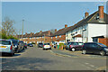
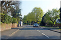
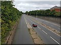
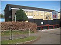
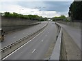
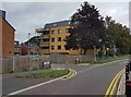
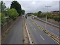
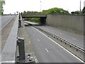
Images taken near to Harris Road, WD25 0AY and the surrounding area
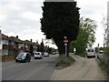
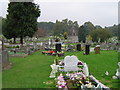
Please click the More button for more images, licensing and image copyright information.
Watford and nearby Videos From YouTube
London Drone Footage 4K - Totteridge Lane
London Drone Footage 4K - Totteridge Lane Music: Get 2 extra months for free with Artlist.io https://artlist.io/Demetrios-2232974 ...
Channel: Demetrios (View Channel)
Published: 18 Jul 2022
Police
This area is policed by Hertfordshire Constabulary.
Hertfordshire Constabulary split their policing area into 33 separate neighbourhoods and this postcode is in the Watford North neighbourhood.

Watford North Neighbourhood Crime
Top 3 Categories
For full details of all categories together with more crime information, click on the Details button.
Member of UK Parliament
This postcode is in the Watford parliamentary constituency.
Watford is a constituency in the East of England region of England. The seat has been held by Dean Russell (Conservative) since December 2019.

Most Recent House Sales for Harris Road, WD25 0AY
23 Oct 2019
12 Jun 2015
22 Nov 2013
28 Jan 2011
Local Petrol Station Prices
Coordinates for WD25 0AY
Residents at WD25 0AY
Sunrise and Sunset at WD25 0AY
Traffic Emission and Congestion Zones
Historical Weather Summary
| Clear | 8.42% |
| Cloudy | 78.35% |
| Rain | 8.56% |
| Windy | 4.62% |
| Other | 0.05% |
Population
Deprivation Index
the more deprived the postcode
Average Energy Performance
Companies Registered at WD25 0AY
Postcode Details for WD25 0AY
Recent Updates
|
18 Apr 2024 Added Traffic Camera Views from Traffic Scotland to Roadworks within Scotland |
|
15 Apr 2024 Schools Data updated for April 2024 |
|
10 Apr 2024 Companies Data updated for March 2024 |
|
7 Apr 2024 New option to receive automatic updates to roadworks that affect you |
|
7 Apr 2024 Police and Crime data updated for February 2024 |
|
3 Apr 2024 Sold House Price data updated for February 2024 |
|
30 Mar 2024 Energy Performance Certificates (England and Wales) updated February 2024 |
|
28 Mar 2024 New feature to use Geolocating functions to detect your current location |
Random Postcodes
Want an idea of what is in our extensive website? Try somewhere completely random!
The Rural/Urban classification is based upon data collected during the 2011 Census and released in August 2013 and is categorised into 6 distinct classes.
[A] Urban Major conurbation: A built up area with a population of 10,000 (3,000 in Scotland) or more and is assigned to the major conurbation settlement category.
[B] Urban Minor conurbation: A built up area with a population of 10,000 (3,000 in Scotland) or more and is assigned to the minor conurbation settlement category.
[C] Urban City and town: A built up area with a population of 10,000 (3,000 in Scotland) or more and is assigned to the city and town settlement category.
[D] Rural Town and fringe
[E] Rural Village
[F] Rural Hamlet and isolated dwelling
The Index of Multiple Deprivation (IMD) is the official measure of relative deprivation.
The index is based on 39 separate indicators across seven distinct domains (Income; Employment; Health and Disability; Education, Skills and Training; Crime; Barriers to Housing and Services; Living Environment) to provide an overall measure of multiple deprivation and is calculated for every neighbourhood.
The index is relative rather than an absolute scale and so a neighbourhood with a score of 10 is more deprived than one rated 20, but this does not equate to being twice as deprived.
Please note: Different indices are used in England, Scotland, Wales and Northern Ireland and so comparison of scores from neighbourhoods in different countries should not be undertaken.
These figures report on incorporated UK companies only that are registered at this postcode and do not include sole-traders, partnerships or overseas organisations.
The population figure shown for your area are an estimate provided by the Office for National Statistics and is rounded to the nearest 1,000.
The estimates are derived from the Annual Population Survey (APS) which is the Labour Force Survey (LFS) plus various sample boosts.
There are 26 county councils in 2-tier areas, providing services such as education, social services and waste disposal.
In 2-tier areas, each county council area is subdivided into districts, for which there is an independent district council. There are 192 district councils.
District councils are responsible for local services such as rubbish collection, housing and planning applications.