Overview for Swinton Street, LONDON, WC1X 9NL
Introduction
London is the capital and largest city of England and the United Kingdom, with a population of around 8.7 million. It stands on the River Thames in south-east England at the head of a 50-mile (80 km) estuary down to the North Sea and has been a major settlement for two millennia. The City of London, its ancient core and financial centre, was founded by the Romans as Londinium and retains its medieval boundaries. The City of Westminster, to the west of the City of London, has for centuries hosted the national government and parliament. Since the 19th century, the name "London" also refers to the metropolis around this core, historically split among the counties of Middlesex, Essex, Surrey, Kent, and Hertfordshire, which since 1965 has largely comprised Greater London, which is governed by 33 local authorities and the Greater London Authority.
As one of the world's major global cities, London exerts a strong influence on its arts, entertainment, fashion, commerce and finance, education, health care, media, science and technology, tourism, transport, and communications. Its GDP (€801.66 billion in 2017) makes it the largest urban economy in Europe, and it is one of the major financial centres in the world. With Europe's largest concentration of higher education institutions, it is home to some of the highest-ranked academic institutions in the world—Imperial College London in natural and applied sciences, the London School of Economics in social sciences, and the comprehensive University College London. London is the most visited city in Europe and has the busiest city airport system in the world. The London Underground is the oldest rapid transit system in the world.
London's diverse cultures encompass over 300 languages. The mid-2018 population of Greater London of about 9 million made it Europe's third-most populous city, accounting for 13.4% of the population of the United Kingdom and over 16% of the population of England. The Greater London Built-up Area is the fourth-most populous in Europe, with about 9.8 million inhabitants at the 2011 census. The London metropolitan area is the third-most populous in Europe, with about 14 million inhabitants in 2016, granting London the status of a megacity.
London has four World Heritage Sites: the Tower of London; Kew Gardens; the combined Palace of Westminster, Westminster Abbey, and St Margaret's Church; and also the historic settlement in Greenwich, where the Royal Observatory, Greenwich, defines the prime meridian (0° longitude) and Greenwich Mean Time. Other landmarks include Buckingham Palace, the London Eye, Piccadilly Circus, St Paul's Cathedral, Tower Bridge, and Trafalgar Square. London has many museums, galleries, libraries, and cultural venues, including the British Museum, National Gallery, Natural History Museum, Tate Modern, British Library, and numerous West End theatres. Important sporting events held in London include the FA Cup Final, the Wimbledon Tennis Championships, and the London Marathon. In 2012, London became the first city to host three Summer Olympic Games.
Summary for Swinton Street, LONDON, WC1X 9NL
Roadworks near WC1X 9NL
Road Safety near WC1X 9NL
Details of personal injury accidents in and around Swinton Street, WC1X 9NL that have been reported to Metropolitan Police Service over the past 20 years.
Traffic Levels near WC1X 9NL
View traffic levels near Swinton Street, WC1X 9NL from official Department for Transport counts.
Images taken near to Swinton Street, WC1X 9NL and the surrounding area
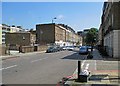
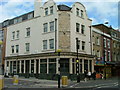
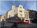
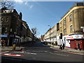
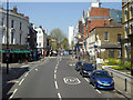
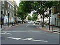


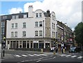
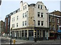
Please click the More button for more images, licensing and image copyright information.
London and nearby Videos From YouTube
Amazing White City drone footage
to explore the fast development and increase of commercial residences.
Channel: rollybentulan (View Channel)
Published: 13 Oct 2021
Member of UK Parliament
Unfortunately, Parliamentary details are not available for this postcode.
Most Recent House Sales for Swinton Street, WC1X 9NL
31 Mar 2014
4 Jul 2013
16 Jan 2013
31 Oct 2011
Local Petrol Station Prices
Coordinates for WC1X 9NL
Residents at WC1X 9NL
Sunrise and Sunset at WC1X 9NL
Traffic Congestion Zones
Traffic Emission Zones
Historical Weather Summary
| Clear | 8.93% |
| Cloudy | 81.83% |
| Rain | 7.90% |
| Windy | 1.29% |
| Other | 0.05% |
Population
Deprivation Index
the more deprived the postcode
Average Energy Performance
Companies Registered at WC1X 9NL
Postcode Details for WC1X 9NL
Recent Updates
|
18 Apr 2024 Added Traffic Camera Views from Traffic Scotland to Roadworks within Scotland |
|
15 Apr 2024 Schools Data updated for April 2024 |
|
10 Apr 2024 Companies Data updated for March 2024 |
|
7 Apr 2024 New option to receive automatic updates to roadworks that affect you |
|
7 Apr 2024 Police and Crime data updated for February 2024 |
|
3 Apr 2024 Sold House Price data updated for February 2024 |
|
30 Mar 2024 Energy Performance Certificates (England and Wales) updated February 2024 |
|
28 Mar 2024 New feature to use Geolocating functions to detect your current location |
Random Postcodes
Want an idea of what is in our extensive website? Try somewhere completely random!
The Rural/Urban classification is based upon data collected during the 2011 Census and released in August 2013 and is categorised into 6 distinct classes.
[A] Urban Major conurbation: A built up area with a population of 10,000 (3,000 in Scotland) or more and is assigned to the major conurbation settlement category.
[B] Urban Minor conurbation: A built up area with a population of 10,000 (3,000 in Scotland) or more and is assigned to the minor conurbation settlement category.
[C] Urban City and town: A built up area with a population of 10,000 (3,000 in Scotland) or more and is assigned to the city and town settlement category.
[D] Rural Town and fringe
[E] Rural Village
[F] Rural Hamlet and isolated dwelling
The Index of Multiple Deprivation (IMD) is the official measure of relative deprivation.
The index is based on 39 separate indicators across seven distinct domains (Income; Employment; Health and Disability; Education, Skills and Training; Crime; Barriers to Housing and Services; Living Environment) to provide an overall measure of multiple deprivation and is calculated for every neighbourhood.
The index is relative rather than an absolute scale and so a neighbourhood with a score of 10 is more deprived than one rated 20, but this does not equate to being twice as deprived.
Please note: Different indices are used in England, Scotland, Wales and Northern Ireland and so comparison of scores from neighbourhoods in different countries should not be undertaken.
These figures report on incorporated UK companies only that are registered at this postcode and do not include sole-traders, partnerships or overseas organisations.
The population figure shown for your area are an estimate provided by the Office for National Statistics and is rounded to the nearest 1,000.
The estimates are derived from the Annual Population Survey (APS) which is the Labour Force Survey (LFS) plus various sample boosts.
There are 32 London boroughs. They provide nearly all the services in their area. However, the Greater London Authority (GLA) provides London-wide government, including special responsibility for police, fire, strategic planning and transport.