Overview for Chapel Lane, WARRINGTON, WA5 4PY
Introduction
Warrington is an industrial town in the borough of the same name in Cheshire, England. The town sits on the banks of the River Mersey and until 1974, was part of Lancashire. It is 19 miles (31 km) east of Liverpool, and 18 miles (29 km) west of Manchester.
The population in 2019 was estimated at 165,456 for the town's urban area, and 210,014 for the wider borough, the latter being more than double that of 1968 when it became a new town. Warrington is the largest town in the ceremonial county of Cheshire.
Warrington was founded by the Romans at an important crossing place on the River Mersey. A new settlement was established by the Saxon Wærings. By the Middle Ages, Warrington had emerged as a market town at the lowest bridging point of the river. A local tradition of textile and tool production dates from this time.
The expansion and urbanisation of Warrington coincided with the Industrial Revolution, particularly after the Mersey was made navigable in the 18th century. The West Coast Main Line runs north to south through the town, and the Liverpool to Manchester railway (the Cheshire Lines route) west to east. The Manchester Ship Canal cuts through the south of the borough (west to east). The M6, M56 and M62 motorways form a partial box around the town and are all accessible through Warrington.
The modern Borough of Warrington was formed in 1974 with the amalgamation of the former County Borough of Warrington, part of the Golborne Urban District, the Lymm Urban District, part of the Runcorn Rural District, the Warrington Rural District and part of the Whiston Rural District.
Summary for Chapel Lane, WARRINGTON, WA5 4PY
Roadworks near WA5 4PY
Road Safety near WA5 4PY
Details of personal injury accidents in and around Chapel Lane, WA5 4PY that have been reported to Cheshire Constabulary over the past 20 years.
Traffic Levels near WA5 4PY
View traffic levels near Chapel Lane, WA5 4PY from official Department for Transport counts.
Images taken near to Chapel Lane, WA5 4PY and the surrounding area
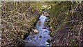
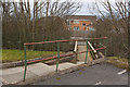
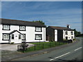
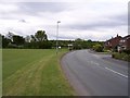
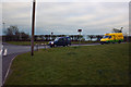

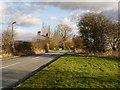
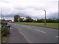
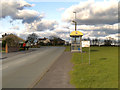
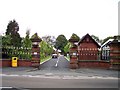
Please click the More button for more images, licensing and image copyright information.
Warrington and nearby Videos From YouTube
dji Air 2S Footage Mucky Mountains Earlstown
What Mountains in Earlstown, Mucky Mountains using dji air 2s drone Footage. Went for a ride down the canal by Mucky ...
Channel: TS Drones (View Channel)
Published: 15 Oct 2021
Police
This area is policed by Cheshire Constabulary.
Cheshire Constabulary split their policing area into 122 separate neighbourhoods and this postcode is in the Burtonwood and Winwick neighbourhood.

Burtonwood and Winwick Neighbourhood Crime
Top 3 Categories
For full details of all categories together with more crime information, click on the Details button.
Member of UK Parliament
This postcode is in the Warrington North parliamentary constituency.
Warrington North is a constituency in the North West region of England. The seat has been held by Charlotte Nichols (Labour) since December 2019.

Most Recent House Sales for Chapel Lane, WA5 4PY
28 Jun 2023
19 Oct 2020
22 Jun 2016
14 Aug 2015
Local Petrol Station Prices
Coordinates for WA5 4PY
Residents at WA5 4PY
Sunrise and Sunset at WA5 4PY
Traffic Emission and Congestion Zones
Historical Weather Summary
| Clear | 17.53% |
| Cloudy | 61.21% |
| Rain | 7.62% |
| Windy | 13.43% |
| Other | 0.21% |
Population
Deprivation Index
the more deprived the postcode
Average Energy Performance
Companies Registered at WA5 4PY
Postcode Details for WA5 4PY
Recent Updates
|
18 Apr 2024 Added Traffic Camera Views from Traffic Scotland to Roadworks within Scotland |
|
15 Apr 2024 Schools Data updated for April 2024 |
|
10 Apr 2024 Companies Data updated for March 2024 |
|
7 Apr 2024 New option to receive automatic updates to roadworks that affect you |
|
7 Apr 2024 Police and Crime data updated for February 2024 |
|
3 Apr 2024 Sold House Price data updated for February 2024 |
|
30 Mar 2024 Energy Performance Certificates (England and Wales) updated February 2024 |
|
28 Mar 2024 New feature to use Geolocating functions to detect your current location |
Random Postcodes
Want an idea of what is in our extensive website? Try somewhere completely random!
The Rural/Urban classification is based upon data collected during the 2011 Census and released in August 2013 and is categorised into 6 distinct classes.
[A] Urban Major conurbation: A built up area with a population of 10,000 (3,000 in Scotland) or more and is assigned to the major conurbation settlement category.
[B] Urban Minor conurbation: A built up area with a population of 10,000 (3,000 in Scotland) or more and is assigned to the minor conurbation settlement category.
[C] Urban City and town: A built up area with a population of 10,000 (3,000 in Scotland) or more and is assigned to the city and town settlement category.
[D] Rural Town and fringe
[E] Rural Village
[F] Rural Hamlet and isolated dwelling
The Index of Multiple Deprivation (IMD) is the official measure of relative deprivation.
The index is based on 39 separate indicators across seven distinct domains (Income; Employment; Health and Disability; Education, Skills and Training; Crime; Barriers to Housing and Services; Living Environment) to provide an overall measure of multiple deprivation and is calculated for every neighbourhood.
The index is relative rather than an absolute scale and so a neighbourhood with a score of 10 is more deprived than one rated 20, but this does not equate to being twice as deprived.
Please note: Different indices are used in England, Scotland, Wales and Northern Ireland and so comparison of scores from neighbourhoods in different countries should not be undertaken.
These figures report on incorporated UK companies only that are registered at this postcode and do not include sole-traders, partnerships or overseas organisations.
The population figure shown for your area are an estimate provided by the Office for National Statistics and is rounded to the nearest 1,000.
The estimates are derived from the Annual Population Survey (APS) which is the Labour Force Survey (LFS) plus various sample boosts.
There are 55 unitary authorities. They provide all local government services in their areas. These are mainly in the cities, urban areas and larger towns although there are now 6 shire county councils that are unitary (ie have no district councils beneath them).