Overview for Hadrian Way, STAINES-UPON-THAMES, TW19 7HF
Introduction
Staines-upon-Thames is a market town in northwest Surrey, England, around 17 mi (27 km) west of central London. It is in the Borough of Spelthorne, at the confluence of the River Thames and Colne. Historically part of Middlesex, the town was transferred to Surrey in 1965. Staines is close to Heathrow Airport and is linked to the national motorway network by the M25 and M3.
The earliest evidence of human activity in the area is from the Paleolithic and, during the Neolithic, there was a causewayed enclosure on Staines Moor. The first bridge across the Thames at Staines is thought to have been built by the Romans and there was a settlement in the area around the modern High Street by the end of the 1st century CE. Throughout the Middle Ages, Staines was primarily an agricultural settlement and was held by Westminster Abbey. The first surviving record of a market is from 1218, but one may have taken place near St Mary's Church in the Anglo-Saxon period.
The industrialisation of Staines began in the mid-17th century when Thomas Ashby established a brewery in the town. Improvements to the local transport network in the mid-19th century also stimulated an expansion of the local population. The current Staines Bridge, designed by George Rennie, was opened in 1832 by William IV and the first railway line through Staines opened in 1848. The town became a centre for linoleum manufacture in 1864, when Frederick Walton established a factory on the site of the 13th-century Hale Mill.
At the end of the 20th century, Staines became infamous as the home town of the fictional film and television character, Ali G. Although many local residents felt that the town's reputation was suffering through its association with the character, Sacha Baron Cohen, the creator of Ali G, praised Staines for being a "lovely, leafy, middle-class suburb... where swans swim under the beautiful bridge". Partly in response to the reaction to the character, Spelthorne Borough Council voted in 2011 to add the suffix "upon-Thames" to the name.
Summary for Hadrian Way, STAINES-UPON-THAMES, TW19 7HF
Roadworks near TW19 7HF
Road Safety near TW19 7HF
Details of personal injury accidents in and around Hadrian Way, TW19 7HF that have been reported to Surrey Police over the past 20 years.
Traffic Levels near TW19 7HF
View traffic levels near Hadrian Way, TW19 7HF from official Department for Transport counts.
Images taken near to Hadrian Way, TW19 7HF and the surrounding area
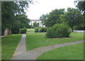
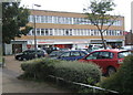
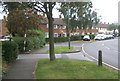
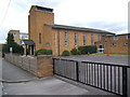

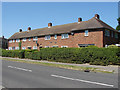
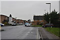
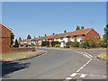
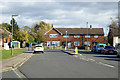
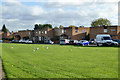
Please click the More button for more images, licensing and image copyright information.
Member of UK Parliament
This postcode is in the Spelthorne parliamentary constituency.
Spelthorne is a constituency in the South East region of England. The seat has been held by Kwasi Kwarteng (Conservative) since May 2010.

Most Recent House Sales for Hadrian Way, TW19 7HF
25 Feb 2022
30 Aug 2019
24 Jun 2016
17 Dec 2014
Local Petrol Station Prices
Coordinates for TW19 7HF
Residents at TW19 7HF
Sunrise and Sunset at TW19 7HF
Traffic Emission and Congestion Zones
Historical Weather Summary
| Clear | 20.57% |
| Cloudy | 53.44% |
| Rain | 5.69% |
| Windy | 20.22% |
| Other | 0.08% |
Population
Deprivation Index
the more deprived the postcode
Average Energy Performance
Companies Registered at TW19 7HF
Postcode Details for TW19 7HF
Recent Updates
|
18 Apr 2024 Added Traffic Camera Views from Traffic Scotland to Roadworks within Scotland |
|
15 Apr 2024 Schools Data updated for April 2024 |
|
10 Apr 2024 Companies Data updated for March 2024 |
|
7 Apr 2024 New option to receive automatic updates to roadworks that affect you |
|
7 Apr 2024 Police and Crime data updated for February 2024 |
|
3 Apr 2024 Sold House Price data updated for February 2024 |
|
30 Mar 2024 Energy Performance Certificates (England and Wales) updated February 2024 |
|
28 Mar 2024 New feature to use Geolocating functions to detect your current location |
Random Postcodes
Want an idea of what is in our extensive website? Try somewhere completely random!
The Rural/Urban classification is based upon data collected during the 2011 Census and released in August 2013 and is categorised into 6 distinct classes.
[A] Urban Major conurbation: A built up area with a population of 10,000 (3,000 in Scotland) or more and is assigned to the major conurbation settlement category.
[B] Urban Minor conurbation: A built up area with a population of 10,000 (3,000 in Scotland) or more and is assigned to the minor conurbation settlement category.
[C] Urban City and town: A built up area with a population of 10,000 (3,000 in Scotland) or more and is assigned to the city and town settlement category.
[D] Rural Town and fringe
[E] Rural Village
[F] Rural Hamlet and isolated dwelling
The Index of Multiple Deprivation (IMD) is the official measure of relative deprivation.
The index is based on 39 separate indicators across seven distinct domains (Income; Employment; Health and Disability; Education, Skills and Training; Crime; Barriers to Housing and Services; Living Environment) to provide an overall measure of multiple deprivation and is calculated for every neighbourhood.
The index is relative rather than an absolute scale and so a neighbourhood with a score of 10 is more deprived than one rated 20, but this does not equate to being twice as deprived.
Please note: Different indices are used in England, Scotland, Wales and Northern Ireland and so comparison of scores from neighbourhoods in different countries should not be undertaken.
These figures report on incorporated UK companies only that are registered at this postcode and do not include sole-traders, partnerships or overseas organisations.
The population figure shown for your area are an estimate provided by the Office for National Statistics and is rounded to the nearest 1,000.
The estimates are derived from the Annual Population Survey (APS) which is the Labour Force Survey (LFS) plus various sample boosts.
There are 26 county councils in 2-tier areas, providing services such as education, social services and waste disposal.
In 2-tier areas, each county council area is subdivided into districts, for which there is an independent district council. There are 192 district councils.
District councils are responsible for local services such as rubbish collection, housing and planning applications.