Overview for Ashling Way, MIDDLESBROUGH, TS5 4EX
Introduction
Middlesbrough (MID-əlz-brə) is a town in the Middlesbrough unitary authority borough of North Yorkshire, England. The town lies near the mouth of the River Tees and north of the North York Moors National Park. The built-up area had a population of 148,215 at the 2021 UK census. It is the largest town of the wider Teesside area, which had a population of 376,633 in 2011.
Until the early 1800s, the area was rural farmland in the historic county of Yorkshire. The town was a planned development which started in 1830, based around a new port with coal and later ironworks added. Steel production and ship building began in the late 1800s, remaining associated with the town until the post-industrial decline of the late twentieth century. Trade (notably through ports) and digital enterprise sectors contemporarily contribute to the local economy, Teesside University and Middlesbrough College to local education.
Middlesbrough was made a municipal borough in 1853. When elected county councils were created in 1889, Middlesbrough was considered large enough to provide its own county-level services and so it became a county borough, independent from North Riding County Council. The borough of Middlesbrough was abolished in 1968 when the area was absorbed into the larger County Borough of Teesside. Six years later in 1974 Middlesbrough was re-established as a borough within the new county of Cleveland. Cleveland was abolished in 1996, since when Middlesbrough has been a unitary authority within the ceremonial county of North Yorkshire.
Summary for Ashling Way, MIDDLESBROUGH, TS5 4EX
Roadworks near TS5 4EX
Road Safety near TS5 4EX
Details of personal injury accidents in and around Ashling Way, TS5 4EX that have been reported to Cleveland Police over the past 20 years.
Traffic Levels near TS5 4EX
View traffic levels near Ashling Way, TS5 4EX from official Department for Transport counts.
Images taken near to Ashling Way, TS5 4EX and the surrounding area
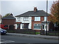
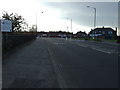
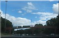

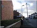
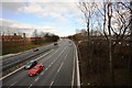
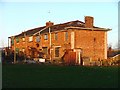

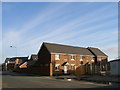
Please click the More button for more images, licensing and image copyright information.
Middlesbrough and nearby Videos From YouTube
4k Cinematic Drone Footage // South Gare Lighthouse // Paddy's Hole
Flight from the Lighthouse to Paddy's Hole & Back on a Lovely sunny night Dji Mavic Air 2 4k 30fps.
Channel: Gary's Aerial Views (View Channel)
Published: 23 Sep 2021
Member of UK Parliament
This postcode is in the Middlesbrough parliamentary constituency.
Middlesbrough is a constituency in the North East region of England. The seat has been held by Andy McDonald (Labour) since November 2012.

Most Recent House Sales for Ashling Way, TS5 4EX
No recorded house sales or transfers for this postcode.
Local Petrol Station Prices
Coordinates for TS5 4EX
Residents at TS5 4EX
Sunrise and Sunset at TS5 4EX
Traffic Emission and Congestion Zones
Historical Weather Summary
| Clear | 12.22% |
| Cloudy | 66.42% |
| Rain | 8.09% |
| Windy | 13.22% |
| Other | 0.05% |
Population
Deprivation Index
the more deprived the postcode
Average Energy Performance
Companies Registered at TS5 4EX
Postcode Details for TS5 4EX
Recent Updates
|
18 Apr 2024 Added Traffic Camera Views from Traffic Scotland to Roadworks within Scotland |
|
15 Apr 2024 Schools Data updated for April 2024 |
|
10 Apr 2024 Companies Data updated for March 2024 |
|
7 Apr 2024 New option to receive automatic updates to roadworks that affect you |
|
7 Apr 2024 Police and Crime data updated for February 2024 |
|
3 Apr 2024 Sold House Price data updated for February 2024 |
|
30 Mar 2024 Energy Performance Certificates (England and Wales) updated February 2024 |
|
28 Mar 2024 New feature to use Geolocating functions to detect your current location |
Random Postcodes
Want an idea of what is in our extensive website? Try somewhere completely random!
The Rural/Urban classification is based upon data collected during the 2011 Census and released in August 2013 and is categorised into 6 distinct classes.
[A] Urban Major conurbation: A built up area with a population of 10,000 (3,000 in Scotland) or more and is assigned to the major conurbation settlement category.
[B] Urban Minor conurbation: A built up area with a population of 10,000 (3,000 in Scotland) or more and is assigned to the minor conurbation settlement category.
[C] Urban City and town: A built up area with a population of 10,000 (3,000 in Scotland) or more and is assigned to the city and town settlement category.
[D] Rural Town and fringe
[E] Rural Village
[F] Rural Hamlet and isolated dwelling
The Index of Multiple Deprivation (IMD) is the official measure of relative deprivation.
The index is based on 39 separate indicators across seven distinct domains (Income; Employment; Health and Disability; Education, Skills and Training; Crime; Barriers to Housing and Services; Living Environment) to provide an overall measure of multiple deprivation and is calculated for every neighbourhood.
The index is relative rather than an absolute scale and so a neighbourhood with a score of 10 is more deprived than one rated 20, but this does not equate to being twice as deprived.
Please note: Different indices are used in England, Scotland, Wales and Northern Ireland and so comparison of scores from neighbourhoods in different countries should not be undertaken.
These figures report on incorporated UK companies only that are registered at this postcode and do not include sole-traders, partnerships or overseas organisations.
The population figure shown for your area are an estimate provided by the Office for National Statistics and is rounded to the nearest 1,000.
The estimates are derived from the Annual Population Survey (APS) which is the Labour Force Survey (LFS) plus various sample boosts.
There are 55 unitary authorities. They provide all local government services in their areas. These are mainly in the cities, urban areas and larger towns although there are now 6 shire county councils that are unitary (ie have no district councils beneath them).