Overview for School Avenue, HARTLEPOOL, TS27 4ND
Introduction
Hartlepool is a seaside and port town in County Durham, England. It is governed by a unitary authority borough named after the town. The borough is part of the devolved Tees Valley area. With an estimated population of 87,995, it is the second-largest settlement (after Darlington) in County Durham.
The old town was founded in the 7th century, around the monastery of Hartlepool Abbey on a headland. As the village grew into a town in the Middle Ages, its harbour served as the County Palatine of Durham's official port. The new town of West Hartlepool was created in 1835 after a new port was built and railway links from the South Durham coal fields (to the north) and from Stockton-on-Tees (to the south) were created. The two towns merged and became known as the Hartlepools before dropping the "s".
Industrialisation in northern England and the start of a shipbuilding industry in the later part of the 19th century meant it was a target for the Imperial German Navy at the beginning of the First World War. A bombardment of 1,150 shells on 16 December 1914 resulted in the death of 117 people in the town. A severe decline in heavy industries and shipbuilding following the Second World War caused periods of high unemployment until the 1990s when major investment projects and the redevelopment of the docks area into a marina saw a rise in the town's prospects. The town also has a seaside resort called Seaton Carew.
Summary for School Avenue, HARTLEPOOL, TS27 4ND
Roadworks near TS27 4ND
Road Safety near TS27 4ND
Details of personal injury accidents in and around School Avenue, TS27 4ND that have been reported to Durham Constabulary over the past 20 years.
Traffic Levels near TS27 4ND
View traffic levels near School Avenue, TS27 4ND from official Department for Transport counts.
Images taken near to School Avenue, TS27 4ND and the surrounding area
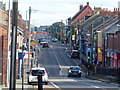
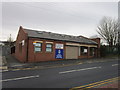
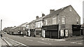
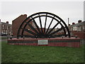
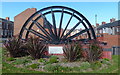
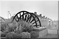
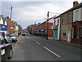
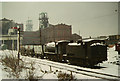
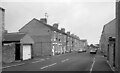
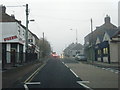
Please click the More button for more images, licensing and image copyright information.
Police
This area is policed by Durham Constabulary.
Durham Constabulary split their policing area into 71 separate neighbourhoods and this postcode is in the Peterlee (Blackhall) neighbourhood.

Peterlee (Blackhall) Neighbourhood Crime
Top 3 Categories
For full details of all categories together with more crime information, click on the Details button.
Member of UK Parliament
This postcode is in the Easington parliamentary constituency.
Easington is a constituency in the North East region of England. The seat has been held by Grahame Morris (Labour) since May 2010.

Most Recent House Sales for School Avenue, TS27 4ND
16 Aug 2023
23 Oct 2020
11 Feb 2011
24 Sep 2010
Local Petrol Station Prices
Coordinates for TS27 4ND
Residents at TS27 4ND
Sunrise and Sunset at TS27 4ND
Traffic Emission and Congestion Zones
Historical Weather Summary
| Clear | 13.43% |
| Cloudy | 68.14% |
| Rain | 8.83% |
| Windy | 9.47% |
| Other | 0.13% |
Population
Deprivation Index
the more deprived the postcode
Average Energy Performance
Companies Registered at TS27 4ND
Postcode Details for TS27 4ND
Recent Updates
|
18 Apr 2024 Added Traffic Camera Views from Traffic Scotland to Roadworks within Scotland |
|
15 Apr 2024 Schools Data updated for April 2024 |
|
10 Apr 2024 Companies Data updated for March 2024 |
|
7 Apr 2024 New option to receive automatic updates to roadworks that affect you |
|
7 Apr 2024 Police and Crime data updated for February 2024 |
|
3 Apr 2024 Sold House Price data updated for February 2024 |
|
30 Mar 2024 Energy Performance Certificates (England and Wales) updated February 2024 |
|
28 Mar 2024 New feature to use Geolocating functions to detect your current location |
Random Postcodes
Want an idea of what is in our extensive website? Try somewhere completely random!
The Rural/Urban classification is based upon data collected during the 2011 Census and released in August 2013 and is categorised into 6 distinct classes.
[A] Urban Major conurbation: A built up area with a population of 10,000 (3,000 in Scotland) or more and is assigned to the major conurbation settlement category.
[B] Urban Minor conurbation: A built up area with a population of 10,000 (3,000 in Scotland) or more and is assigned to the minor conurbation settlement category.
[C] Urban City and town: A built up area with a population of 10,000 (3,000 in Scotland) or more and is assigned to the city and town settlement category.
[D] Rural Town and fringe
[E] Rural Village
[F] Rural Hamlet and isolated dwelling
The Index of Multiple Deprivation (IMD) is the official measure of relative deprivation.
The index is based on 39 separate indicators across seven distinct domains (Income; Employment; Health and Disability; Education, Skills and Training; Crime; Barriers to Housing and Services; Living Environment) to provide an overall measure of multiple deprivation and is calculated for every neighbourhood.
The index is relative rather than an absolute scale and so a neighbourhood with a score of 10 is more deprived than one rated 20, but this does not equate to being twice as deprived.
Please note: Different indices are used in England, Scotland, Wales and Northern Ireland and so comparison of scores from neighbourhoods in different countries should not be undertaken.
These figures report on incorporated UK companies only that are registered at this postcode and do not include sole-traders, partnerships or overseas organisations.
The population figure shown for your area are an estimate provided by the Office for National Statistics and is rounded to the nearest 1,000.
The estimates are derived from the Annual Population Survey (APS) which is the Labour Force Survey (LFS) plus various sample boosts.
There are 55 unitary authorities. They provide all local government services in their areas. These are mainly in the cities, urban areas and larger towns although there are now 6 shire county councils that are unitary (ie have no district councils beneath them).