Overview for Hartburn Lane, STOCKTON-ON-TEES, TS18 4EN
Introduction
Stockton-on-Tees, often simply referred to as Stockton, is a market town in the Stockton-on-Tees unitary authority borough of County Durham, England. With a population of 84,815 in the 2021 UK census. It is part of the Teesside and the devolved Tees Valley area, on the northern banks of the River Tees.
The Tees was straightened in the early 1800s for larger ships to access the town. The ports have since relocated closer to the North Sea and ships are no longer able to sail from the sea to the town due to the Tees Barrage, which was installed to manage tidal flooding. The Stockton and Darlington Railway, on which coal was ferried to the town for shipment, served the port during early part of the Industrial Revolution. The railway was also the world's first permanent steam-locomotive-powered passenger railway.
Summary for Hartburn Lane, STOCKTON-ON-TEES, TS18 4EN
Roadworks near TS18 4EN
Road Safety near TS18 4EN
Details of personal injury accidents in and around Hartburn Lane, TS18 4EN that have been reported to Cleveland Police over the past 20 years.
Traffic Levels near TS18 4EN
View traffic levels near Hartburn Lane, TS18 4EN from official Department for Transport counts.
Images taken near to Hartburn Lane, TS18 4EN and the surrounding area
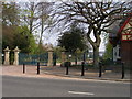

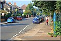

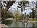
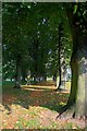

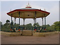
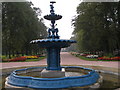

Please click the More button for more images, licensing and image copyright information.
Stockton-On-Tees and nearby Videos From YouTube
DJI Mini 2 fly around the Transporter Bridge in Teesside before the birds appear #drone #dronevideo
This was my second attempt to get some drone shots of the mighty Transporter bridge before the birds show up in attack formation ...
Channel: Teesside Drones (View Channel)
Published: 14 Jul 2023
Member of UK Parliament
This postcode is in the Stockton South parliamentary constituency.
Stockton South is a constituency in the North East region of England. The seat has been held by Matt Vickers (Conservative) since December 2019.

Most Recent House Sales for Hartburn Lane, TS18 4EN
12 Feb 2016
30 Jul 2010
27 Mar 2008
11 Sep 2007
Local Petrol Station Prices
Coordinates for TS18 4EN
Residents at TS18 4EN
Sunrise and Sunset at TS18 4EN
Traffic Emission and Congestion Zones
Historical Weather Summary
| Clear | 11.85% |
| Cloudy | 69.34% |
| Rain | 8.75% |
| Windy | 9.96% |
| Other | 0.10% |
Population
Deprivation Index
the more deprived the postcode
Average Energy Performance
Companies Registered at TS18 4EN
Postcode Details for TS18 4EN
Recent Updates
|
18 Apr 2024 Added Traffic Camera Views from Traffic Scotland to Roadworks within Scotland |
|
15 Apr 2024 Schools Data updated for April 2024 |
|
10 Apr 2024 Companies Data updated for March 2024 |
|
7 Apr 2024 New option to receive automatic updates to roadworks that affect you |
|
7 Apr 2024 Police and Crime data updated for February 2024 |
|
3 Apr 2024 Sold House Price data updated for February 2024 |
|
30 Mar 2024 Energy Performance Certificates (England and Wales) updated February 2024 |
|
28 Mar 2024 New feature to use Geolocating functions to detect your current location |
Random Postcodes
Want an idea of what is in our extensive website? Try somewhere completely random!
The Rural/Urban classification is based upon data collected during the 2011 Census and released in August 2013 and is categorised into 6 distinct classes.
[A] Urban Major conurbation: A built up area with a population of 10,000 (3,000 in Scotland) or more and is assigned to the major conurbation settlement category.
[B] Urban Minor conurbation: A built up area with a population of 10,000 (3,000 in Scotland) or more and is assigned to the minor conurbation settlement category.
[C] Urban City and town: A built up area with a population of 10,000 (3,000 in Scotland) or more and is assigned to the city and town settlement category.
[D] Rural Town and fringe
[E] Rural Village
[F] Rural Hamlet and isolated dwelling
The Index of Multiple Deprivation (IMD) is the official measure of relative deprivation.
The index is based on 39 separate indicators across seven distinct domains (Income; Employment; Health and Disability; Education, Skills and Training; Crime; Barriers to Housing and Services; Living Environment) to provide an overall measure of multiple deprivation and is calculated for every neighbourhood.
The index is relative rather than an absolute scale and so a neighbourhood with a score of 10 is more deprived than one rated 20, but this does not equate to being twice as deprived.
Please note: Different indices are used in England, Scotland, Wales and Northern Ireland and so comparison of scores from neighbourhoods in different countries should not be undertaken.
These figures report on incorporated UK companies only that are registered at this postcode and do not include sole-traders, partnerships or overseas organisations.
The population figure shown for your area are an estimate provided by the Office for National Statistics and is rounded to the nearest 1,000.
The estimates are derived from the Annual Population Survey (APS) which is the Labour Force Survey (LFS) plus various sample boosts.
There are 55 unitary authorities. They provide all local government services in their areas. These are mainly in the cities, urban areas and larger towns although there are now 6 shire county councils that are unitary (ie have no district councils beneath them).