Overview for Fraddon Hill, ST. COLUMB, TR9 6NG
Introduction
St Columb Major is a town and civil parish in Cornwall, England, United Kingdom. Often referred to locally as St Columb, it is approximately seven miles (11 km) southwest of Wadebridge and six miles (10 km) east of Newquay
The designation Major distinguishes it from the nearby settlement and parish of St Columb Minor on the coast. An electoral ward simply named St Columb exists with a population at the 2011 census of 5,050. The town is named after the 6th-century AD Saint Columba of Cornwall, also known as Columb.
Twice a year the town plays host to "hurling", a medieval game once common throughout Cornwall but now only played in St Columb and St Ives. It is played on Shrove Tuesday and again on the Saturday eleven days later. The game involves two teams of unlimited numbers (the 'townsmen' and the 'countrymen' of St Columb parish) who endeavour to carry a silver ball to goals set two miles (3 km) apart or across the parish boundary, making the parish, around 17.2 square miles (45 km2) in area, the de facto largest sports ground in the world.
Summary for Fraddon Hill, ST. COLUMB, TR9 6NG
Roadworks near TR9 6NG
Road Safety near TR9 6NG
Details of personal injury accidents in and around Fraddon Hill, TR9 6NG that have been reported to Devon & Cornwall Police over the past 20 years.
Traffic Levels near TR9 6NG
View traffic levels near Fraddon Hill, TR9 6NG from official Department for Transport counts.
Images taken near to Fraddon Hill, TR9 6NG and the surrounding area
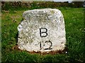
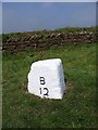
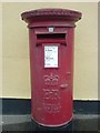
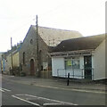
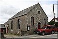
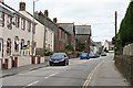
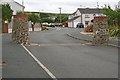
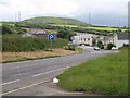
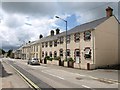
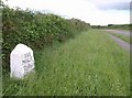
Please click the More button for more images, licensing and image copyright information.
Member of UK Parliament
Unfortunately, Parliamentary details are not available for this postcode.
Most Recent House Sales for Fraddon Hill, TR9 6NG
11 Jun 2021
27 Sep 2018
12 Jan 2018
28 Mar 2013
Local Petrol Station Prices
Coordinates for TR9 6NG
Residents at TR9 6NG
Sunrise and Sunset at TR9 6NG
Traffic Emission and Congestion Zones
Historical Weather Summary
| Clear | 20.56% |
| Cloudy | 60.15% |
| Rain | 10.16% |
| Windy | 9.00% |
| Other | 0.13% |
Population
Deprivation Index
the more deprived the postcode
Average Energy Performance
Companies Registered at TR9 6NG
Postcode Details for TR9 6NG
Recent Updates
|
18 Apr 2024 Added Traffic Camera Views from Traffic Scotland to Roadworks within Scotland |
|
15 Apr 2024 Schools Data updated for April 2024 |
|
10 Apr 2024 Companies Data updated for March 2024 |
|
7 Apr 2024 New option to receive automatic updates to roadworks that affect you |
|
7 Apr 2024 Police and Crime data updated for February 2024 |
|
3 Apr 2024 Sold House Price data updated for February 2024 |
|
30 Mar 2024 Energy Performance Certificates (England and Wales) updated February 2024 |
|
28 Mar 2024 New feature to use Geolocating functions to detect your current location |
Random Postcodes
Want an idea of what is in our extensive website? Try somewhere completely random!
The Rural/Urban classification is based upon data collected during the 2011 Census and released in August 2013 and is categorised into 6 distinct classes.
[A] Urban Major conurbation: A built up area with a population of 10,000 (3,000 in Scotland) or more and is assigned to the major conurbation settlement category.
[B] Urban Minor conurbation: A built up area with a population of 10,000 (3,000 in Scotland) or more and is assigned to the minor conurbation settlement category.
[C] Urban City and town: A built up area with a population of 10,000 (3,000 in Scotland) or more and is assigned to the city and town settlement category.
[D] Rural Town and fringe
[E] Rural Village
[F] Rural Hamlet and isolated dwelling
The Index of Multiple Deprivation (IMD) is the official measure of relative deprivation.
The index is based on 39 separate indicators across seven distinct domains (Income; Employment; Health and Disability; Education, Skills and Training; Crime; Barriers to Housing and Services; Living Environment) to provide an overall measure of multiple deprivation and is calculated for every neighbourhood.
The index is relative rather than an absolute scale and so a neighbourhood with a score of 10 is more deprived than one rated 20, but this does not equate to being twice as deprived.
Please note: Different indices are used in England, Scotland, Wales and Northern Ireland and so comparison of scores from neighbourhoods in different countries should not be undertaken.
These figures report on incorporated UK companies only that are registered at this postcode and do not include sole-traders, partnerships or overseas organisations.
The population figure shown for your area are an estimate provided by the Office for National Statistics and is rounded to the nearest 1,000.
The estimates are derived from the Annual Population Survey (APS) which is the Labour Force Survey (LFS) plus various sample boosts.
There are 55 unitary authorities. They provide all local government services in their areas. These are mainly in the cities, urban areas and larger towns although there are now 6 shire county councils that are unitary (ie have no district councils beneath them).