Overview for Courtenay Street, SALCOMBE, TQ8 8DG
Introduction
Salcombe is a popular resort town in the South Hams district of Devon, south west England. The town is close to the mouth of the Kingsbridge Estuary, mostly built on the steep west side of the estuary. It lies within the South Devon Area of Outstanding Natural Beauty (AONB). The town's extensive waterfront and the naturally sheltered harbour formed by the estuary gave rise to its success as a boat and shipbuilding and sailing port and, in modern times, tourism especially in the form of pleasure boats and yachting. The town is also home to a traditional shellfish fishing industry. The town is part of the electoral ward of Salcombe and Malborough, for which the 2011 census recorded a total population of 3,353.
Kingsbridge Estuary (actually a ria or drowned valley) lies between Bolt Head and Sharpitor on the west and Portlemouth Down on the east, and runs inland for some 8.6 kilometres (5.3 mi). The estuary was designated a Site of Special Scientific Interest in February 1987 and is also a Local Nature Reserve.
Summary for Courtenay Street, SALCOMBE, TQ8 8DG
Roadworks near TQ8 8DG
Road Safety near TQ8 8DG
Details of personal injury accidents in and around Courtenay Street, TQ8 8DG that have been reported to Devon & Cornwall Police over the past 20 years.
Traffic Levels near TQ8 8DG
View traffic levels near Courtenay Street, TQ8 8DG from official Department for Transport counts.
Images taken near to Courtenay Street, TQ8 8DG and the surrounding area
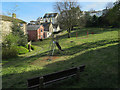
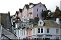
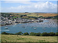
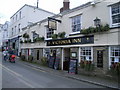
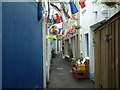
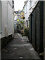
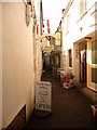
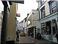
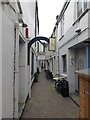
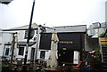
Please click the More button for more images, licensing and image copyright information.
Member of UK Parliament
This postcode is in the Totnes parliamentary constituency.
Totnes is a constituency in the South West region of England. The seat has been held by Anthony Mangnall (Conservative) since December 2019.

Most Recent House Sales for Courtenay Street, TQ8 8DG
No recorded house sales or transfers for this postcode.
Local Petrol Station Prices
Coordinates for TQ8 8DG
Residents at TQ8 8DG
Sunrise and Sunset at TQ8 8DG
Traffic Emission and Congestion Zones
Historical Weather Summary
| Clear | 6.64% |
| Cloudy | 32.46% |
| Rain | 13.69% |
| Windy | 47.16% |
| Other | 0.05% |
Population
Deprivation Index
the more deprived the postcode
Average Energy Performance
Companies Registered at TQ8 8DG
Postcode Details for TQ8 8DG
Recent Updates
|
15 Apr 2024 Schools Data updated for April 2024 |
|
10 Apr 2024 Companies Data updated for March 2024 |
|
7 Apr 2024 New option to receive automatic updates to roadworks that affect you |
|
7 Apr 2024 Police and Crime data updated for February 2024 |
|
3 Apr 2024 Sold House Price data updated for February 2024 |
|
30 Mar 2024 Energy Performance Certificates (England and Wales) updated February 2024 |
|
28 Mar 2024 New feature to use Geolocating functions to detect your current location |
|
17 Mar 2024 Schools Data updated for March 2024 |
Random Postcodes
Want an idea of what is in our extensive website? Try somewhere completely random!
The Rural/Urban classification is based upon data collected during the 2011 Census and released in August 2013 and is categorised into 6 distinct classes.
[A] Urban Major conurbation: A built up area with a population of 10,000 (3,000 in Scotland) or more and is assigned to the major conurbation settlement category.
[B] Urban Minor conurbation: A built up area with a population of 10,000 (3,000 in Scotland) or more and is assigned to the minor conurbation settlement category.
[C] Urban City and town: A built up area with a population of 10,000 (3,000 in Scotland) or more and is assigned to the city and town settlement category.
[D] Rural Town and fringe
[E] Rural Village
[F] Rural Hamlet and isolated dwelling
The Index of Multiple Deprivation (IMD) is the official measure of relative deprivation.
The index is based on 39 separate indicators across seven distinct domains (Income; Employment; Health and Disability; Education, Skills and Training; Crime; Barriers to Housing and Services; Living Environment) to provide an overall measure of multiple deprivation and is calculated for every neighbourhood.
The index is relative rather than an absolute scale and so a neighbourhood with a score of 10 is more deprived than one rated 20, but this does not equate to being twice as deprived.
Please note: Different indices are used in England, Scotland, Wales and Northern Ireland and so comparison of scores from neighbourhoods in different countries should not be undertaken.
These figures report on incorporated UK companies only that are registered at this postcode and do not include sole-traders, partnerships or overseas organisations.
The population figure shown for your area are an estimate provided by the Office for National Statistics and is rounded to the nearest 1,000.
The estimates are derived from the Annual Population Survey (APS) which is the Labour Force Survey (LFS) plus various sample boosts.
There are 26 county councils in 2-tier areas, providing services such as education, social services and waste disposal.
In 2-tier areas, each county council area is subdivided into districts, for which there is an independent district council. There are 192 district councils.
District councils are responsible for local services such as rubbish collection, housing and planning applications.