Overview for Henbury Close, TORQUAY, TQ1 3HR
Introduction
Torquay (tor-KEE) is a seaside town in Devon, England, part of the unitary authority area of Torbay. It lies 18 miles (29 km) south of the county town of Exeter and 28 miles (45 km) east-north-east of Plymouth, on the north of Tor Bay, adjoining the neighbouring town of Paignton on the west of the bay and across from the fishing port of Brixham.
The town's economy, like Brixham's, was initially based upon fishing and agriculture; however, in the early 19th century, it began to develop into a fashionable seaside resort. Later, as the town's fame spread, it was popular with Victorian society. Renowned for its mild climate, the town earned the nickname the English Riviera.
The writer Agatha Christie was born in the town and lived at Ashfield in Torquay during her early years. There is an "Agatha Christie Mile", a tour with plaques dedicated to her life and work.
The poet Elizabeth Barrett Browning lived in the town from 1837 to 1841. This was on the recommendation of her doctor in an attempt to cure her of a disease; the disease is thought likely to have been tuberculosis. Her former home now forms part of the Regina Hotel in Vaughan Parade.
Summary for Henbury Close, TORQUAY, TQ1 3HR
Roadworks near TQ1 3HR
Road Safety near TQ1 3HR
Details of personal injury accidents in and around Henbury Close, TQ1 3HR that have been reported to Devon & Cornwall Police over the past 20 years.
Traffic Levels near TQ1 3HR
View traffic levels near Henbury Close, TQ1 3HR from official Department for Transport counts.
Images taken near to Henbury Close, TQ1 3HR and the surrounding area
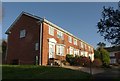
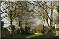
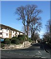
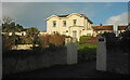
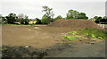

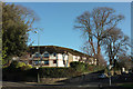
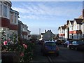
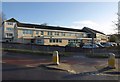
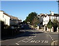
Please click the More button for more images, licensing and image copyright information.
Member of UK Parliament
This postcode is in the Torbay parliamentary constituency.
Torbay is a constituency in the South West region of England. The seat has been held by Kevin Foster (Conservative) since May 2015.

Most Recent House Sales for Henbury Close, TQ1 3HR
30 Nov 2021
27 Sep 2021
16 Oct 2020
14 Feb 2020
Local Petrol Station Prices
Coordinates for TQ1 3HR
Residents at TQ1 3HR
Sunrise and Sunset at TQ1 3HR
Traffic Emission and Congestion Zones
Historical Weather Summary
| Clear | 13.14% |
| Cloudy | 62.24% |
| Rain | 12.33% |
| Windy | 12.20% |
| Other | 0.09% |
Population
Deprivation Index
the more deprived the postcode
Average Energy Performance
Companies Registered at TQ1 3HR
Postcode Details for TQ1 3HR
Recent Updates
|
18 Apr 2024 Added Traffic Camera Views from Traffic Scotland to Roadworks within Scotland |
|
15 Apr 2024 Schools Data updated for April 2024 |
|
10 Apr 2024 Companies Data updated for March 2024 |
|
7 Apr 2024 New option to receive automatic updates to roadworks that affect you |
|
7 Apr 2024 Police and Crime data updated for February 2024 |
|
3 Apr 2024 Sold House Price data updated for February 2024 |
|
30 Mar 2024 Energy Performance Certificates (England and Wales) updated February 2024 |
|
28 Mar 2024 New feature to use Geolocating functions to detect your current location |
Random Postcodes
Want an idea of what is in our extensive website? Try somewhere completely random!
The Rural/Urban classification is based upon data collected during the 2011 Census and released in August 2013 and is categorised into 6 distinct classes.
[A] Urban Major conurbation: A built up area with a population of 10,000 (3,000 in Scotland) or more and is assigned to the major conurbation settlement category.
[B] Urban Minor conurbation: A built up area with a population of 10,000 (3,000 in Scotland) or more and is assigned to the minor conurbation settlement category.
[C] Urban City and town: A built up area with a population of 10,000 (3,000 in Scotland) or more and is assigned to the city and town settlement category.
[D] Rural Town and fringe
[E] Rural Village
[F] Rural Hamlet and isolated dwelling
The Index of Multiple Deprivation (IMD) is the official measure of relative deprivation.
The index is based on 39 separate indicators across seven distinct domains (Income; Employment; Health and Disability; Education, Skills and Training; Crime; Barriers to Housing and Services; Living Environment) to provide an overall measure of multiple deprivation and is calculated for every neighbourhood.
The index is relative rather than an absolute scale and so a neighbourhood with a score of 10 is more deprived than one rated 20, but this does not equate to being twice as deprived.
Please note: Different indices are used in England, Scotland, Wales and Northern Ireland and so comparison of scores from neighbourhoods in different countries should not be undertaken.
These figures report on incorporated UK companies only that are registered at this postcode and do not include sole-traders, partnerships or overseas organisations.
The population figure shown for your area are an estimate provided by the Office for National Statistics and is rounded to the nearest 1,000.
The estimates are derived from the Annual Population Survey (APS) which is the Labour Force Survey (LFS) plus various sample boosts.
There are 55 unitary authorities. They provide all local government services in their areas. These are mainly in the cities, urban areas and larger towns although there are now 6 shire county councils that are unitary (ie have no district councils beneath them).