Overview for Gibbons Brook, ASHFORD, TN25 6HH
Introduction
Ashford is a town in the Ashford district, in the county of Kent, England. It lies on the River Great Stour at the southern or scarp edge of the North Downs, about 61 miles (98 km) southeast of central London and 15 miles (24 km) northwest of Folkestone by road. At the 2021 census, it had a population of 83,213. The name comes from the Old English æscet, indicating a ford near a clump of ash trees. It has been a market town since the Middle Ages, and a regular market continues to be held.
St Mary's Parish Church has been a local landmark since the 13th century, and expanded in the 15th. Today, the church functions in a dual role as a centre for worship and entertainment.
The arrival of the railways from the mid 19th century onwards, created a significant source of employment contributing to the town's growth as a rail hub at the centre of five distinct railway lines. The high speed rail line (HS1 High Speed 1) between London and the Channel Tunnel passes through Ashford's International Railway Station thus linking the town to Paris and other European destinations. The M20 motorway connects Ashford to the Channel Tunnel, the national motorway network (via the M25 Motorway) and to London (via the A20).
Ashford has been marked out for growth in several Government plans from the 1960s onwards. In the 1970s, the construction of a controversial four lane ring road together with the multi-storey Charter House building led to the destruction of significant parts of the old town although some areas were spared and preserved. Other changes in the last 40 years include the construction of the County Square shopping centre, the redevelopment of the Templer Barracks at Repton Park, the Finberry estate to the southeast, and the award-winning Ashford Designer Outlet.
Summary for Gibbons Brook, ASHFORD, TN25 6HH
Roadworks near TN25 6HH
Road Safety near TN25 6HH
Details of personal injury accidents in and around Gibbons Brook, TN25 6HH that have been reported to Kent Police over the past 20 years.
Traffic Levels near TN25 6HH
View traffic levels near Gibbons Brook, TN25 6HH from official Department for Transport counts.
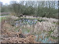
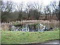
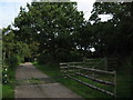
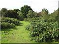
Images taken near to Gibbons Brook, TN25 6HH and the surrounding area
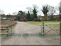
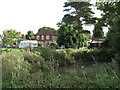
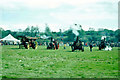
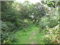
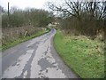
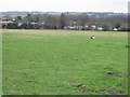
Please click the More button for more images, licensing and image copyright information.
Ashford and nearby Videos From YouTube
Wye | Fields near Wye National Nature Reserve | Drone Flight
Channel: Jay Eastaugh (View Channel)
Published: 18 May 2022
Police
This area is policed by Kent Police.
Kent Police split their policing area into 293 separate neighbourhoods and this postcode is in the North Downs West neighbourhood.

North Downs West Neighbourhood Crime
Top 3 Categories
For full details of all categories together with more crime information, click on the Details button.
Member of UK Parliament
This postcode is in the Folkestone and Hythe parliamentary constituency.
Folkestone and Hythe is a constituency in the South East region of England. The seat has been held by Damian Collins (Conservative) since May 2010.

Most Recent House Sales for Gibbons Brook, TN25 6HH
29 Jul 2015
20 Sep 2001
12 Feb 1998
Local Petrol Station Prices
Coordinates for TN25 6HH
Residents at TN25 6HH
Sunrise and Sunset at TN25 6HH
Traffic Emission and Congestion Zones
Historical Weather Summary
| Clear | 10.25% |
| Cloudy | 60.53% |
| Rain | 10.81% |
| Windy | 18.40% |
| Other | 0.01% |
Population
Deprivation Index
the more deprived the postcode
Average Energy Performance
Companies Registered at TN25 6HH
Postcode Details for TN25 6HH
Recent Updates
|
15 Apr 2024 Schools Data updated for April 2024 |
|
10 Apr 2024 Companies Data updated for March 2024 |
|
7 Apr 2024 New option to receive automatic updates to roadworks that affect you |
|
7 Apr 2024 Police and Crime data updated for February 2024 |
|
3 Apr 2024 Sold House Price data updated for February 2024 |
|
30 Mar 2024 Energy Performance Certificates (England and Wales) updated February 2024 |
|
28 Mar 2024 New feature to use Geolocating functions to detect your current location |
|
17 Mar 2024 Schools Data updated for March 2024 |
Random Postcodes
Want an idea of what is in our extensive website? Try somewhere completely random!
The Rural/Urban classification is based upon data collected during the 2011 Census and released in August 2013 and is categorised into 6 distinct classes.
[A] Urban Major conurbation: A built up area with a population of 10,000 (3,000 in Scotland) or more and is assigned to the major conurbation settlement category.
[B] Urban Minor conurbation: A built up area with a population of 10,000 (3,000 in Scotland) or more and is assigned to the minor conurbation settlement category.
[C] Urban City and town: A built up area with a population of 10,000 (3,000 in Scotland) or more and is assigned to the city and town settlement category.
[D] Rural Town and fringe
[E] Rural Village
[F] Rural Hamlet and isolated dwelling
The Index of Multiple Deprivation (IMD) is the official measure of relative deprivation.
The index is based on 39 separate indicators across seven distinct domains (Income; Employment; Health and Disability; Education, Skills and Training; Crime; Barriers to Housing and Services; Living Environment) to provide an overall measure of multiple deprivation and is calculated for every neighbourhood.
The index is relative rather than an absolute scale and so a neighbourhood with a score of 10 is more deprived than one rated 20, but this does not equate to being twice as deprived.
Please note: Different indices are used in England, Scotland, Wales and Northern Ireland and so comparison of scores from neighbourhoods in different countries should not be undertaken.
These figures report on incorporated UK companies only that are registered at this postcode and do not include sole-traders, partnerships or overseas organisations.
The population figure shown for your area are an estimate provided by the Office for National Statistics and is rounded to the nearest 1,000.
The estimates are derived from the Annual Population Survey (APS) which is the Labour Force Survey (LFS) plus various sample boosts.
There are 26 county councils in 2-tier areas, providing services such as education, social services and waste disposal.
In 2-tier areas, each county council area is subdivided into districts, for which there is an independent district council. There are 192 district councils.
District councils are responsible for local services such as rubbish collection, housing and planning applications.