Overview for St. Peters Place, BERWICK-UPON-TWEED, TD15 2WZ
Introduction
Berwick-upon-Tweed, sometimes known as Berwick-on-Tweed or simply Berwick, is a town and civil parish in Northumberland, England, 2+1⁄2 mi (4 km) south of the Anglo-Scottish border, and the northernmost town in England. The 2011 United Kingdom census recorded Berwick's population as 12,043.
The town is at the mouth of the River Tweed on the east coast, 56 mi (90 km) south east of Edinburgh, 65 mi (105 km) north of Newcastle upon Tyne, and 345 mi (555 km) north of London. Uniquely for England, the town is slightly further north than Denmark's capital Copenhagen and the southern tip of Sweden further east of the North Sea, which Berwick borders.
Berwick was founded as an Anglo-Saxon settlement in the Kingdom of Northumbria, which was annexed by England in the 10th century. A civil parish and town council were formed in 2008 comprising the communities of Berwick, Spittal and Tweedmouth. It is the northernmost civil parish in England.
The area was for more than 400 years central to historic border wars between the Kingdoms of England and Scotland, and several times possession of Berwick changed hands between the two kingdoms. The last time it changed hands was when Richard of Gloucester retook it for England in 1482. To this day, many Berwickers feel a close affinity to Scotland. Both Berwick Rangers Football Club and Berwick Rugby Football Club play in Scottish leagues.
Berwick remains a traditional market town and also has some notable architectural features, in particular its medieval town walls, its Georgian Town Hall, its Elizabethan ramparts, and Britain's earliest barracks buildings, which Nicholas Hawksmoor built (1717–1721) for the Board of Ordnance.
Summary for St. Peters Place, BERWICK-UPON-TWEED, TD15 2WZ
Roadworks near TD15 2WZ
Road Safety near TD15 2WZ
Details of personal injury accidents in and around St. Peters Place, TD15 2WZ that have been reported to Northumbria Police over the past 20 years.
Traffic Levels near TD15 2WZ
View traffic levels near St. Peters Place, TD15 2WZ from official Department for Transport counts.
Images taken near to St. Peters Place, TD15 2WZ and the surrounding area
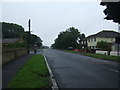
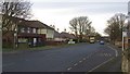
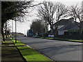
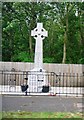
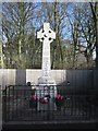
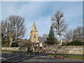
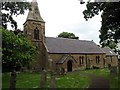
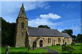
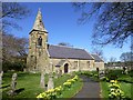
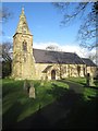
Please click the More button for more images, licensing and image copyright information.
Police
This area is policed by Northumbria Police.
Northumbria Police split their policing area into 35 separate neighbourhoods and this postcode is in the Berwick neighbourhood.

Berwick Neighbourhood Crime
Top 3 Categories
For full details of all categories together with more crime information, click on the Details button.
Member of UK Parliament
This postcode is in the Berwick-upon-Tweed parliamentary constituency.
Berwick-upon-Tweed is a constituency in the North East region of England. The seat has been held by Anne-Marie Trevelyan (Conservative) since May 2015.

Most Recent House Sales for St. Peters Place, TD15 2WZ
26 Aug 2020
17 Mar 2017
16 Dec 2016
16 Jul 2010
Local Petrol Station Prices
Coordinates for TD15 2WZ
Residents at TD15 2WZ
Sunrise and Sunset at TD15 2WZ
Traffic Emission and Congestion Zones
Historical Weather Summary
| Clear | 9.15% |
| Cloudy | 43.98% |
| Rain | 10.33% |
| Windy | 36.41% |
| Other | 0.13% |
Population
Deprivation Index
the more deprived the postcode
Average Energy Performance
Companies Registered at TD15 2WZ
Postcode Details for TD15 2WZ
Recent Updates
|
18 Apr 2024 Added Traffic Camera Views from Traffic Scotland to Roadworks within Scotland |
|
15 Apr 2024 Schools Data updated for April 2024 |
|
10 Apr 2024 Companies Data updated for March 2024 |
|
7 Apr 2024 New option to receive automatic updates to roadworks that affect you |
|
7 Apr 2024 Police and Crime data updated for February 2024 |
|
3 Apr 2024 Sold House Price data updated for February 2024 |
|
30 Mar 2024 Energy Performance Certificates (England and Wales) updated February 2024 |
|
28 Mar 2024 New feature to use Geolocating functions to detect your current location |
Random Postcodes
Want an idea of what is in our extensive website? Try somewhere completely random!
The Rural/Urban classification is based upon data collected during the 2011 Census and released in August 2013 and is categorised into 6 distinct classes.
[A] Urban Major conurbation: A built up area with a population of 10,000 (3,000 in Scotland) or more and is assigned to the major conurbation settlement category.
[B] Urban Minor conurbation: A built up area with a population of 10,000 (3,000 in Scotland) or more and is assigned to the minor conurbation settlement category.
[C] Urban City and town: A built up area with a population of 10,000 (3,000 in Scotland) or more and is assigned to the city and town settlement category.
[D] Rural Town and fringe
[E] Rural Village
[F] Rural Hamlet and isolated dwelling
The Index of Multiple Deprivation (IMD) is the official measure of relative deprivation.
The index is based on 39 separate indicators across seven distinct domains (Income; Employment; Health and Disability; Education, Skills and Training; Crime; Barriers to Housing and Services; Living Environment) to provide an overall measure of multiple deprivation and is calculated for every neighbourhood.
The index is relative rather than an absolute scale and so a neighbourhood with a score of 10 is more deprived than one rated 20, but this does not equate to being twice as deprived.
Please note: Different indices are used in England, Scotland, Wales and Northern Ireland and so comparison of scores from neighbourhoods in different countries should not be undertaken.
These figures report on incorporated UK companies only that are registered at this postcode and do not include sole-traders, partnerships or overseas organisations.
The population figure shown for your area are an estimate provided by the Office for National Statistics and is rounded to the nearest 1,000.
The estimates are derived from the Annual Population Survey (APS) which is the Labour Force Survey (LFS) plus various sample boosts.
There are 55 unitary authorities. They provide all local government services in their areas. These are mainly in the cities, urban areas and larger towns although there are now 6 shire county councils that are unitary (ie have no district councils beneath them).