Overview for Brent Road, BURNHAM-ON-SEA, TA8 2JU
Introduction
Burnham-on-Sea is a seaside town in Somerset, England, at the mouth of the River Parrett, upon Bridgwater Bay. Burnham was a small fishing village until the late 18th century when it began to grow because of its popularity as a seaside resort.
Burnham-on-Sea forms part of the parish of Burnham-on-Sea and Highbridge and shares a town council with its neighbouring small market town of Highbridge. According to the 2011 census the population of the parish (including Highbridge) was 19,576, of which the most populous wards 'Burnham Central' and 'Burnham North'; totalled 13,601.
Burnham-on-Sea is famous for its low lighthouse. The lighthouse was built in 1832 and is a Grade-II listed building with a red and white striped facade.
The position of the town on the edge of the Somerset Levels and moors where they meet the Bristol Channel, has resulted in a history dominated by land reclamation and sea defences since Roman times. Burnham was seriously affected by the Bristol Channel floods of 1607, with the present curved concrete wall being completed in 1988. There have been many shipwrecks on the Gore Sands, which lie just offshore and can be exposed at low tides. Lighthouses are hence prominent landmarks in the town, with the original lighthouse known as the Round Tower built to replace the light on the top of the 14th-century tower of St Andrews Church. The 110-foot (34-metre) pillar or High Lighthouse and the low wooden pile lighthouse or Lighthouse on legs on the beach were built to replace it. The town's first lifeboat was provided in 1836 by the Corporation of Bridgwater.
Summary for Brent Road, BURNHAM-ON-SEA, TA8 2JU
Roadworks near TA8 2JU
Road Safety near TA8 2JU
Details of personal injury accidents in and around Brent Road, TA8 2JU that have been reported to Avon and Somerset Constabulary over the past 20 years.
Traffic Levels near TA8 2JU
View traffic levels near Brent Road, TA8 2JU from official Department for Transport counts.
Images taken near to Brent Road, TA8 2JU and the surrounding area
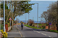
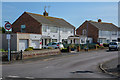
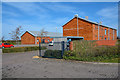
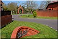
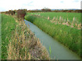
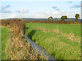
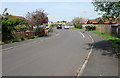
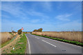
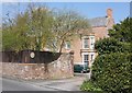
Please click the More button for more images, licensing and image copyright information.
Police
This area is policed by Avon and Somerset Constabulary.
Avon and Somerset Constabulary split their policing area into 123 separate neighbourhoods and this postcode is in the Sedgemoor North West neighbourhood.

Sedgemoor North West Neighbourhood Crime
Top 3 Categories
For full details of all categories together with more crime information, click on the Details button.
Member of UK Parliament
This postcode is in the Wells parliamentary constituency.
Wells is a constituency in the South West region of England. The seat has been held by James Heappey (Conservative) since May 2015.

Most Recent House Sales for Brent Road, TA8 2JU
1 Aug 2022
13 Apr 2021
13 Jan 2021
12 Oct 2020
Local Petrol Station Prices
Coordinates for TA8 2JU
Residents at TA8 2JU
Sunrise and Sunset at TA8 2JU
Traffic Emission and Congestion Zones
Historical Weather Summary
| Clear | 20.90% |
| Cloudy | 66.76% |
| Rain | 7.90% |
| Windy | 4.11% |
| Other | 0.33% |
Deprivation Index
the more deprived the postcode
Average Energy Performance
Companies Registered at TA8 2JU
Postcode Details for TA8 2JU
Recent Updates
|
18 Apr 2024 Added Traffic Camera Views from Traffic Scotland to Roadworks within Scotland |
|
15 Apr 2024 Schools Data updated for April 2024 |
|
10 Apr 2024 Companies Data updated for March 2024 |
|
7 Apr 2024 New option to receive automatic updates to roadworks that affect you |
|
7 Apr 2024 Police and Crime data updated for February 2024 |
|
3 Apr 2024 Sold House Price data updated for February 2024 |
|
30 Mar 2024 Energy Performance Certificates (England and Wales) updated February 2024 |
|
28 Mar 2024 New feature to use Geolocating functions to detect your current location |
Random Postcodes
Want an idea of what is in our extensive website? Try somewhere completely random!
The Rural/Urban classification is based upon data collected during the 2011 Census and released in August 2013 and is categorised into 6 distinct classes.
[A] Urban Major conurbation: A built up area with a population of 10,000 (3,000 in Scotland) or more and is assigned to the major conurbation settlement category.
[B] Urban Minor conurbation: A built up area with a population of 10,000 (3,000 in Scotland) or more and is assigned to the minor conurbation settlement category.
[C] Urban City and town: A built up area with a population of 10,000 (3,000 in Scotland) or more and is assigned to the city and town settlement category.
[D] Rural Town and fringe
[E] Rural Village
[F] Rural Hamlet and isolated dwelling
The Index of Multiple Deprivation (IMD) is the official measure of relative deprivation.
The index is based on 39 separate indicators across seven distinct domains (Income; Employment; Health and Disability; Education, Skills and Training; Crime; Barriers to Housing and Services; Living Environment) to provide an overall measure of multiple deprivation and is calculated for every neighbourhood.
The index is relative rather than an absolute scale and so a neighbourhood with a score of 10 is more deprived than one rated 20, but this does not equate to being twice as deprived.
Please note: Different indices are used in England, Scotland, Wales and Northern Ireland and so comparison of scores from neighbourhoods in different countries should not be undertaken.
These figures report on incorporated UK companies only that are registered at this postcode and do not include sole-traders, partnerships or overseas organisations.
The population figure shown for your area are an estimate provided by the Office for National Statistics and is rounded to the nearest 1,000.
The estimates are derived from the Annual Population Survey (APS) which is the Labour Force Survey (LFS) plus various sample boosts.
There are 55 unitary authorities. They provide all local government services in their areas. These are mainly in the cities, urban areas and larger towns although there are now 6 shire county councils that are unitary (ie have no district councils beneath them).