Overview for Doniford Road, WATCHET, TA23 0TG
Introduction
Watchet is a harbour town, civil parish and electoral ward in the county of Somerset, England, with a population in 2011 of 3,785. It is situated 15 miles (24 km) West of Bridgwater, 15 miles (24 km) north-west of Taunton, and 9 miles (14 km) East of Minehead. The town lies at the mouth of the Washford River on Bridgwater Bay, part of the Bristol Channel, and on the edge of Exmoor National Park.
The original settlement may have been at the Iron Age fort, Daw's Castle. It then moved to the mouth of the river and a small harbour developed, named by the celts as Gwo Coed meaning "under the wood". After the Saxon conquest of the area the town developed, becoming known as Weced or Waeced, and was attacked by Vikings in the 10th century. Trade using the harbour gradually grew, despite damage during several severe storms, with import and exports of goods including those from Wansbrough Paper Mill until the 19th century when it increased with the export of iron ore, brought from the Brendon Hills via the West Somerset Mineral Railway, mainly to Newport for onward transportation to the Ebbw Vale Steelworks. The West Somerset Railway also served the town and port bringing goods and people from the Bristol and Exeter Railway. The iron ore trade reduced, finally ceasing in the early 20th century. The port continued a smaller commercial trade until 2000 when it was converted into a marina. In 2016, Watchet joined the rest of West Somerset in receiving 'Opportunity Area' status.
The church is dedicated to Saint Decuman who is thought to have died here around 706. An early church was built near Daw's Castle and a new church was erected in the 15th century. It has several tombs and monuments to Sir John Wyndham and his family who were the lords of the manor. Samuel Taylor Coleridge's poem The Rime of the Ancient Mariner, which was written in the area, is commemorated by a statue on the harbourside.
Summary for Doniford Road, WATCHET, TA23 0TG
Roadworks near TA23 0TG
Road Safety near TA23 0TG
Details of personal injury accidents in and around Doniford Road, TA23 0TG that have been reported to Avon and Somerset Constabulary over the past 20 years.
Traffic Levels near TA23 0TG
View traffic levels near Doniford Road, TA23 0TG from official Department for Transport counts.
Images taken near to Doniford Road, TA23 0TG and the surrounding area
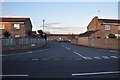
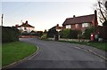

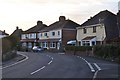
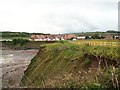

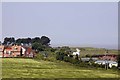
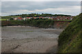
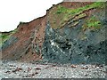

Please click the More button for more images, licensing and image copyright information.
Police
This area is policed by Avon and Somerset Constabulary.
Avon and Somerset Constabulary split their policing area into 123 separate neighbourhoods and this postcode is in the Williton and Watchet neighbourhood.

Williton and Watchet Neighbourhood Crime
Top 3 Categories
For full details of all categories together with more crime information, click on the Details button.
Member of UK Parliament
This postcode is in the Bridgwater and West Somerset parliamentary constituency.
Bridgwater and West Somerset is a constituency in the South West region of England. The seat has been held by Mr Ian Liddell-Grainger (Conservative) since May 2010.

Most Recent House Sales for Doniford Road, TA23 0TG
25 May 2021
29 Jul 2019
31 May 2019
21 Sep 2018
Local Petrol Station Prices
Coordinates for TA23 0TG
Residents at TA23 0TG
Sunrise and Sunset at TA23 0TG
Traffic Emission and Congestion Zones
Historical Weather Summary
| Clear | 20.09% |
| Cloudy | 62.36% |
| Rain | 7.45% |
| Windy | 9.84% |
| Other | 0.26% |
Deprivation Index
the more deprived the postcode
Average Energy Performance
Companies Registered at TA23 0TG
Postcode Details for TA23 0TG
Recent Updates
|
18 Apr 2024 Added Traffic Camera Views from Traffic Scotland to Roadworks within Scotland |
|
15 Apr 2024 Schools Data updated for April 2024 |
|
10 Apr 2024 Companies Data updated for March 2024 |
|
7 Apr 2024 New option to receive automatic updates to roadworks that affect you |
|
7 Apr 2024 Police and Crime data updated for February 2024 |
|
3 Apr 2024 Sold House Price data updated for February 2024 |
|
30 Mar 2024 Energy Performance Certificates (England and Wales) updated February 2024 |
|
28 Mar 2024 New feature to use Geolocating functions to detect your current location |
Random Postcodes
Want an idea of what is in our extensive website? Try somewhere completely random!
The Rural/Urban classification is based upon data collected during the 2011 Census and released in August 2013 and is categorised into 6 distinct classes.
[A] Urban Major conurbation: A built up area with a population of 10,000 (3,000 in Scotland) or more and is assigned to the major conurbation settlement category.
[B] Urban Minor conurbation: A built up area with a population of 10,000 (3,000 in Scotland) or more and is assigned to the minor conurbation settlement category.
[C] Urban City and town: A built up area with a population of 10,000 (3,000 in Scotland) or more and is assigned to the city and town settlement category.
[D] Rural Town and fringe
[E] Rural Village
[F] Rural Hamlet and isolated dwelling
The Index of Multiple Deprivation (IMD) is the official measure of relative deprivation.
The index is based on 39 separate indicators across seven distinct domains (Income; Employment; Health and Disability; Education, Skills and Training; Crime; Barriers to Housing and Services; Living Environment) to provide an overall measure of multiple deprivation and is calculated for every neighbourhood.
The index is relative rather than an absolute scale and so a neighbourhood with a score of 10 is more deprived than one rated 20, but this does not equate to being twice as deprived.
Please note: Different indices are used in England, Scotland, Wales and Northern Ireland and so comparison of scores from neighbourhoods in different countries should not be undertaken.
These figures report on incorporated UK companies only that are registered at this postcode and do not include sole-traders, partnerships or overseas organisations.
The population figure shown for your area are an estimate provided by the Office for National Statistics and is rounded to the nearest 1,000.
The estimates are derived from the Annual Population Survey (APS) which is the Labour Force Survey (LFS) plus various sample boosts.
There are 55 unitary authorities. They provide all local government services in their areas. These are mainly in the cities, urban areas and larger towns although there are now 6 shire county councils that are unitary (ie have no district councils beneath them).