Overview for Mills Drive, WELLINGTON, TA21 9BW
Introduction
Wellington is a market town in rural Somerset, a county in the west of England, situated 7 miles (11 km) south west of Taunton, near the border with Devon, which runs along the Blackdown Hills to the south of the town. The town has a population of 14,549, which includes the residents of the parish of Wellington Without, and the villages of Tone and Tonedale.
Known as Weolingtun in the Anglo-Saxon period, its name had changed to Walintone by the time of the Domesday Book of 1086. Wellington became a town under a royal charter of 1215 and during the Middle Ages it grew as a centre for trade on the road from Bristol to Exeter. Major rebuilding took place following a fire in the town in 1731, after which it became a centre for cloth-making. It is possible that the fire referred to here was actually in Tiverton, Devon which has details of a major fire in the same year. Further information on a major fire in Wellington at this time cannot be found.
In 1809, the Crown referenced Wellington when creating a viscountcy for the eventual Duke of Wellington, Arthur Wellesley, after his victory at the Battle of Talavera in the Peninsular War. When the title's name was being considered, Arthur's brother, Richard Wellesley, Earl of Mornington, found an available manor in the parish of Wellington, a name close to the family name. Richard oversaw the manor's purchase while Arthur commanded the army in Spain against the French. The Wellington Monument south of Wellington commemorates Arthur.
The Grand Western Canal reached the town in 1835 and then the Bristol and Exeter Railway in 1843. The town's own railway station survived until 1964. Wellington was home of Fox, Fowler and Company, which was the last commercial bank permitted to print their own sterling banknotes in England and Wales. In the 20th century closer links with Taunton meant that many of the residents of Wellington commuted there for work, and the M5 motorway enabled car journeys to be made more easily.
Local industries, which now include an aerosol factory and bed manufacturers, are celebrated at the Wellington Museum in Fore street. Wellington is home to the independent Wellington School, and state-funded Court Fields School. It is also home to a range of cultural, sporting and religious sites including the 15th century Church of St John the Baptist.
The capital city of New Zealand is named after Arthur Wellesley, 1st Duke of Wellington, being recognised as having some influence in the company that founded the New Zealand town. The New Zealand capital therefore takes its name ultimately from the English town of Wellington in Somerset.
Summary for Mills Drive, WELLINGTON, TA21 9BW
Roadworks near TA21 9BW
Road Safety near TA21 9BW
Details of personal injury accidents in and around Mills Drive, TA21 9BW that have been reported to Avon and Somerset Constabulary over the past 20 years.
Traffic Levels near TA21 9BW
View traffic levels near Mills Drive, TA21 9BW from official Department for Transport counts.
Images taken near to Mills Drive, TA21 9BW and the surrounding area
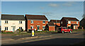

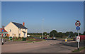
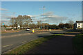
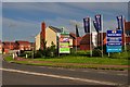
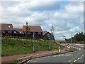

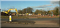
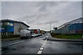

Please click the More button for more images, licensing and image copyright information.
Police
This area is policed by Avon and Somerset Constabulary.
Avon and Somerset Constabulary split their policing area into 123 separate neighbourhoods and this postcode is in the Wellington Centre and South neighbourhood.

Wellington Centre and South Neighbourhood Crime
Top 3 Categories
For full details of all categories together with more crime information, click on the Details button.
Member of UK Parliament
This postcode is in the Taunton Deane parliamentary constituency.
Taunton Deane is a constituency in the South West region of England. The seat has been held by Rebecca Pow (Conservative) since May 2015.

Most Recent House Sales for Mills Drive, TA21 9BW
30 Jun 2023
31 Aug 2022
22 Jul 2022
20 Aug 2021
Local Petrol Station Prices
Coordinates for TA21 9BW
Residents at TA21 9BW
Sunrise and Sunset at TA21 9BW
Traffic Emission and Congestion Zones
Historical Weather Summary
| Clear | 20.11% |
| Cloudy | 59.16% |
| Rain | 7.52% |
| Windy | 12.83% |
| Other | 0.38% |
Deprivation Index
the more deprived the postcode
Average Energy Performance
Companies Registered at TA21 9BW
Postcode Details for TA21 9BW
Recent Updates
|
18 Apr 2024 Added Traffic Camera Views from Traffic Scotland to Roadworks within Scotland |
|
15 Apr 2024 Schools Data updated for April 2024 |
|
10 Apr 2024 Companies Data updated for March 2024 |
|
7 Apr 2024 New option to receive automatic updates to roadworks that affect you |
|
7 Apr 2024 Police and Crime data updated for February 2024 |
|
3 Apr 2024 Sold House Price data updated for February 2024 |
|
30 Mar 2024 Energy Performance Certificates (England and Wales) updated February 2024 |
|
28 Mar 2024 New feature to use Geolocating functions to detect your current location |
Random Postcodes
Want an idea of what is in our extensive website? Try somewhere completely random!
The Rural/Urban classification is based upon data collected during the 2011 Census and released in August 2013 and is categorised into 6 distinct classes.
[A] Urban Major conurbation: A built up area with a population of 10,000 (3,000 in Scotland) or more and is assigned to the major conurbation settlement category.
[B] Urban Minor conurbation: A built up area with a population of 10,000 (3,000 in Scotland) or more and is assigned to the minor conurbation settlement category.
[C] Urban City and town: A built up area with a population of 10,000 (3,000 in Scotland) or more and is assigned to the city and town settlement category.
[D] Rural Town and fringe
[E] Rural Village
[F] Rural Hamlet and isolated dwelling
The Index of Multiple Deprivation (IMD) is the official measure of relative deprivation.
The index is based on 39 separate indicators across seven distinct domains (Income; Employment; Health and Disability; Education, Skills and Training; Crime; Barriers to Housing and Services; Living Environment) to provide an overall measure of multiple deprivation and is calculated for every neighbourhood.
The index is relative rather than an absolute scale and so a neighbourhood with a score of 10 is more deprived than one rated 20, but this does not equate to being twice as deprived.
Please note: Different indices are used in England, Scotland, Wales and Northern Ireland and so comparison of scores from neighbourhoods in different countries should not be undertaken.
These figures report on incorporated UK companies only that are registered at this postcode and do not include sole-traders, partnerships or overseas organisations.
The population figure shown for your area are an estimate provided by the Office for National Statistics and is rounded to the nearest 1,000.
The estimates are derived from the Annual Population Survey (APS) which is the Labour Force Survey (LFS) plus various sample boosts.
There are 55 unitary authorities. They provide all local government services in their areas. These are mainly in the cities, urban areas and larger towns although there are now 6 shire county councils that are unitary (ie have no district councils beneath them).