Overview for Sycamore Drive, CREWKERNE, TA18 7BT
Introduction
Crewkerne (KROO-kərn) is a town and electoral ward in Somerset, England, 9 miles (14 km) southwest of Yeovil and 7 miles (11 km) east of Chard all in the South Somerset district. The civil parish of West Crewkerne includes the hamlets of Coombe, Woolminstone and Henley – and borders the county of Dorset to the south. The town is on the main headwater of the River Parrett, A30 road and West of England Main Line railway, in modern times the slower route between the capital and the southwest peninsula, having been eclipsed by the Taunton route.
The earliest written record of Crewkerne is in the 899 will of Alfred the Great who left it to his youngest son Æthelweard. After the Norman conquest it was held by William the Conqueror and in the Domesday Survey of 1086 was described as a royal manor. Crewkerne Castle was possibly a Norman motte castle. The town grew up in the late mediaeval period around the textile industry, its wealth demonstrated in the fifteenth century Church of St Bartholomew. During the 18th and 19th centuries the main industry was cloth making, including webbing, and sails for the Royal Navy.
Local ecological sites include the Bincombe Beeches Local Nature Reserve and the Millwater biological Site of Special Scientific Interest. Crewkerne railway station is served by South Western Railway. There are local supermarkets and local shops, and some local industry. The town is the birthplace of several notable people and has varied cultural and sporting facilities including those at Wadham Community School.
Summary for Sycamore Drive, CREWKERNE, TA18 7BT
Roadworks near TA18 7BT
Road Safety near TA18 7BT
Details of personal injury accidents in and around Sycamore Drive, TA18 7BT that have been reported to Avon and Somerset Constabulary over the past 20 years.
Traffic Levels near TA18 7BT
View traffic levels near Sycamore Drive, TA18 7BT from official Department for Transport counts.
Images taken near to Sycamore Drive, TA18 7BT and the surrounding area
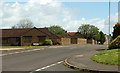
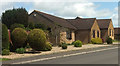
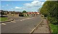
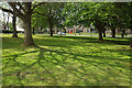
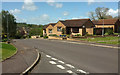

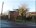

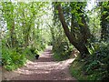
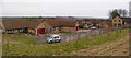
Please click the More button for more images, licensing and image copyright information.
Police
This area is policed by Avon and Somerset Constabulary.
Avon and Somerset Constabulary split their policing area into 123 separate neighbourhoods and this postcode is in the Crewkerne Town neighbourhood.

Crewkerne Town Neighbourhood Crime
Top 3 Categories
For full details of all categories together with more crime information, click on the Details button.
Member of UK Parliament
This postcode is in the Yeovil parliamentary constituency.
Yeovil is a constituency in the South West region of England. The seat has been held by Mr Marcus Fysh (Conservative) since May 2015.

Most Recent House Sales for Sycamore Drive, TA18 7BT
19 Apr 2023
23 Nov 2018
19 Oct 2018
15 Sep 2017
Local Petrol Station Prices
Coordinates for TA18 7BT
Residents at TA18 7BT
Sunrise and Sunset at TA18 7BT
Traffic Emission and Congestion Zones
Historical Weather Summary
| Clear | 22.79% |
| Cloudy | 66.13% |
| Rain | 7.66% |
| Windy | 3.27% |
| Other | 0.15% |
Deprivation Index
the more deprived the postcode
Average Energy Performance
Companies Registered at TA18 7BT
Postcode Details for TA18 7BT
Recent Updates
|
18 Apr 2024 Added Traffic Camera Views from Traffic Scotland to Roadworks within Scotland |
|
15 Apr 2024 Schools Data updated for April 2024 |
|
10 Apr 2024 Companies Data updated for March 2024 |
|
7 Apr 2024 New option to receive automatic updates to roadworks that affect you |
|
7 Apr 2024 Police and Crime data updated for February 2024 |
|
3 Apr 2024 Sold House Price data updated for February 2024 |
|
30 Mar 2024 Energy Performance Certificates (England and Wales) updated February 2024 |
|
28 Mar 2024 New feature to use Geolocating functions to detect your current location |
Random Postcodes
Want an idea of what is in our extensive website? Try somewhere completely random!
The Rural/Urban classification is based upon data collected during the 2011 Census and released in August 2013 and is categorised into 6 distinct classes.
[A] Urban Major conurbation: A built up area with a population of 10,000 (3,000 in Scotland) or more and is assigned to the major conurbation settlement category.
[B] Urban Minor conurbation: A built up area with a population of 10,000 (3,000 in Scotland) or more and is assigned to the minor conurbation settlement category.
[C] Urban City and town: A built up area with a population of 10,000 (3,000 in Scotland) or more and is assigned to the city and town settlement category.
[D] Rural Town and fringe
[E] Rural Village
[F] Rural Hamlet and isolated dwelling
The Index of Multiple Deprivation (IMD) is the official measure of relative deprivation.
The index is based on 39 separate indicators across seven distinct domains (Income; Employment; Health and Disability; Education, Skills and Training; Crime; Barriers to Housing and Services; Living Environment) to provide an overall measure of multiple deprivation and is calculated for every neighbourhood.
The index is relative rather than an absolute scale and so a neighbourhood with a score of 10 is more deprived than one rated 20, but this does not equate to being twice as deprived.
Please note: Different indices are used in England, Scotland, Wales and Northern Ireland and so comparison of scores from neighbourhoods in different countries should not be undertaken.
These figures report on incorporated UK companies only that are registered at this postcode and do not include sole-traders, partnerships or overseas organisations.
The population figure shown for your area are an estimate provided by the Office for National Statistics and is rounded to the nearest 1,000.
The estimates are derived from the Annual Population Survey (APS) which is the Labour Force Survey (LFS) plus various sample boosts.
There are 55 unitary authorities. They provide all local government services in their areas. These are mainly in the cities, urban areas and larger towns although there are now 6 shire county councils that are unitary (ie have no district councils beneath them).