Overview for Behind Town Lane, SOMERTON, TA11 6PT
Introduction
Somerton (SUM-ər-tən) is a town and civil parish in the English county of Somerset. It gave its name to the county and was briefly, around the start of the 14th century, the county town, and around 900 was possibly the capital of Wessex. It has held a weekly market since the Middle Ages, and the main square with its market cross is today popular with visitors. Situated on the River Cary, approximately 8.8 miles (14.2 km) north-west of Yeovil, Somerton has its own town council serving a population of 4,697 as of 2011.
Residents are often referred to locally as Somertonians. The civil parish includes the hamlets of Etsome, Hurcot, Catsgore, and Catcombe.
Archaeological remains at Somerton are evidence of a Celtic settlement. The discovery of a high status cemetery in 2019, suggests that these local people adopted a more Roman lifestyle. During the Anglo-Saxon era, Somerton was an important political and commercial centre. After the Norman conquest of England the importance of the town declined, despite being the county town of Somerset in the late thirteenth century and early fourteenth century. Having lost county town status, Somerton then became a market town in the Middle Ages, whose economy was supported by transport systems using the River Parrett, and later rail transport via the Great Western Railway, and by light industries including glove making and gypsum mining.
In the centre of Somerton the wide market square, with its octagonal roofed market cross, is surrounded by old houses, while close by is the 13th century Church of St Michael and All Angels. Somerton also had links with Muchelney Abbey in the Middle Ages. The BBC drama The Monocled Mutineer was filmed in Somerton from 1985 to 1986.
Summary for Behind Town Lane, SOMERTON, TA11 6PT
Roadworks near TA11 6PT
Road Safety near TA11 6PT
Details of personal injury accidents in and around Behind Town Lane, TA11 6PT that have been reported to Avon and Somerset Constabulary over the past 20 years.
Traffic Levels near TA11 6PT
View traffic levels near Behind Town Lane, TA11 6PT from official Department for Transport counts.
Images taken near to Behind Town Lane, TA11 6PT and the surrounding area
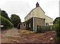
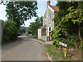
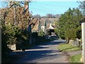
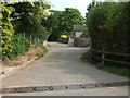
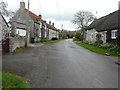
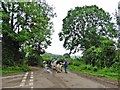
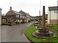
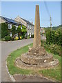
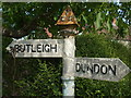
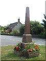
Please click the More button for more images, licensing and image copyright information.
Police
This area is policed by Avon and Somerset Constabulary.
Avon and Somerset Constabulary split their policing area into 123 separate neighbourhoods and this postcode is in the Somerton and Langport neighbourhood.

Somerton and Langport Neighbourhood Crime
Top 3 Categories
For full details of all categories together with more crime information, click on the Details button.
Member of UK Parliament
This postcode is in the Somerton and Frome parliamentary constituency.
Somerton and Frome is a constituency in the South West region of England. The seat has been held by Sarah Dyke (Liberal Democrat) since July 2023.

Most Recent House Sales for Behind Town Lane, TA11 6PT
24 Sep 2013
6 Sep 2013
1 Dec 2008
31 May 1996
Local Petrol Station Prices
Coordinates for TA11 6PT
Residents at TA11 6PT
Sunrise and Sunset at TA11 6PT
Traffic Emission and Congestion Zones
Historical Weather Summary
| Clear | 21.49% |
| Cloudy | 66.55% |
| Rain | 7.53% |
| Windy | 4.25% |
| Other | 0.18% |
Deprivation Index
the more deprived the postcode
Average Energy Performance
Companies Registered at TA11 6PT
Postcode Details for TA11 6PT
Recent Updates
|
18 Apr 2024 Added Traffic Camera Views from Traffic Scotland to Roadworks within Scotland |
|
15 Apr 2024 Schools Data updated for April 2024 |
|
10 Apr 2024 Companies Data updated for March 2024 |
|
7 Apr 2024 New option to receive automatic updates to roadworks that affect you |
|
7 Apr 2024 Police and Crime data updated for February 2024 |
|
3 Apr 2024 Sold House Price data updated for February 2024 |
|
30 Mar 2024 Energy Performance Certificates (England and Wales) updated February 2024 |
|
28 Mar 2024 New feature to use Geolocating functions to detect your current location |
Random Postcodes
Want an idea of what is in our extensive website? Try somewhere completely random!
The Rural/Urban classification is based upon data collected during the 2011 Census and released in August 2013 and is categorised into 6 distinct classes.
[A] Urban Major conurbation: A built up area with a population of 10,000 (3,000 in Scotland) or more and is assigned to the major conurbation settlement category.
[B] Urban Minor conurbation: A built up area with a population of 10,000 (3,000 in Scotland) or more and is assigned to the minor conurbation settlement category.
[C] Urban City and town: A built up area with a population of 10,000 (3,000 in Scotland) or more and is assigned to the city and town settlement category.
[D] Rural Town and fringe
[E] Rural Village
[F] Rural Hamlet and isolated dwelling
The Index of Multiple Deprivation (IMD) is the official measure of relative deprivation.
The index is based on 39 separate indicators across seven distinct domains (Income; Employment; Health and Disability; Education, Skills and Training; Crime; Barriers to Housing and Services; Living Environment) to provide an overall measure of multiple deprivation and is calculated for every neighbourhood.
The index is relative rather than an absolute scale and so a neighbourhood with a score of 10 is more deprived than one rated 20, but this does not equate to being twice as deprived.
Please note: Different indices are used in England, Scotland, Wales and Northern Ireland and so comparison of scores from neighbourhoods in different countries should not be undertaken.
These figures report on incorporated UK companies only that are registered at this postcode and do not include sole-traders, partnerships or overseas organisations.
The population figure shown for your area are an estimate provided by the Office for National Statistics and is rounded to the nearest 1,000.
The estimates are derived from the Annual Population Survey (APS) which is the Labour Force Survey (LFS) plus various sample boosts.
There are 55 unitary authorities. They provide all local government services in their areas. These are mainly in the cities, urban areas and larger towns although there are now 6 shire county councils that are unitary (ie have no district councils beneath them).