Overview for Vicarage Road, SHREWSBURY, SY3 9EX
Introduction
Shrewsbury (SHROHZ-bər-ee, also SHROOZ-) is a market town, civil parish, and the county town of Shropshire, England, on the River Severn, 150 miles (240 km) north-west of London. At the 2021 census, the parish had a population of 76,782.
The town has Saxon roots and surviving institutions whose foundations date from that time, represent a cultural continuity possibly going back as far as the 8th century.
The centre has a largely undisturbed medieval street plan and over 660 listed buildings, including several examples of timber framing from the 15th and 16th centuries. Shrewsbury Castle, a red sandstone fortification, and Shrewsbury Abbey, were founded in 1074 and 1083 respectively by the Norman Earl of Shrewsbury, Roger de Montgomery.
The town is the birthplace of Charles Darwin. It has had a role in nurturing aspects of English culture, including drama, ballet, dance and pantomime.
Located 9 miles (14 km) east of the Welsh border, Shrewsbury serves as the commercial centre for Shropshire and mid-Wales, with a retail output of over £299 million per year and light industry and distribution centres, such as Battlefield Enterprise Park, on the outskirts. The A5 and A49 trunk roads come together as the town's by-pass and five railway lines meet at Shrewsbury railway station.
Summary for Vicarage Road, SHREWSBURY, SY3 9EX
Roadworks near SY3 9EX
Road Safety near SY3 9EX
Details of personal injury accidents in and around Vicarage Road, SY3 9EX that have been reported to West Mercia Police over the past 20 years.
Traffic Levels near SY3 9EX
View traffic levels near Vicarage Road, SY3 9EX from official Department for Transport counts.
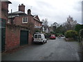
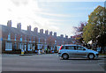
Images taken near to Vicarage Road, SY3 9EX and the surrounding area
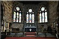
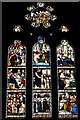
Please click the More button for more images, licensing and image copyright information.
Shrewsbury and nearby Videos From YouTube
F A L L - FPV 🍂
F A L L - FPV Love flying around the trees this time of year, I don't fly this spot often enough. My setups! Cameras; Dji Mavic 2 ...
Channel: DronerUK (View Channel)
Published: 19 Nov 2018
Police
This area is policed by West Mercia Police.
West Mercia Police split their policing area into 82 separate neighbourhoods and this postcode is in the Meole Copthorne and Sutton neighbourhood.

Meole Copthorne and Sutton Neighbourhood Crime
Top 3 Categories
For full details of all categories together with more crime information, click on the Details button.
Member of UK Parliament
This postcode is in the Shrewsbury and Atcham parliamentary constituency.
Shrewsbury and Atcham is a constituency in the West Midlands region of England. The seat has been held by Daniel Kawczynski (Conservative) since May 2010.

Most Recent House Sales for Vicarage Road, SY3 9EX
7 Mar 2014
4 May 2001
Local Petrol Station Prices
Coordinates for SY3 9EX
Residents at SY3 9EX
Sunrise and Sunset at SY3 9EX
Traffic Emission and Congestion Zones
Historical Weather Summary
| Clear | 18.62% |
| Cloudy | 64.74% |
| Rain | 6.89% |
| Windy | 9.61% |
| Other | 0.14% |
Population
Deprivation Index
the more deprived the postcode
Average Energy Performance
Companies Registered at SY3 9EX
Postcode Details for SY3 9EX
Recent Updates
|
15 Apr 2024 Schools Data updated for April 2024 |
|
10 Apr 2024 Companies Data updated for March 2024 |
|
7 Apr 2024 New option to receive automatic updates to roadworks that affect you |
|
7 Apr 2024 Police and Crime data updated for February 2024 |
|
3 Apr 2024 Sold House Price data updated for February 2024 |
|
30 Mar 2024 Energy Performance Certificates (England and Wales) updated February 2024 |
|
28 Mar 2024 New feature to use Geolocating functions to detect your current location |
|
17 Mar 2024 Schools Data updated for March 2024 |
Random Postcodes
Want an idea of what is in our extensive website? Try somewhere completely random!
The Rural/Urban classification is based upon data collected during the 2011 Census and released in August 2013 and is categorised into 6 distinct classes.
[A] Urban Major conurbation: A built up area with a population of 10,000 (3,000 in Scotland) or more and is assigned to the major conurbation settlement category.
[B] Urban Minor conurbation: A built up area with a population of 10,000 (3,000 in Scotland) or more and is assigned to the minor conurbation settlement category.
[C] Urban City and town: A built up area with a population of 10,000 (3,000 in Scotland) or more and is assigned to the city and town settlement category.
[D] Rural Town and fringe
[E] Rural Village
[F] Rural Hamlet and isolated dwelling
The Index of Multiple Deprivation (IMD) is the official measure of relative deprivation.
The index is based on 39 separate indicators across seven distinct domains (Income; Employment; Health and Disability; Education, Skills and Training; Crime; Barriers to Housing and Services; Living Environment) to provide an overall measure of multiple deprivation and is calculated for every neighbourhood.
The index is relative rather than an absolute scale and so a neighbourhood with a score of 10 is more deprived than one rated 20, but this does not equate to being twice as deprived.
Please note: Different indices are used in England, Scotland, Wales and Northern Ireland and so comparison of scores from neighbourhoods in different countries should not be undertaken.
These figures report on incorporated UK companies only that are registered at this postcode and do not include sole-traders, partnerships or overseas organisations.
The population figure shown for your area are an estimate provided by the Office for National Statistics and is rounded to the nearest 1,000.
The estimates are derived from the Annual Population Survey (APS) which is the Labour Force Survey (LFS) plus various sample boosts.
There are 55 unitary authorities. They provide all local government services in their areas. These are mainly in the cities, urban areas and larger towns although there are now 6 shire county councils that are unitary (ie have no district councils beneath them).