Overview for Ashingdale Close, CANVEY ISLAND, SS8 7DY
Introduction
Canvey Island is a town, civil parish and reclaimed island in the Thames estuary, near Southend-on-Sea, in the Castle Point district, in the county of Essex, England. It has an area of 7.12 square miles (18.44 km2) and a population of 38,170. It is separated from the mainland of south Essex by a network of creeks. Lying only just above sea level, it is prone to flooding at exceptional tides and has been inhabited since the Roman conquest of Britain.
The island was mainly agricultural land until the 20th century, when it became the fastest-growing seaside resort in Britain between 1911 and 1951. The North Sea flood of 1953 devastated the island, killing 58 islanders and leading to the temporary evacuation of the 13,000 residents. Canvey is consequently protected by modern sea defences comprising 2 miles (3.2 km) of concrete sea walls.
Canvey Island is also notable for its relationship to the petrochemical industry. The island was the site of the first delivery in the world of liquefied natural gas by container ship and later became the subject of an influential assessment on the risks to a population living within the vicinity of petrochemical shipping and storage facilities.
Summary for Ashingdale Close, CANVEY ISLAND, SS8 7DY
Roadworks near SS8 7DY
Road Safety near SS8 7DY
Details of personal injury accidents in and around Ashingdale Close, SS8 7DY that have been reported to Essex Police over the past 20 years.
Traffic Levels near SS8 7DY
View traffic levels near Ashingdale Close, SS8 7DY from official Department for Transport counts.
Images taken near to Ashingdale Close, SS8 7DY and the surrounding area
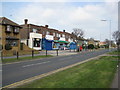
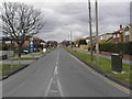


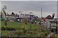
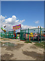

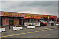

Please click the More button for more images, licensing and image copyright information.
Police
This area is policed by Essex Police.
Essex Police split their policing area into 56 separate neighbourhoods and this postcode is in the Canvey neighbourhood.

Canvey Neighbourhood Crime
Top 3 Categories
For full details of all categories together with more crime information, click on the Details button.
Member of UK Parliament
This postcode is in the Castle Point parliamentary constituency.
Castle Point is a constituency in the East of England region of England. The seat has been held by Rebecca Harris (Conservative) since May 2010.

Most Recent House Sales for Ashingdale Close, SS8 7DY
13 Apr 2017
30 Nov 2007
5 Apr 2007
Local Petrol Station Prices
Coordinates for SS8 7DY
Residents at SS8 7DY
Sunrise and Sunset at SS8 7DY
Traffic Emission and Congestion Zones
Historical Weather Summary
| Clear | 9.06% |
| Cloudy | 58.29% |
| Rain | 7.25% |
| Windy | 25.41% |
| Other | -0.01% |
Population
Deprivation Index
the more deprived the postcode
Average Energy Performance
Companies Registered at SS8 7DY
Postcode Details for SS8 7DY
Recent Updates
|
18 Apr 2024 Added Traffic Camera Views from Traffic Scotland to Roadworks within Scotland |
|
15 Apr 2024 Schools Data updated for April 2024 |
|
10 Apr 2024 Companies Data updated for March 2024 |
|
7 Apr 2024 New option to receive automatic updates to roadworks that affect you |
|
7 Apr 2024 Police and Crime data updated for February 2024 |
|
3 Apr 2024 Sold House Price data updated for February 2024 |
|
30 Mar 2024 Energy Performance Certificates (England and Wales) updated February 2024 |
|
28 Mar 2024 New feature to use Geolocating functions to detect your current location |
Random Postcodes
Want an idea of what is in our extensive website? Try somewhere completely random!
The Rural/Urban classification is based upon data collected during the 2011 Census and released in August 2013 and is categorised into 6 distinct classes.
[A] Urban Major conurbation: A built up area with a population of 10,000 (3,000 in Scotland) or more and is assigned to the major conurbation settlement category.
[B] Urban Minor conurbation: A built up area with a population of 10,000 (3,000 in Scotland) or more and is assigned to the minor conurbation settlement category.
[C] Urban City and town: A built up area with a population of 10,000 (3,000 in Scotland) or more and is assigned to the city and town settlement category.
[D] Rural Town and fringe
[E] Rural Village
[F] Rural Hamlet and isolated dwelling
The Index of Multiple Deprivation (IMD) is the official measure of relative deprivation.
The index is based on 39 separate indicators across seven distinct domains (Income; Employment; Health and Disability; Education, Skills and Training; Crime; Barriers to Housing and Services; Living Environment) to provide an overall measure of multiple deprivation and is calculated for every neighbourhood.
The index is relative rather than an absolute scale and so a neighbourhood with a score of 10 is more deprived than one rated 20, but this does not equate to being twice as deprived.
Please note: Different indices are used in England, Scotland, Wales and Northern Ireland and so comparison of scores from neighbourhoods in different countries should not be undertaken.
These figures report on incorporated UK companies only that are registered at this postcode and do not include sole-traders, partnerships or overseas organisations.
The population figure shown for your area are an estimate provided by the Office for National Statistics and is rounded to the nearest 1,000.
The estimates are derived from the Annual Population Survey (APS) which is the Labour Force Survey (LFS) plus various sample boosts.
There are 26 county councils in 2-tier areas, providing services such as education, social services and waste disposal.
In 2-tier areas, each county council area is subdivided into districts, for which there is an independent district council. There are 192 district councils.
District councils are responsible for local services such as rubbish collection, housing and planning applications.