Overview for Millport, SUNDERLAND, SR3 2FB
Introduction
Sunderland is a port city in Tyne and Wear, England. It is the City of Sunderland's administrative centre and in the historic county of Durham. The city is 10 miles (16 km) from Newcastle-upon-Tyne and is on the River Wear's mouth to the North Sea. The river also flows through Durham roughly 12 miles (19 km) south-west of Sunderland City Centre. It is the only other city in the county and the second largest settlement in the North East after Newcastle upon Tyne.
Locals from the city are sometimes known as Mackems. The term originated as recently as the early 1980s; its use and acceptance by residents, particularly among the older generations, is not universal. At one time, ships built on the Wear were called "Jamies", in contrast with those from the Tyne, which were known as "Geordies", although in the case of "Jamie" it is not known whether this was ever extended to people.
There were three original settlements by the River's mouth which are part of the modern-day city: Monkwearmouth, settled in 674 on the river's north bank with King Ecgfrith of Northumbria land granting to Benedict Biscop to found a monastery which, together with Jarrow monastery, later formed the dual Monkwearmouth-Jarrow Abbey; Sunderland, settled in 685; and Bishopwearmouth, founded in 930. The later two are on the Wear's southern bank. The second settlement on the wear's mouth grew as a fishing settlement and later as a port, being granted a town charter in 1179. The city started to trade coal and salt with ships starting to be built on the river in the 14th century. By the 19th century, with a population increase due to shipbuilding, port and docks, the town absorbed the other two settlements. Following the decline of its traditional industries in the late 20th century, the area became an automotive building centre. In 1992, the borough of Sunderland was granted city status.
Summary for Millport, SUNDERLAND, SR3 2FB
Roadworks near SR3 2FB
Road Safety near SR3 2FB
Details of personal injury accidents in and around Millport, SR3 2FB that have been reported to Northumbria Police over the past 20 years.
Traffic Levels near SR3 2FB
View traffic levels near Millport, SR3 2FB from official Department for Transport counts.
Images taken near to Millport, SR3 2FB and the surrounding area
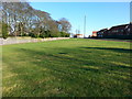
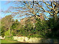
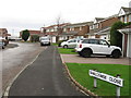
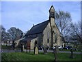

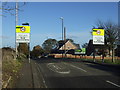

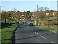
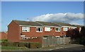

Please click the More button for more images, licensing and image copyright information.
Sunderland and nearby Videos From YouTube
Ryhope Dene to Hawthorn Dene with Seaham Coastline in-between. (4K Coastal Drone Footage)
Chilled video showing our Beautiful East Durham Coastline, Starting at Ryhope Dene and finishing at Hawthorn Dene with the ...
Channel: Peace Drone. (View Channel)
Published: 9 Mar 2022
Police
This area is policed by Northumbria Police.
Northumbria Police split their policing area into 35 separate neighbourhoods and this postcode is in the Farringdon, Pennywell, Pallion, Silksworth and Ryhope neighbourhood.

Farringdon, Pennywell, Pallion, Silksworth and Ryhope Neighbourhood Crime
Top 3 Categories
For full details of all categories together with more crime information, click on the Details button.
Member of UK Parliament
This postcode is in the Houghton and Sunderland South parliamentary constituency.
Houghton and Sunderland South is a constituency in the North East region of England. The seat has been held by Bridget Phillipson (Labour) since May 2010.

Most Recent House Sales for Millport, SR3 2FB
27 Jun 2022
Local Petrol Station Prices
Coordinates for SR3 2FB
Residents at SR3 2FB
Sunrise and Sunset at SR3 2FB
Traffic Emission and Congestion Zones
Historical Weather Summary
| Clear | 14.49% |
| Cloudy | 72.97% |
| Rain | 9.07% |
| Windy | 3.42% |
| Other | 0.05% |
Population
Deprivation Index
the more deprived the postcode
Average Energy Performance
Companies Registered at SR3 2FB
Postcode Details for SR3 2FB
Recent Updates
|
18 Apr 2024 Added Traffic Camera Views from Traffic Scotland to Roadworks within Scotland |
|
15 Apr 2024 Schools Data updated for April 2024 |
|
10 Apr 2024 Companies Data updated for March 2024 |
|
7 Apr 2024 New option to receive automatic updates to roadworks that affect you |
|
7 Apr 2024 Police and Crime data updated for February 2024 |
|
3 Apr 2024 Sold House Price data updated for February 2024 |
|
30 Mar 2024 Energy Performance Certificates (England and Wales) updated February 2024 |
|
28 Mar 2024 New feature to use Geolocating functions to detect your current location |
Random Postcodes
Want an idea of what is in our extensive website? Try somewhere completely random!
The Rural/Urban classification is based upon data collected during the 2011 Census and released in August 2013 and is categorised into 6 distinct classes.
[A] Urban Major conurbation: A built up area with a population of 10,000 (3,000 in Scotland) or more and is assigned to the major conurbation settlement category.
[B] Urban Minor conurbation: A built up area with a population of 10,000 (3,000 in Scotland) or more and is assigned to the minor conurbation settlement category.
[C] Urban City and town: A built up area with a population of 10,000 (3,000 in Scotland) or more and is assigned to the city and town settlement category.
[D] Rural Town and fringe
[E] Rural Village
[F] Rural Hamlet and isolated dwelling
The Index of Multiple Deprivation (IMD) is the official measure of relative deprivation.
The index is based on 39 separate indicators across seven distinct domains (Income; Employment; Health and Disability; Education, Skills and Training; Crime; Barriers to Housing and Services; Living Environment) to provide an overall measure of multiple deprivation and is calculated for every neighbourhood.
The index is relative rather than an absolute scale and so a neighbourhood with a score of 10 is more deprived than one rated 20, but this does not equate to being twice as deprived.
Please note: Different indices are used in England, Scotland, Wales and Northern Ireland and so comparison of scores from neighbourhoods in different countries should not be undertaken.
These figures report on incorporated UK companies only that are registered at this postcode and do not include sole-traders, partnerships or overseas organisations.
The population figure shown for your area are an estimate provided by the Office for National Statistics and is rounded to the nearest 1,000.
The estimates are derived from the Annual Population Survey (APS) which is the Labour Force Survey (LFS) plus various sample boosts.
There are 36 metropolitan district councils which together cover 6 large urban areas: the counties of Greater Manchester, Merseyside, South Yorkshire, Tyne and Wear, West Midlands, and West Yorkshire.
Metropolitan districts are responsible for all services in their area, although certain conurbation wide services such as fire and civil defence, police, waste disposal and passenger transport are provided through joint authorities (the districts acting jointly).