Overview for Hazeleigh Avenue, SOUTHAMPTON, SO19 9DG
Introduction
Southampton is a port city in Hampshire, England. It is located approximately 80 miles (130 km) south-west of London, 20 miles (32 km) west of Portsmouth, and 20 miles (32 km) south-east of Salisbury. Southampton had a population of 253,651 at the 2011 census, making it one of the most populous cities in southern England. Southampton forms part of the larger South Hampshire conurbation which includes the city of Portsmouth and the boroughs of Havant, Eastleigh, Fareham, and Gosport.
A major port, and close to the New Forest, Southampton lies at the northernmost point of Southampton Water, at the confluence of the River Test and Itchen, with the River Hamble joining to the south. Southampton is classified as a Medium-Port City.
Southampton was the departure point for the RMS Titanic and home to 500 of the people who perished on board. The Spitfire was built in the city and Southampton has a strong association with the Mayflower, being the departure point before the vessel was forced to return to Plymouth. In the past century, the city was one of Europe's main ports for ocean liners. More recently, Southampton is known as the home port of some of the largest cruise ships in the world. The Cunard Line maintains a regular transatlantic service to New York from the city. Southampton is also one of the largest retail destinations in the South of England.
Southampton was heavily bombed during the Second World War during what was known as the Southampton Blitz. It was one of the major embarkation points for D-Day. In the Middle Ages Southampton was where troops left England for the Battle of Agincourt. It was itself raided by French pirates, leading to the construction of the fortified town walls, many of which still stand today. Jane Austen also lived in Southampton for a number of years. In 1964, the town of Southampton acquired city status, becoming the City of Southampton.
Some notable employers in the city include the University of Southampton, Ordnance Survey, BBC South, Associated British Ports, and Carnival UK.
Summary for Hazeleigh Avenue, SOUTHAMPTON, SO19 9DG
Roadworks near SO19 9DG
Road Safety near SO19 9DG
Details of personal injury accidents in and around Hazeleigh Avenue, SO19 9DG that have been reported to Hampshire Constabulary over the past 20 years.
Traffic Levels near SO19 9DG
View traffic levels near Hazeleigh Avenue, SO19 9DG from official Department for Transport counts.
Images taken near to Hazeleigh Avenue, SO19 9DG and the surrounding area
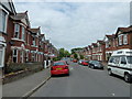
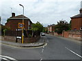
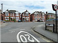
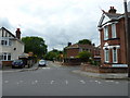
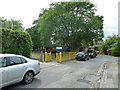
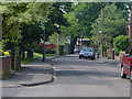

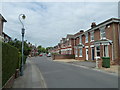
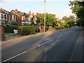
Please click the More button for more images, licensing and image copyright information.
Southampton and nearby Videos From YouTube
P&O Cruises Iona & Ventura ships 09/07/2022 4k Southampton drone footage.
P&O Ships arriving into Southampton 09/07/2022. FOLLOW/SUB for Iona departure, sadly missed Princess and Ventura ...
Channel: #cruisescape uk (View Channel)
Published: 14 Jul 2022
Police
This area is policed by Hampshire Constabulary.
Hampshire Constabulary split their policing area into 95 separate neighbourhoods and this postcode is in the Peartree and Woolston neighbourhood.

Peartree and Woolston Neighbourhood Crime
Top 3 Categories
For full details of all categories together with more crime information, click on the Details button.
Member of UK Parliament
This postcode is in the Southampton, Itchen parliamentary constituency.
Southampton, Itchen is a constituency in the South East region of England. The seat has been held by Royston Smith (Conservative) since May 2015.

Most Recent House Sales for Hazeleigh Avenue, SO19 9DG
5 Jul 2022
25 Jun 2021
1 Apr 2021
17 Jun 2020
Local Petrol Station Prices
Coordinates for SO19 9DG
Residents at SO19 9DG
Sunrise and Sunset at SO19 9DG
Traffic Emission and Congestion Zones
Historical Weather Summary
| Clear | 23.90% |
| Cloudy | 65.43% |
| Rain | 8.00% |
| Windy | 2.52% |
| Other | 0.15% |
Population
Deprivation Index
the more deprived the postcode
Average Energy Performance
Companies Registered at SO19 9DG
Postcode Details for SO19 9DG
Recent Updates
|
18 Apr 2024 Added Traffic Camera Views from Traffic Scotland to Roadworks within Scotland |
|
15 Apr 2024 Schools Data updated for April 2024 |
|
10 Apr 2024 Companies Data updated for March 2024 |
|
7 Apr 2024 New option to receive automatic updates to roadworks that affect you |
|
7 Apr 2024 Police and Crime data updated for February 2024 |
|
3 Apr 2024 Sold House Price data updated for February 2024 |
|
30 Mar 2024 Energy Performance Certificates (England and Wales) updated February 2024 |
|
28 Mar 2024 New feature to use Geolocating functions to detect your current location |
Random Postcodes
Want an idea of what is in our extensive website? Try somewhere completely random!
The Rural/Urban classification is based upon data collected during the 2011 Census and released in August 2013 and is categorised into 6 distinct classes.
[A] Urban Major conurbation: A built up area with a population of 10,000 (3,000 in Scotland) or more and is assigned to the major conurbation settlement category.
[B] Urban Minor conurbation: A built up area with a population of 10,000 (3,000 in Scotland) or more and is assigned to the minor conurbation settlement category.
[C] Urban City and town: A built up area with a population of 10,000 (3,000 in Scotland) or more and is assigned to the city and town settlement category.
[D] Rural Town and fringe
[E] Rural Village
[F] Rural Hamlet and isolated dwelling
The Index of Multiple Deprivation (IMD) is the official measure of relative deprivation.
The index is based on 39 separate indicators across seven distinct domains (Income; Employment; Health and Disability; Education, Skills and Training; Crime; Barriers to Housing and Services; Living Environment) to provide an overall measure of multiple deprivation and is calculated for every neighbourhood.
The index is relative rather than an absolute scale and so a neighbourhood with a score of 10 is more deprived than one rated 20, but this does not equate to being twice as deprived.
Please note: Different indices are used in England, Scotland, Wales and Northern Ireland and so comparison of scores from neighbourhoods in different countries should not be undertaken.
These figures report on incorporated UK companies only that are registered at this postcode and do not include sole-traders, partnerships or overseas organisations.
The population figure shown for your area are an estimate provided by the Office for National Statistics and is rounded to the nearest 1,000.
The estimates are derived from the Annual Population Survey (APS) which is the Labour Force Survey (LFS) plus various sample boosts.
There are 55 unitary authorities. They provide all local government services in their areas. These are mainly in the cities, urban areas and larger towns although there are now 6 shire county councils that are unitary (ie have no district councils beneath them).