Overview for Shrivenham Road, SWINDON, SN1 2QA
Introduction
Swindon is a large town in Wiltshire, England. At the time of the 2021 Census the population of the borough was 233,400, making it the largest settlement in the county. Located in South West England, Swindon lies on the M4 corridor, 71 miles (114km) to the west of London and 36 miles (57 km) to the east of Bristol. The Cotswolds lie just to the town's north and the North Wessex Downs to its south.
Recorded in the 1086 Domesday Book as Suindune, the arrival of the Great Western Railway in 1843 transformed it from a small market town of 2500 into a thriving railway hub that would become one of the largest railway engineering complexes in the world at its peak. This brought with it pioneering amenities such as the UK's first lending library and a 'cradle-to-grave' healthcare centre that was later used as a blueprint for the NHS. Swindon's railway heritage can be primarily seen today with the grade II listed Railway Village and STEAM Museum. The McArthurGlen Designer Outlet is housed in the renovated former works and the Brunel Shopping Centre is one of several places in Swindon that bears the name of the famous engineer generally acknowledged with bringing the railways to the town.
Despite the subsequent decline and closure of its railway works, Swindon was one of the fastest growing towns in Europe post-war as its economy diversified, attracting large international companies, who made use of its burgeoning population and strategic transport links. Today, Swindon contains the head offices of organisations such as Intel, Nationwide, the UK Space Agency, English Heritage, National Trust, WHSmith and Zurich Insurance Group. The Swindon Collection of Modern British Art consists of roughly 900 pieces, with the town also housing the Bodleian Library's Book Storage Facility, the Historic England Archive, and the Science Museum's National Collections. Until 2021, Honda's UK headquarters were in the town, with the factory producing up to 160,000 vehicles a year.
Major venues in the town include the Wyvern Theatre and currently closed Oasis Leisure Centre (claimed by some to be the inspiration for the name of the Manchester band). Lydiard Park has hosted festival such as BBC Radio 1's Big Weekend, while the Swindon Mela, an all-day celebration of South Indian arts and culture, attracts up to 10,000 visitors a year. The ancient Ridgeway, known as Britain's oldest road, runs a few miles to Swindon's south, with Avebury, the largest megalithic stone circle in the world, and Uffington White Horse, Britains oldest white horse figure, also nearby.
Swindon Town F.
C., the county's only professional football club, have played in the Premier League and won a major trophy, securing a famous giant-killing victory over Arsenal in the 1969 League Cup final. They currently play in League Two at the 15,000-seat County Ground in the town centre. Other sports in the town include Swindon Wildcats Ice Hockey and five-time British speedway champions the Swindon Robins.
Summary for Shrivenham Road, SWINDON, SN1 2QA
Roadworks near SN1 2QA
Road Safety near SN1 2QA
Details of personal injury accidents in and around Shrivenham Road, SN1 2QA that have been reported to Wiltshire Police over the past 20 years.
Traffic Levels near SN1 2QA
View traffic levels near Shrivenham Road, SN1 2QA from official Department for Transport counts.
Images taken near to Shrivenham Road, SN1 2QA and the surrounding area

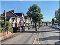


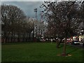
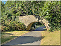
Please click the More button for more images, licensing and image copyright information.
Swindon and nearby Videos From YouTube
The Magic Roundabout / The County Ground Drone Footage
Channel: Little Levv (View Channel)
Published: 10 Jul 2023
Police
This area is policed by Wiltshire Police.
Wiltshire Police split their policing area into 105 separate neighbourhoods and this postcode is in the Shrivenham Road Area neighbourhood.

Shrivenham Road Area Neighbourhood Crime
Top 3 Categories
For full details of all categories together with more crime information, click on the Details button.
Member of UK Parliament
This postcode is in the South Swindon parliamentary constituency.
South Swindon is a constituency in the South West region of England. The seat has been held by Sir Robert Buckland (Conservative) since May 2010.

Most Recent House Sales for Shrivenham Road, SN1 2QA
6 Nov 2023
22 Jun 2023
30 Mar 2023
16 Mar 2023
Local Petrol Station Prices
Coordinates for SN1 2QA
Residents at SN1 2QA
Sunrise and Sunset at SN1 2QA
Traffic Emission and Congestion Zones
Historical Weather Summary
| Clear | 20.41% |
| Cloudy | 68.86% |
| Rain | 6.71% |
| Windy | 3.91% |
| Other | 0.11% |
Population
Deprivation Index
the more deprived the postcode
Average Energy Performance
Companies Registered at SN1 2QA
Postcode Details for SN1 2QA
Recent Updates
|
18 Apr 2024 Added Traffic Camera Views from Traffic Scotland to Roadworks within Scotland |
|
15 Apr 2024 Schools Data updated for April 2024 |
|
10 Apr 2024 Companies Data updated for March 2024 |
|
7 Apr 2024 New option to receive automatic updates to roadworks that affect you |
|
7 Apr 2024 Police and Crime data updated for February 2024 |
|
3 Apr 2024 Sold House Price data updated for February 2024 |
|
30 Mar 2024 Energy Performance Certificates (England and Wales) updated February 2024 |
|
28 Mar 2024 New feature to use Geolocating functions to detect your current location |
Random Postcodes
Want an idea of what is in our extensive website? Try somewhere completely random!
The Rural/Urban classification is based upon data collected during the 2011 Census and released in August 2013 and is categorised into 6 distinct classes.
[A] Urban Major conurbation: A built up area with a population of 10,000 (3,000 in Scotland) or more and is assigned to the major conurbation settlement category.
[B] Urban Minor conurbation: A built up area with a population of 10,000 (3,000 in Scotland) or more and is assigned to the minor conurbation settlement category.
[C] Urban City and town: A built up area with a population of 10,000 (3,000 in Scotland) or more and is assigned to the city and town settlement category.
[D] Rural Town and fringe
[E] Rural Village
[F] Rural Hamlet and isolated dwelling
The Index of Multiple Deprivation (IMD) is the official measure of relative deprivation.
The index is based on 39 separate indicators across seven distinct domains (Income; Employment; Health and Disability; Education, Skills and Training; Crime; Barriers to Housing and Services; Living Environment) to provide an overall measure of multiple deprivation and is calculated for every neighbourhood.
The index is relative rather than an absolute scale and so a neighbourhood with a score of 10 is more deprived than one rated 20, but this does not equate to being twice as deprived.
Please note: Different indices are used in England, Scotland, Wales and Northern Ireland and so comparison of scores from neighbourhoods in different countries should not be undertaken.
These figures report on incorporated UK companies only that are registered at this postcode and do not include sole-traders, partnerships or overseas organisations.
The population figure shown for your area are an estimate provided by the Office for National Statistics and is rounded to the nearest 1,000.
The estimates are derived from the Annual Population Survey (APS) which is the Labour Force Survey (LFS) plus various sample boosts.
There are 55 unitary authorities. They provide all local government services in their areas. These are mainly in the cities, urban areas and larger towns although there are now 6 shire county councils that are unitary (ie have no district councils beneath them).