Overview for Latchmoor Way, GERRARDS CROSS, SL9 8LR
Introduction
Gerrards Cross is a town and civil parish in south Buckinghamshire, England, separated from the London Borough of Hillingdon at Harefield by Denham, south of Chalfont St Peter and north bordering villages of Fulmer, Hedgerley, Iver Heath and Stoke Poges. It spans foothills of the Chiltern Hills and land on the right bank of the River Misbourne. It is 19.3 miles (31.1 km) west-north-west of Charing Cross, central London. Bulstrode Park Camp was an Iron Age fortified encampment.
The town has a railway station on the Chiltern Main Line with regular services to London. Fast train takes 19 minutes to Marylebone. The town is close to M25 motorway and the M40 motorway runs beside woodland on its southern boundary.
In 2014, a major national surveying company named Gerrards Cross as the most sought-after and expensive commuter town or village in their London Hot 100 report, with an average sale price of £1,000,000.
Summary for Latchmoor Way, GERRARDS CROSS, SL9 8LR
Roadworks near SL9 8LR
Road Safety near SL9 8LR
Details of personal injury accidents in and around Latchmoor Way, SL9 8LR that have been reported to Thames Valley Police over the past 20 years.
Traffic Levels near SL9 8LR
View traffic levels near Latchmoor Way, SL9 8LR from official Department for Transport counts.
Images taken near to Latchmoor Way, SL9 8LR and the surrounding area
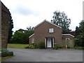
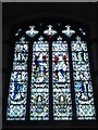
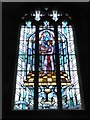


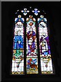
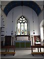
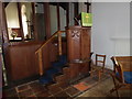

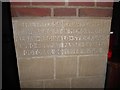
Please click the More button for more images, licensing and image copyright information.
Police
This area is policed by Thames Valley Police.
Thames Valley Police split their policing area into 108 separate neighbourhoods and this postcode is in the Chalfonts neighbourhood.

Chalfonts Neighbourhood Crime
Top 3 Categories
For full details of all categories together with more crime information, click on the Details button.
Member of UK Parliament
This postcode is in the Chesham and Amersham parliamentary constituency.
Chesham and Amersham is a constituency in the South East region of England. The seat has been held by Sarah Green (Liberal Democrat) since June 2021.

Most Recent House Sales for Latchmoor Way, SL9 8LR
3 May 2019
12 Jun 2014
2 Jun 2014
20 Jun 2003
Local Petrol Station Prices
Coordinates for SL9 8LR
Residents at SL9 8LR
Sunrise and Sunset at SL9 8LR
Traffic Emission and Congestion Zones
Historical Weather Summary
| Clear | 19.92% |
| Cloudy | 56.40% |
| Rain | 6.27% |
| Windy | 17.24% |
| Other | 0.17% |
Deprivation Index
the more deprived the postcode
Average Energy Performance
Companies Registered at SL9 8LR
Postcode Details for SL9 8LR
Recent Updates
|
18 Apr 2024 Added Traffic Camera Views from Traffic Scotland to Roadworks within Scotland |
|
15 Apr 2024 Schools Data updated for April 2024 |
|
10 Apr 2024 Companies Data updated for March 2024 |
|
7 Apr 2024 New option to receive automatic updates to roadworks that affect you |
|
7 Apr 2024 Police and Crime data updated for February 2024 |
|
3 Apr 2024 Sold House Price data updated for February 2024 |
|
30 Mar 2024 Energy Performance Certificates (England and Wales) updated February 2024 |
|
28 Mar 2024 New feature to use Geolocating functions to detect your current location |
Random Postcodes
Want an idea of what is in our extensive website? Try somewhere completely random!
The Rural/Urban classification is based upon data collected during the 2011 Census and released in August 2013 and is categorised into 6 distinct classes.
[A] Urban Major conurbation: A built up area with a population of 10,000 (3,000 in Scotland) or more and is assigned to the major conurbation settlement category.
[B] Urban Minor conurbation: A built up area with a population of 10,000 (3,000 in Scotland) or more and is assigned to the minor conurbation settlement category.
[C] Urban City and town: A built up area with a population of 10,000 (3,000 in Scotland) or more and is assigned to the city and town settlement category.
[D] Rural Town and fringe
[E] Rural Village
[F] Rural Hamlet and isolated dwelling
The Index of Multiple Deprivation (IMD) is the official measure of relative deprivation.
The index is based on 39 separate indicators across seven distinct domains (Income; Employment; Health and Disability; Education, Skills and Training; Crime; Barriers to Housing and Services; Living Environment) to provide an overall measure of multiple deprivation and is calculated for every neighbourhood.
The index is relative rather than an absolute scale and so a neighbourhood with a score of 10 is more deprived than one rated 20, but this does not equate to being twice as deprived.
Please note: Different indices are used in England, Scotland, Wales and Northern Ireland and so comparison of scores from neighbourhoods in different countries should not be undertaken.
These figures report on incorporated UK companies only that are registered at this postcode and do not include sole-traders, partnerships or overseas organisations.
The population figure shown for your area are an estimate provided by the Office for National Statistics and is rounded to the nearest 1,000.
The estimates are derived from the Annual Population Survey (APS) which is the Labour Force Survey (LFS) plus various sample boosts.
There are 55 unitary authorities. They provide all local government services in their areas. These are mainly in the cities, urban areas and larger towns although there are now 6 shire county councils that are unitary (ie have no district councils beneath them).