Overview for Penn Road, SLOUGH, SL3 9RB
Introduction
Slough is a town in Berkshire, England, in the Thames Valley 20 miles (32 km) west of central London and 19 miles (31 km) north-east of Reading, at the intersection of the M4, M40 and M25 motorways. It is part of the historic county of Buckinghamshire. In 2020, the built-up area subdivision had an estimated population of 164,793. In 2011, the district had a population of 140,713. It borders Greater London and Buckinghamshire.
Slough's population is one of the most ethnically diverse in the United Kingdom, attracting people from across the country and the world for labour since the 1920s, which has helped shape it into a major trading centre. In 2017, unemployment stood at 1.4%, one-third the UK average of 4.5%.
Slough has the highest concentration of UK HQs of global companies outside London. Slough Trading Estate is the largest industrial estate in single private ownership in Europe, with over 17,000 jobs in 400 businesses. Blackberry, McAfee, Burger King, DHL, Telefonica and Lego have head offices in the town.
Summary for Penn Road, SLOUGH, SL3 9RB
Roadworks near SL3 9RB
Road Safety near SL3 9RB
Details of personal injury accidents in and around Penn Road, SL3 9RB that have been reported to Thames Valley Police over the past 20 years.
Traffic Levels near SL3 9RB
View traffic levels near Penn Road, SL3 9RB from official Department for Transport counts.
Images taken near to Penn Road, SL3 9RB and the surrounding area
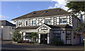
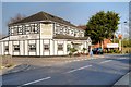
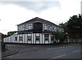
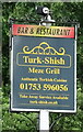
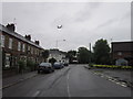
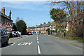
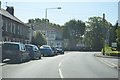
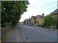
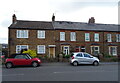
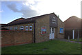
Please click the More button for more images, licensing and image copyright information.
Slough and nearby Videos From YouTube
Autumn at Bourne End River, UK | 4K Drone Stock Footage | DJI Mini 2
B-roll footage in 4K of some lunchtime shots by Bourne End River, UK. DJI Mini 2 No ND Filter #Drone #DJIMini2 #DJI #DJIGlobal ...
Channel: NB17 (View Channel)
Published: 6 Nov 2022
Police
This area is policed by Thames Valley Police.
Thames Valley Police split their policing area into 108 separate neighbourhoods and this postcode is in the Windsor East neighbourhood.

Windsor East Neighbourhood Crime
Top 3 Categories
For full details of all categories together with more crime information, click on the Details button.
Member of UK Parliament
This postcode is in the Windsor parliamentary constituency.
Windsor is a constituency in the South East region of England. The seat has been held by Adam Afriyie (Conservative) since May 2010.

Most Recent House Sales for Penn Road, SL3 9RB
22 Oct 2010
28 Nov 2002
13 Jun 1997
Local Petrol Station Prices
Coordinates for SL3 9RB
Residents at SL3 9RB
Sunrise and Sunset at SL3 9RB
Traffic Emission and Congestion Zones
Historical Weather Summary
| Clear | 19.88% |
| Cloudy | 53.75% |
| Rain | 5.64% |
| Windy | 20.31% |
| Other | 0.42% |
Population
Deprivation Index
the more deprived the postcode
Average Energy Performance
Companies Registered at SL3 9RB
Postcode Details for SL3 9RB
Recent Updates
|
18 Apr 2024 Added Traffic Camera Views from Traffic Scotland to Roadworks within Scotland |
|
15 Apr 2024 Schools Data updated for April 2024 |
|
10 Apr 2024 Companies Data updated for March 2024 |
|
7 Apr 2024 New option to receive automatic updates to roadworks that affect you |
|
7 Apr 2024 Police and Crime data updated for February 2024 |
|
3 Apr 2024 Sold House Price data updated for February 2024 |
|
30 Mar 2024 Energy Performance Certificates (England and Wales) updated February 2024 |
|
28 Mar 2024 New feature to use Geolocating functions to detect your current location |
Random Postcodes
Want an idea of what is in our extensive website? Try somewhere completely random!
The Rural/Urban classification is based upon data collected during the 2011 Census and released in August 2013 and is categorised into 6 distinct classes.
[A] Urban Major conurbation: A built up area with a population of 10,000 (3,000 in Scotland) or more and is assigned to the major conurbation settlement category.
[B] Urban Minor conurbation: A built up area with a population of 10,000 (3,000 in Scotland) or more and is assigned to the minor conurbation settlement category.
[C] Urban City and town: A built up area with a population of 10,000 (3,000 in Scotland) or more and is assigned to the city and town settlement category.
[D] Rural Town and fringe
[E] Rural Village
[F] Rural Hamlet and isolated dwelling
The Index of Multiple Deprivation (IMD) is the official measure of relative deprivation.
The index is based on 39 separate indicators across seven distinct domains (Income; Employment; Health and Disability; Education, Skills and Training; Crime; Barriers to Housing and Services; Living Environment) to provide an overall measure of multiple deprivation and is calculated for every neighbourhood.
The index is relative rather than an absolute scale and so a neighbourhood with a score of 10 is more deprived than one rated 20, but this does not equate to being twice as deprived.
Please note: Different indices are used in England, Scotland, Wales and Northern Ireland and so comparison of scores from neighbourhoods in different countries should not be undertaken.
These figures report on incorporated UK companies only that are registered at this postcode and do not include sole-traders, partnerships or overseas organisations.
The population figure shown for your area are an estimate provided by the Office for National Statistics and is rounded to the nearest 1,000.
The estimates are derived from the Annual Population Survey (APS) which is the Labour Force Survey (LFS) plus various sample boosts.
There are 55 unitary authorities. They provide all local government services in their areas. These are mainly in the cities, urban areas and larger towns although there are now 6 shire county councils that are unitary (ie have no district councils beneath them).