Overview for Byron Street, MACCLESFIELD, SK11 7PL
Introduction
Macclesfield is a market town and civil parish in the unitary authority of Cheshire East in Cheshire, England. It is located on the River Bollin in the east of the county, on the edge of the Cheshire Plain, with Macclesfield Forest to its east; it is 16 miles (26 km) south of Manchester and 38 miles (61 km) east of Chester.
Before the Norman Conquest, Macclesfield was held by Edwin, Earl of Mercia and was assessed at £8. The manor is recorded in the Domesday Book as "Maclesfeld", meaning "Maccel's open country". The medieval town grew up on the hilltop around what is now St Michael's Church. It was granted a charter by Edward I in 1261, before he became king. Macclesfield Grammar School was founded in 1502. The town had a silk-button industry from at least the middle of the 17th century and became a major silk-manufacturing centre from the mid-18th century. The Macclesfield Canal was constructed in 1826–31.
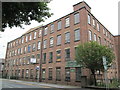
Hovis breadmakers were another Victorian employer. Modern industries include pharmaceuticals. Multiple mill buildings are still standing and several of the town's museums explore the local silk industry. Other landmarks include Georgian buildings such as the Town Hall and former Sunday School; St Alban's Church, designed by Augustus Pugin; and the Arighi Bianchi furniture shop.
The population of Macclesfield at the 2021 census was 57,539. A person from Macclesfield is referred to as a "Maxonian".
Summary for Byron Street, MACCLESFIELD, SK11 7PL
Roadworks near SK11 7PL
Road Safety near SK11 7PL
Details of personal injury accidents in and around Byron Street, SK11 7PL that have been reported to Cheshire Constabulary over the past 20 years.
Traffic Levels near SK11 7PL
View traffic levels near Byron Street, SK11 7PL from official Department for Transport counts.
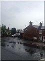
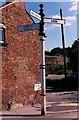
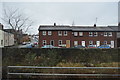
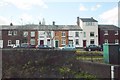
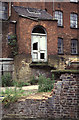
Images taken near to Byron Street, SK11 7PL and the surrounding area
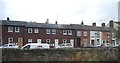
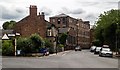
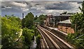
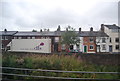
Please click the More button for more images, licensing and image copyright information.
Police
This area is policed by Cheshire Constabulary.
Cheshire Constabulary split their policing area into 122 separate neighbourhoods and this postcode is in the Macclesfield South neighbourhood.

Macclesfield South Neighbourhood Crime
Top 3 Categories
For full details of all categories together with more crime information, click on the Details button.
Member of UK Parliament
This postcode is in the Macclesfield parliamentary constituency.
Macclesfield is a constituency in the North West region of England. The seat has been held by David Rutley (Conservative) since May 2010.

Most Recent House Sales for Byron Street, SK11 7PL
19 Jul 2023
13 Jan 2023
31 Aug 2021
28 May 2021
Local Petrol Station Prices
Coordinates for SK11 7PL
Residents at SK11 7PL
Sunrise and Sunset at SK11 7PL
Traffic Emission and Congestion Zones
Historical Weather Summary
| Clear | 17.28% |
| Cloudy | 59.58% |
| Rain | 7.57% |
| Windy | 15.33% |
| Other | 0.24% |
Population
Deprivation Index
the more deprived the postcode
Average Energy Performance
Companies Registered at SK11 7PL
Postcode Details for SK11 7PL
Recent Updates
|
18 Apr 2024 Added Traffic Camera Views from Traffic Scotland to Roadworks within Scotland |
|
15 Apr 2024 Schools Data updated for April 2024 |
|
10 Apr 2024 Companies Data updated for March 2024 |
|
7 Apr 2024 New option to receive automatic updates to roadworks that affect you |
|
7 Apr 2024 Police and Crime data updated for February 2024 |
|
3 Apr 2024 Sold House Price data updated for February 2024 |
|
30 Mar 2024 Energy Performance Certificates (England and Wales) updated February 2024 |
|
28 Mar 2024 New feature to use Geolocating functions to detect your current location |
Random Postcodes
Want an idea of what is in our extensive website? Try somewhere completely random!
The Rural/Urban classification is based upon data collected during the 2011 Census and released in August 2013 and is categorised into 6 distinct classes.
[A] Urban Major conurbation: A built up area with a population of 10,000 (3,000 in Scotland) or more and is assigned to the major conurbation settlement category.
[B] Urban Minor conurbation: A built up area with a population of 10,000 (3,000 in Scotland) or more and is assigned to the minor conurbation settlement category.
[C] Urban City and town: A built up area with a population of 10,000 (3,000 in Scotland) or more and is assigned to the city and town settlement category.
[D] Rural Town and fringe
[E] Rural Village
[F] Rural Hamlet and isolated dwelling
The Index of Multiple Deprivation (IMD) is the official measure of relative deprivation.
The index is based on 39 separate indicators across seven distinct domains (Income; Employment; Health and Disability; Education, Skills and Training; Crime; Barriers to Housing and Services; Living Environment) to provide an overall measure of multiple deprivation and is calculated for every neighbourhood.
The index is relative rather than an absolute scale and so a neighbourhood with a score of 10 is more deprived than one rated 20, but this does not equate to being twice as deprived.
Please note: Different indices are used in England, Scotland, Wales and Northern Ireland and so comparison of scores from neighbourhoods in different countries should not be undertaken.
These figures report on incorporated UK companies only that are registered at this postcode and do not include sole-traders, partnerships or overseas organisations.
The population figure shown for your area are an estimate provided by the Office for National Statistics and is rounded to the nearest 1,000.
The estimates are derived from the Annual Population Survey (APS) which is the Labour Force Survey (LFS) plus various sample boosts.
There are 55 unitary authorities. They provide all local government services in their areas. These are mainly in the cities, urban areas and larger towns although there are now 6 shire county councils that are unitary (ie have no district councils beneath them).