Overview for Yorke Close, MILFORD HAVEN, SA73 2LF
Introduction
Milford Haven is both a town and a community in Pembrokeshire, Wales. It is situated on the north side of the Milford Haven Waterway, an estuary forming a natural harbour that has been used as a port since the Middle Ages.
The town was founded in 1790 by Sir William Hamilton, who designed a grid pattern. It was originally intended to be a whaling centre, though by 1800 it was developing as a Royal Navy dockyard which it remained until the dockyard was transferred to Pembroke in 1814. It then became a commercial dock, with the focus moving in the 1960s, after the construction of an oil refinery built by Esso, to logistics for fuel oil and liquid gas. By 2010, the town's port had become the fourth largest in the United Kingdom in terms of tonnage, and continues its important role in the United Kingdom's energy sector with several oil refineries and one of the biggest LNG terminals in the world.
Milford Haven is the most populous community in the county, with a population of 13,907 within the community boundary at the 2011 census. When measured in terms of urban area the population was 13,582, making it the second largest urban area in the county after Haverfordwest (where the urban area extends beyond its community boundary).
The natural harbour of the Haven was known as a safe port and was exploited for several historical military operations throughout the second millennium. Campaigns conducted from the Haven included part of the invasion of Ireland in 1171 by Henry II and by Cromwell in 1649. Forces which have disembarked at the point include Jean II de Rieux's 1405 reinforcement of the Glyndŵr Rising. In 1485, the future Henry VII landed close to his birthplace in Mill Bay before marching on to England.
Summary for Yorke Close, MILFORD HAVEN, SA73 2LF
Roadworks near SA73 2LF
A local roadworks feed is not available for Wales at this time.
However, Traffic Wales/Traffig Cymru provide works details for motorways and major trunk roads in Wales on their website at traffic.wales/roadworks
Road Safety near SA73 2LF
Details of personal injury accidents in and around Yorke Close, SA73 2LF that have been reported to Dyfed-Powys Police over the past 20 years.
Traffic Levels near SA73 2LF
View traffic levels near Yorke Close, SA73 2LF from official Department for Transport counts.
Images taken near to Yorke Close, SA73 2LF and the surrounding area

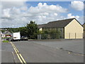
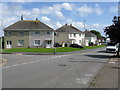
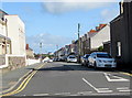
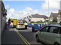
Please click the More button for more images, licensing and image copyright information.
Police
This area is policed by Dyfed-Powys Police.
Dyfed-Powys Police split their policing area into 235 separate neighbourhoods and this postcode is in the Milford - Central neighbourhood.

Milford - Central Neighbourhood Crime
Top 3 Categories
For full details of all categories together with more crime information, click on the Details button.
Member of UK Parliament
This postcode is in the Preseli Pembrokeshire parliamentary constituency.
Preseli Pembrokeshire is a constituency in Wales. The seat has been held by Stephen Crabb (Conservative) since May 2010.

Most Recent House Sales for Yorke Close, SA73 2LF
No recorded house sales or transfers for this postcode.
Local Petrol Station Prices
Coordinates for SA73 2LF
Residents at SA73 2LF
Sunrise and Sunset at SA73 2LF
Traffic Emission and Congestion Zones
Historical Weather Summary
| Clear | 17.30% |
| Cloudy | 55.45% |
| Rain | 12.75% |
| Windy | 12.34% |
| Other | 2.16% |
Population
Deprivation Index
the more deprived the postcode
Average Energy Performance
Companies Registered at SA73 2LF
Postcode Details for SA73 2LF
Recent Updates
|
18 Apr 2024 Added Traffic Camera Views from Traffic Scotland to Roadworks within Scotland |
|
15 Apr 2024 Schools Data updated for April 2024 |
|
10 Apr 2024 Companies Data updated for March 2024 |
|
7 Apr 2024 New option to receive automatic updates to roadworks that affect you |
|
7 Apr 2024 Police and Crime data updated for February 2024 |
|
3 Apr 2024 Sold House Price data updated for February 2024 |
|
30 Mar 2024 Energy Performance Certificates (England and Wales) updated February 2024 |
|
28 Mar 2024 New feature to use Geolocating functions to detect your current location |
Random Postcodes
Want an idea of what is in our extensive website? Try somewhere completely random!
The Rural/Urban classification is based upon data collected during the 2011 Census and released in August 2013 and is categorised into 6 distinct classes.
[A] Urban Major conurbation: A built up area with a population of 10,000 (3,000 in Scotland) or more and is assigned to the major conurbation settlement category.
[B] Urban Minor conurbation: A built up area with a population of 10,000 (3,000 in Scotland) or more and is assigned to the minor conurbation settlement category.
[C] Urban City and town: A built up area with a population of 10,000 (3,000 in Scotland) or more and is assigned to the city and town settlement category.
[D] Rural Town and fringe
[E] Rural Village
[F] Rural Hamlet and isolated dwelling
The Index of Multiple Deprivation (IMD) is the official measure of relative deprivation.
The index is based on 39 separate indicators across seven distinct domains (Income; Employment; Health and Disability; Education, Skills and Training; Crime; Barriers to Housing and Services; Living Environment) to provide an overall measure of multiple deprivation and is calculated for every neighbourhood.
The index is relative rather than an absolute scale and so a neighbourhood with a score of 10 is more deprived than one rated 20, but this does not equate to being twice as deprived.
Please note: Different indices are used in England, Scotland, Wales and Northern Ireland and so comparison of scores from neighbourhoods in different countries should not be undertaken.
These figures report on incorporated UK companies only that are registered at this postcode and do not include sole-traders, partnerships or overseas organisations.
The population figure shown for your area are an estimate provided by the Office for National Statistics and is rounded to the nearest 1,000.
The estimates are derived from the Annual Population Survey (APS) which is the Labour Force Survey (LFS) plus various sample boosts.
There are 55 unitary authorities. They provide all local government services in their areas. These are mainly in the cities, urban areas and larger towns although there are now 6 shire county councils that are unitary (ie have no district councils beneath them).