Overview for Bro Stinian, FISHGUARD, SA65 9RF
Introduction
Fishguard is a coastal town in Pembrokeshire, Wales, with a population of 3,419 in 2011; the community of Fishguard and Goodwick had a population of 5,407. Modern Fishguard consists of two parts, Lower Fishguard and the "Main Town". Fishguard and Goodwick are twin towns with a joint Town Council.
Lower Fishguard is believed to be the site of the original hamlet from which modern Fishguard has grown. It is in a deep valley where the River Gwaun meets the sea, hence the Welsh name for Fishguard. It is a typical fishing village with a short tidal quay. The settlement stretches along the north slope of the valley.
The main town contains the parish church, the High Street and most of the modern development, and lies upon the hill to the south of Lower Fishguard, to which it is joined by a steep and winding road. The west part of the town that faces Goodwick grew in the first decade of the 20th century with the development of Fishguard Harbour.
Summary for Bro Stinian, FISHGUARD, SA65 9RF
Roadworks near SA65 9RF
A local roadworks feed is not available for Wales at this time.
However, Traffic Wales/Traffig Cymru provide works details for motorways and major trunk roads in Wales on their website at traffic.wales/roadworks
Road Safety near SA65 9RF
Details of personal injury accidents in and around Bro Stinian, SA65 9RF that have been reported to Dyfed-Powys Police over the past 20 years.
Traffic Levels near SA65 9RF
View traffic levels near Bro Stinian, SA65 9RF from official Department for Transport counts.
Images taken near to Bro Stinian, SA65 9RF and the surrounding area
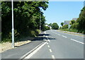
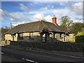

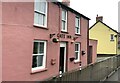
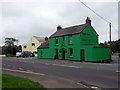
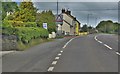

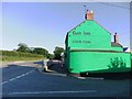
Please click the More button for more images, licensing and image copyright information.
Police
This area is policed by Dyfed-Powys Police.
Dyfed-Powys Police split their policing area into 235 separate neighbourhoods and this postcode is in the Scleddau neighbourhood.

Scleddau Neighbourhood Crime
Top 3 Categories
For full details of all categories together with more crime information, click on the Details button.
Member of UK Parliament
This postcode is in the Preseli Pembrokeshire parliamentary constituency.
Preseli Pembrokeshire is a constituency in Wales. The seat has been held by Stephen Crabb (Conservative) since May 2010.

Most Recent House Sales for Bro Stinian, SA65 9RF
9 Jul 2021
18 Dec 2020
27 Aug 2020
2 Nov 2018
Local Petrol Station Prices
Coordinates for SA65 9RF
Residents at SA65 9RF
Sunrise and Sunset at SA65 9RF
Traffic Emission and Congestion Zones
Historical Weather Summary
| Clear | 14.17% |
| Cloudy | 58.66% |
| Rain | 11.03% |
| Windy | 14.98% |
| Other | 1.16% |
Population
Deprivation Index
the more deprived the postcode
Average Energy Performance
Companies Registered at SA65 9RF
Postcode Details for SA65 9RF
Recent Updates
|
18 Apr 2024 Added Traffic Camera Views from Traffic Scotland to Roadworks within Scotland |
|
15 Apr 2024 Schools Data updated for April 2024 |
|
10 Apr 2024 Companies Data updated for March 2024 |
|
7 Apr 2024 New option to receive automatic updates to roadworks that affect you |
|
7 Apr 2024 Police and Crime data updated for February 2024 |
|
3 Apr 2024 Sold House Price data updated for February 2024 |
|
30 Mar 2024 Energy Performance Certificates (England and Wales) updated February 2024 |
|
28 Mar 2024 New feature to use Geolocating functions to detect your current location |
Random Postcodes
Want an idea of what is in our extensive website? Try somewhere completely random!
The Rural/Urban classification is based upon data collected during the 2011 Census and released in August 2013 and is categorised into 6 distinct classes.
[A] Urban Major conurbation: A built up area with a population of 10,000 (3,000 in Scotland) or more and is assigned to the major conurbation settlement category.
[B] Urban Minor conurbation: A built up area with a population of 10,000 (3,000 in Scotland) or more and is assigned to the minor conurbation settlement category.
[C] Urban City and town: A built up area with a population of 10,000 (3,000 in Scotland) or more and is assigned to the city and town settlement category.
[D] Rural Town and fringe
[E] Rural Village
[F] Rural Hamlet and isolated dwelling
The Index of Multiple Deprivation (IMD) is the official measure of relative deprivation.
The index is based on 39 separate indicators across seven distinct domains (Income; Employment; Health and Disability; Education, Skills and Training; Crime; Barriers to Housing and Services; Living Environment) to provide an overall measure of multiple deprivation and is calculated for every neighbourhood.
The index is relative rather than an absolute scale and so a neighbourhood with a score of 10 is more deprived than one rated 20, but this does not equate to being twice as deprived.
Please note: Different indices are used in England, Scotland, Wales and Northern Ireland and so comparison of scores from neighbourhoods in different countries should not be undertaken.
These figures report on incorporated UK companies only that are registered at this postcode and do not include sole-traders, partnerships or overseas organisations.
The population figure shown for your area are an estimate provided by the Office for National Statistics and is rounded to the nearest 1,000.
The estimates are derived from the Annual Population Survey (APS) which is the Labour Force Survey (LFS) plus various sample boosts.
There are 55 unitary authorities. They provide all local government services in their areas. These are mainly in the cities, urban areas and larger towns although there are now 6 shire county councils that are unitary (ie have no district councils beneath them).