Overview for Millhouses Glen, SHEFFIELD, S11 9HB
Introduction
Sheffield is a city in South Yorkshire, England, whose name derives from the River Sheaf which runs through it. The city serves as the administrative centre of the City of Sheffield. It is historically part of the West Riding of Yorkshire and some of its southern suburbs were transferred from Derbyshire to the city council. It is the largest settlement in South Yorkshire.
The city is in the eastern foothills of the Pennines and the valleys of the River Don with its four tributaries: the Loxley, the Porter Brook, the Rivelin and the Sheaf. Sixty-one per cent of Sheffield's entire area is green space and a third of the city lies within the Peak District national park and is the fifth largest city in England. There are more than 250 parks, woodlands and gardens in the city, which is estimated to contain around 4.5 million trees. The city is 29 miles (47 km) south of Leeds and 32 miles (51 km) east of Manchester.
Sheffield played a crucial role in the Industrial Revolution, with many significant inventions and technologies having developed in the city. In the 19th century, the city saw a huge expansion of its traditional cutlery trade, when stainless steel and crucible steel were developed locally, fuelling an almost tenfold increase in the population. Sheffield received its municipal charter in 1843, becoming the City of Sheffield in 1893. International competition in iron and steel caused a decline in these industries in the 1970s and 1980s, coinciding with the collapse of coal mining in the area. The Yorkshire ridings became counties in their own right in 1889, the West Riding of Yorkshire county was disbanded in 1974. The city then became part of the county of South Yorkshire; this has been made up of separately-governed unitary authorities since 1986. The 21st century has seen extensive redevelopment in Sheffield, consistent with other British cities. Sheffield's gross value added (GVA) has increased by 60% since 1997, standing at £11.3 billion in 2015. The economy has experienced steady growth, averaging around 5% annually, which is greater than that of the broader region of Yorkshire and the Humber.
Sheffield had a population of 556,500 at the 2021 census, making it the second largest city in the Yorkshire and the Humber region. The Sheffield Built-up Area, of which the Sheffield sub-division is the largest part, had a population of 685,369 also including the town of Rotherham. The district borough, governed from the city, had a population of 556,521 at the mid-2019 estimate, making it the 4th most populous district in England. It is one of eleven British cities that make up the Core Cities Group. In 2011, the unparished area had a population of 490,070.
The city has a long sporting heritage and is home both to the world's oldest football club, Sheffield F.
C., and the world's oldest football ground, Sandygate. Matches between the two professional clubs, Sheffield United and Sheffield Wednesday, are known as the Steel City derby. The city is also home to the World Snooker Championship and the Sheffield Steelers, the UK's first professional ice hockey team.
Summary for Millhouses Glen, SHEFFIELD, S11 9HB
Roadworks near S11 9HB
Road Safety near S11 9HB
Details of personal injury accidents in and around Millhouses Glen, S11 9HB that have been reported to South Yorkshire Police over the past 20 years.
Traffic Levels near S11 9HB
View traffic levels near Millhouses Glen, S11 9HB from official Department for Transport counts.
Images taken near to Millhouses Glen, S11 9HB and the surrounding area
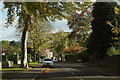

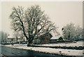
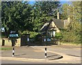
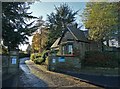
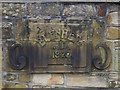
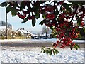
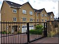
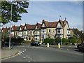
Please click the More button for more images, licensing and image copyright information.
Sheffield and nearby Videos From YouTube
Sheffield - Drone Footage 4K #sheffield
This video footage contains aerial shot of Sheffield. DJI Mavic Mini 2 was used to take the drone shot. Sheffield is a city in the ...
Channel: RESHAM THAPA MAGAR Vlog (View Channel)
Published: 2 Jul 2023
Police
This area is policed by South Yorkshire Police.
South Yorkshire Police split their policing area into 18 separate neighbourhoods and this postcode is in the Sheffield South West neighbourhood.

Sheffield South West Neighbourhood Crime
Top 3 Categories
For full details of all categories together with more crime information, click on the Details button.
Member of UK Parliament
This postcode is in the Sheffield, Hallam parliamentary constituency.
Sheffield, Hallam is a constituency in the Yorkshire and The Humber region of England. The seat has been held by Olivia Blake (Labour) since December 2019.

Most Recent House Sales for Millhouses Glen, S11 9HB
18 Feb 2022
8 Feb 2021
12 Aug 2010
12 Jan 2006
Local Petrol Station Prices
Coordinates for S11 9HB
Residents at S11 9HB
Sunrise and Sunset at S11 9HB
Traffic Emission and Congestion Zones
Historical Weather Summary
| Clear | 9.29% |
| Cloudy | 68.05% |
| Rain | 9.33% |
| Windy | 12.38% |
| Other | 0.95% |
Population
Deprivation Index
the more deprived the postcode
Average Energy Performance
Companies Registered at S11 9HB
Postcode Details for S11 9HB
Recent Updates
|
18 Apr 2024 Added Traffic Camera Views from Traffic Scotland to Roadworks within Scotland |
|
15 Apr 2024 Schools Data updated for April 2024 |
|
10 Apr 2024 Companies Data updated for March 2024 |
|
7 Apr 2024 New option to receive automatic updates to roadworks that affect you |
|
7 Apr 2024 Police and Crime data updated for February 2024 |
|
3 Apr 2024 Sold House Price data updated for February 2024 |
|
30 Mar 2024 Energy Performance Certificates (England and Wales) updated February 2024 |
|
28 Mar 2024 New feature to use Geolocating functions to detect your current location |
Random Postcodes
Want an idea of what is in our extensive website? Try somewhere completely random!
The Rural/Urban classification is based upon data collected during the 2011 Census and released in August 2013 and is categorised into 6 distinct classes.
[A] Urban Major conurbation: A built up area with a population of 10,000 (3,000 in Scotland) or more and is assigned to the major conurbation settlement category.
[B] Urban Minor conurbation: A built up area with a population of 10,000 (3,000 in Scotland) or more and is assigned to the minor conurbation settlement category.
[C] Urban City and town: A built up area with a population of 10,000 (3,000 in Scotland) or more and is assigned to the city and town settlement category.
[D] Rural Town and fringe
[E] Rural Village
[F] Rural Hamlet and isolated dwelling
The Index of Multiple Deprivation (IMD) is the official measure of relative deprivation.
The index is based on 39 separate indicators across seven distinct domains (Income; Employment; Health and Disability; Education, Skills and Training; Crime; Barriers to Housing and Services; Living Environment) to provide an overall measure of multiple deprivation and is calculated for every neighbourhood.
The index is relative rather than an absolute scale and so a neighbourhood with a score of 10 is more deprived than one rated 20, but this does not equate to being twice as deprived.
Please note: Different indices are used in England, Scotland, Wales and Northern Ireland and so comparison of scores from neighbourhoods in different countries should not be undertaken.
These figures report on incorporated UK companies only that are registered at this postcode and do not include sole-traders, partnerships or overseas organisations.
The population figure shown for your area are an estimate provided by the Office for National Statistics and is rounded to the nearest 1,000.
The estimates are derived from the Annual Population Survey (APS) which is the Labour Force Survey (LFS) plus various sample boosts.
There are 36 metropolitan district councils which together cover 6 large urban areas: the counties of Greater Manchester, Merseyside, South Yorkshire, Tyne and Wear, West Midlands, and West Yorkshire.
Metropolitan districts are responsible for all services in their area, although certain conurbation wide services such as fire and civil defence, police, waste disposal and passenger transport are provided through joint authorities (the districts acting jointly).