Overview for Raglan Road, REIGATE, RH2 0HP
Introduction
Reigate (RY-gate) is a town in Surrey, England, around 19 mi (31 km) south of central London. The settlement is recorded in Domesday Book in 1086 as Cherchefelle and first appears with its modern name in the 1190s. The earliest archaeological evidence for human activity is from the Paleolithic and Neolithic, and during the Roman period, tile-making took place to the north east of the modern centre.
A motte-and-bailey castle was erected in Reigate in the late 11th or early 12th century. It was originally constructed of timber, but the curtain walls were rebuilt in stone about a century later. An Augustinian priory was founded to the south of the modern town centre in the first half of the 13th century. The priory was closed during the Reformation and was rebuilt as a private residence for William Howard, the 1st Baron Howard of Effingham. The castle was abandoned around the same time and fell into disrepair.
During the medieval and early modern periods, Reigate was primarily an agricultural settlement. A weekly market began no later than 1279 and continued until 1895. Key crops included oats, hops and flax, but there is no record of rye being grown in the local area. The economy initially declined in the 18th century, as new turnpike roads allowed cheaper goods made outside the town to become available, undercutting local producers. Following the arrival of the railways in the mid-19th century, Reigate began to expand and the sale of much of the priory estate in 1921 released further land for housebuilding.
Since 1974, Reigate has been one of four towns in the borough of Reigate and Banstead and is part of the London commuter belt. The borough council is based at the town hall in Castlefield Road and Surrey County Council has its headquarters at Woodhatch Place. Much of the North Downs, to the north of Reigate, is owned by the National Trust, including Colley Hill, 722 feet (220 m) above ordnance datum (OD) and Reigate Hill 771 feet (235 m) above OD.
Summary for Raglan Road, REIGATE, RH2 0HP
Roadworks near RH2 0HP
Road Safety near RH2 0HP
Details of personal injury accidents in and around Raglan Road, RH2 0HP that have been reported to Surrey Police over the past 20 years.
Traffic Levels near RH2 0HP
View traffic levels near Raglan Road, RH2 0HP from official Department for Transport counts.
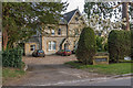
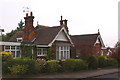
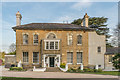
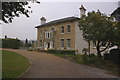
Images taken near to Raglan Road, RH2 0HP and the surrounding area
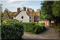
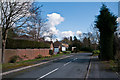
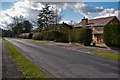
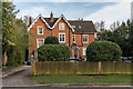
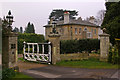
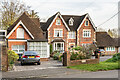
Please click the More button for more images, licensing and image copyright information.
Member of UK Parliament
This postcode is in the Reigate parliamentary constituency.
Reigate is a constituency in the South East region of England. The seat has been held by Crispin Blunt (Independent) since May 2010.

Most Recent House Sales for Raglan Road, RH2 0HP
30 May 2023
14 Oct 2022
28 Jul 2005
2 Oct 2002
Local Petrol Station Prices
Coordinates for RH2 0HP
Residents at RH2 0HP
Sunrise and Sunset at RH2 0HP
Traffic Emission and Congestion Zones
Historical Weather Summary
| Clear | 23.30% |
| Cloudy | 66.64% |
| Rain | 6.83% |
| Windy | 2.94% |
| Other | 0.29% |
Population
Deprivation Index
the more deprived the postcode
Average Energy Performance
Companies Registered at RH2 0HP
Postcode Details for RH2 0HP
Recent Updates
|
18 Apr 2024 Added Traffic Camera Views from Traffic Scotland to Roadworks within Scotland |
|
15 Apr 2024 Schools Data updated for April 2024 |
|
10 Apr 2024 Companies Data updated for March 2024 |
|
7 Apr 2024 New option to receive automatic updates to roadworks that affect you |
|
7 Apr 2024 Police and Crime data updated for February 2024 |
|
3 Apr 2024 Sold House Price data updated for February 2024 |
|
30 Mar 2024 Energy Performance Certificates (England and Wales) updated February 2024 |
|
28 Mar 2024 New feature to use Geolocating functions to detect your current location |
Random Postcodes
Want an idea of what is in our extensive website? Try somewhere completely random!
The Rural/Urban classification is based upon data collected during the 2011 Census and released in August 2013 and is categorised into 6 distinct classes.
[A] Urban Major conurbation: A built up area with a population of 10,000 (3,000 in Scotland) or more and is assigned to the major conurbation settlement category.
[B] Urban Minor conurbation: A built up area with a population of 10,000 (3,000 in Scotland) or more and is assigned to the minor conurbation settlement category.
[C] Urban City and town: A built up area with a population of 10,000 (3,000 in Scotland) or more and is assigned to the city and town settlement category.
[D] Rural Town and fringe
[E] Rural Village
[F] Rural Hamlet and isolated dwelling
The Index of Multiple Deprivation (IMD) is the official measure of relative deprivation.
The index is based on 39 separate indicators across seven distinct domains (Income; Employment; Health and Disability; Education, Skills and Training; Crime; Barriers to Housing and Services; Living Environment) to provide an overall measure of multiple deprivation and is calculated for every neighbourhood.
The index is relative rather than an absolute scale and so a neighbourhood with a score of 10 is more deprived than one rated 20, but this does not equate to being twice as deprived.
Please note: Different indices are used in England, Scotland, Wales and Northern Ireland and so comparison of scores from neighbourhoods in different countries should not be undertaken.
These figures report on incorporated UK companies only that are registered at this postcode and do not include sole-traders, partnerships or overseas organisations.
The population figure shown for your area are an estimate provided by the Office for National Statistics and is rounded to the nearest 1,000.
The estimates are derived from the Annual Population Survey (APS) which is the Labour Force Survey (LFS) plus various sample boosts.
There are 26 county councils in 2-tier areas, providing services such as education, social services and waste disposal.
In 2-tier areas, each county council area is subdivided into districts, for which there is an independent district council. There are 192 district councils.
District councils are responsible for local services such as rubbish collection, housing and planning applications.