Overview for Bensons Hill Road, CRAWLEY, RH11 9SF
Introduction
Crawley is a large town and borough in West Sussex, England. It is 28 miles (45 km) south of London, 18 miles (29 km) north of Brighton and Hove, and 32 miles (51 km) north-east of the county town of Chichester. Crawley covers an area of 17.36 square miles (44.96 km2) and had a population of 106,597 at the time of the 2011 Census.
The area has been inhabited since the Stone Age, and was a centre of ironworking in Roman times. Crawley developed slowly as a market town from the 13th century, serving the surrounding villages in the Weald. Its location on the main road from London to Brighton brought passing trade, which encouraged the development of coaching inns. A rail link to London opened in 1841.
Gatwick Airport, nowadays one of Britain's busiest international airports, opened for commercial flights on the edge of the town in 1933, encouraging commercial and industrial growth. After the Second World War, the British Government planned to move large numbers of people and jobs out of London and into new towns around South East England. The New Towns Act 1946 designated Crawley as the site of one of these. A master plan was developed for the establishment of new residential, commercial, industrial and civic areas, and rapid development greatly increased the size and population of the town over a few decades.
The town contains 14 residential neighbourhoods radiating out from the core of the old market town, and separated by main roads and railway lines. The nearby communities of Ifield, Pound Hill and Three Bridges were absorbed into the new town at various stages in its development. In 2009, expansion was being planned in the west and north-west of the town, in cooperation with Horsham District Council, which has now become a new neighbourhood named Kilnwood Vale, but it is not in Crawley. Economically, the town has developed into the main centre of industry and employment between London and the south coast. Its large industrial area supports manufacturing and service companies, many of them connected with the airport. The commercial and retail sectors continue to expand.
Summary for Bensons Hill Road, CRAWLEY, RH11 9SF
Roadworks near RH11 9SF
Road Safety near RH11 9SF
Details of personal injury accidents in and around Bensons Hill Road, RH11 9SF that have been reported to Sussex Police over the past 20 years.
Traffic Levels near RH11 9SF
View traffic levels near Bensons Hill Road, RH11 9SF from official Department for Transport counts.
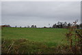
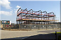
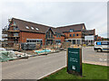
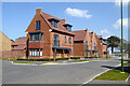
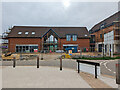
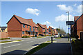
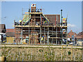
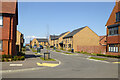
Images taken near to Bensons Hill Road, RH11 9SF and the surrounding area
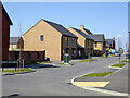
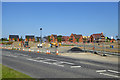
Please click the More button for more images, licensing and image copyright information.
Crawley and nearby Videos From YouTube
Legal drone flight at Gatwick Airport.  @Geeksvana all footage captured on DJI Mavic mini 2
aerialphotography #dronestagram #dronephotography #djimavicair #droneoftheday #dji #djimavicmini #gatwick #gatwickairport.
Channel: Drone Show Live (View Channel)
Published: 8 Jan 2022
Police
This area is policed by Sussex Police.
Sussex Police split their policing area into 273 separate neighbourhoods and this postcode is in the Balcombe, Handcross, Pease Pottage, Ansty, Staplefield and Cuckfield neighbourhood.

Balcombe, Handcross, Pease Pottage, Ansty, Staplefield and Cuckfield Neighbourhood Crime
Top 3 Categories
For full details of all categories together with more crime information, click on the Details button.
Member of UK Parliament
This postcode is in the Horsham parliamentary constituency.
Horsham is a constituency in the South East region of England. The seat has been held by Sir Jeremy Quin (Conservative) since May 2015.

Most Recent House Sales for Bensons Hill Road, RH11 9SF
13 Dec 2022
29 Jul 2022
22 Dec 2021
30 Jun 2021
Local Petrol Station Prices
Coordinates for RH11 9SF
Residents at RH11 9SF
Sunrise and Sunset at RH11 9SF
Traffic Emission and Congestion Zones
Historical Weather Summary
| Clear | 23.75% |
| Cloudy | 63.00% |
| Rain | 7.45% |
| Windy | 5.65% |
| Other | 0.15% |
Population
Deprivation Index
the more deprived the postcode
Average Energy Performance
Companies Registered at RH11 9SF
Postcode Details for RH11 9SF
Recent Updates
|
15 Apr 2024 Schools Data updated for April 2024 |
|
10 Apr 2024 Companies Data updated for March 2024 |
|
7 Apr 2024 New option to receive automatic updates to roadworks that affect you |
|
7 Apr 2024 Police and Crime data updated for February 2024 |
|
3 Apr 2024 Sold House Price data updated for February 2024 |
|
30 Mar 2024 Energy Performance Certificates (England and Wales) updated February 2024 |
|
28 Mar 2024 New feature to use Geolocating functions to detect your current location |
|
17 Mar 2024 Schools Data updated for March 2024 |
Random Postcodes
Want an idea of what is in our extensive website? Try somewhere completely random!
The Rural/Urban classification is based upon data collected during the 2011 Census and released in August 2013 and is categorised into 6 distinct classes.
[A] Urban Major conurbation: A built up area with a population of 10,000 (3,000 in Scotland) or more and is assigned to the major conurbation settlement category.
[B] Urban Minor conurbation: A built up area with a population of 10,000 (3,000 in Scotland) or more and is assigned to the minor conurbation settlement category.
[C] Urban City and town: A built up area with a population of 10,000 (3,000 in Scotland) or more and is assigned to the city and town settlement category.
[D] Rural Town and fringe
[E] Rural Village
[F] Rural Hamlet and isolated dwelling
The Index of Multiple Deprivation (IMD) is the official measure of relative deprivation.
The index is based on 39 separate indicators across seven distinct domains (Income; Employment; Health and Disability; Education, Skills and Training; Crime; Barriers to Housing and Services; Living Environment) to provide an overall measure of multiple deprivation and is calculated for every neighbourhood.
The index is relative rather than an absolute scale and so a neighbourhood with a score of 10 is more deprived than one rated 20, but this does not equate to being twice as deprived.
Please note: Different indices are used in England, Scotland, Wales and Northern Ireland and so comparison of scores from neighbourhoods in different countries should not be undertaken.
These figures report on incorporated UK companies only that are registered at this postcode and do not include sole-traders, partnerships or overseas organisations.
The population figure shown for your area are an estimate provided by the Office for National Statistics and is rounded to the nearest 1,000.
The estimates are derived from the Annual Population Survey (APS) which is the Labour Force Survey (LFS) plus various sample boosts.
There are 26 county councils in 2-tier areas, providing services such as education, social services and waste disposal.
In 2-tier areas, each county council area is subdivided into districts, for which there is an independent district council. There are 192 district councils.
District councils are responsible for local services such as rubbish collection, housing and planning applications.