Overview for Knights Park Road, BASINGSTOKE, RG21 6XE
Introduction
Basingstoke (BAY-zing-stohk) is a town in Hampshire, situated in south-central England across a valley at the source of the River Loddon on the western edge of the North Downs. It is the largest settlement in Hampshire without city status. It is located 30 miles (48 km) north-east of Southampton, 48 miles (77 km) south-west of London, 27 miles (43 km) west of Guildford, 22 miles (35 km) south of Reading and 20 miles (32 km) north-east of the county town and former capital Winchester. According to the 2016 population estimate, the town had a population of 113,776. It is part of the borough of Basingstoke and Deane and part of the parliamentary constituency of Basingstoke.
Basingstoke is an old market town expanded in the mid-1960s, as a result of an agreement between London County Council and Hampshire County Council. It was developed rapidly after the Second World War, along with various other towns in the United Kingdom, in order to accommodate part of the London 'overspill' as perceived under the Greater London Plan in 1944. Basingstoke market was mentioned in the Domesday Book of 1086 and it remained a small market town until the early 1960s. At the start of the Second World War, the population was little more than 13,000. It still has a regular market, but is now larger than Hampshire County Council's definition of a market town.
Basingstoke became an important economic centre during the second half of the 20th century and houses the locations of the UK headquarters of Motorola, The Automobile Association, De La Rue, Sun Life Financial, ST Ericsson, GAME, Barracuda Networks, Eli Lilly and Company, FCB Halesway part of FCB, BNP Paribas Leasing Solutions (the leasing arm of BNP Paribas in the UK) and Sony Professional Solutions. It is also the location of the European headquarters of the TaylorMade Golf Company. Other industries include IT, telecommunications, insurance and electronics.
Summary for Knights Park Road, BASINGSTOKE, RG21 6XE
Roadworks near RG21 6XE
Road Safety near RG21 6XE
Details of personal injury accidents in and around Knights Park Road, RG21 6XE that have been reported to Hampshire Constabulary over the past 20 years.
Traffic Levels near RG21 6XE
View traffic levels near Knights Park Road, RG21 6XE from official Department for Transport counts.
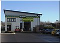
Images taken near to Knights Park Road, RG21 6XE and the surrounding area
Please click the More button for more images, licensing and image copyright information.
Basingstoke and nearby Videos From YouTube
Basingstoke Flying Drone
AdamsAerialDrone#aerialdrone #drone #dronevideo.
Channel: Adam's Aerial Drone (View Channel)
Published: 3 Oct 2022
Police
This area is policed by Hampshire Constabulary.
Hampshire Constabulary split their policing area into 95 separate neighbourhoods and this postcode is in the Basingstoke North neighbourhood.

Basingstoke North Neighbourhood Crime
Top 3 Categories
For full details of all categories together with more crime information, click on the Details button.
Member of UK Parliament
This postcode is in the Basingstoke parliamentary constituency.
Basingstoke is a constituency in the South East region of England. The seat has been held by Dame Maria Miller (Conservative) since May 2010.

Most Recent House Sales for Knights Park Road, RG21 6XE
No recorded house sales or transfers for this postcode.
Local Petrol Station Prices
Coordinates for RG21 6XE
Residents at RG21 6XE
Sunrise and Sunset at RG21 6XE
Traffic Emission and Congestion Zones
Historical Weather Summary
| Clear | 21.22% |
| Cloudy | 65.74% |
| Rain | 6.92% |
| Windy | 5.73% |
| Other | 0.39% |
Population
Deprivation Index
the more deprived the postcode
Companies Registered at RG21 6XE
Postcode Details for RG21 6XE
Recent Updates
|
18 Apr 2024 Added Traffic Camera Views from Traffic Scotland to Roadworks within Scotland |
|
15 Apr 2024 Schools Data updated for April 2024 |
|
10 Apr 2024 Companies Data updated for March 2024 |
|
7 Apr 2024 New option to receive automatic updates to roadworks that affect you |
|
7 Apr 2024 Police and Crime data updated for February 2024 |
|
3 Apr 2024 Sold House Price data updated for February 2024 |
|
30 Mar 2024 Energy Performance Certificates (England and Wales) updated February 2024 |
|
28 Mar 2024 New feature to use Geolocating functions to detect your current location |
Random Postcodes
Want an idea of what is in our extensive website? Try somewhere completely random!
The Rural/Urban classification is based upon data collected during the 2011 Census and released in August 2013 and is categorised into 6 distinct classes.
[A] Urban Major conurbation: A built up area with a population of 10,000 (3,000 in Scotland) or more and is assigned to the major conurbation settlement category.
[B] Urban Minor conurbation: A built up area with a population of 10,000 (3,000 in Scotland) or more and is assigned to the minor conurbation settlement category.
[C] Urban City and town: A built up area with a population of 10,000 (3,000 in Scotland) or more and is assigned to the city and town settlement category.
[D] Rural Town and fringe
[E] Rural Village
[F] Rural Hamlet and isolated dwelling
The Index of Multiple Deprivation (IMD) is the official measure of relative deprivation.
The index is based on 39 separate indicators across seven distinct domains (Income; Employment; Health and Disability; Education, Skills and Training; Crime; Barriers to Housing and Services; Living Environment) to provide an overall measure of multiple deprivation and is calculated for every neighbourhood.
The index is relative rather than an absolute scale and so a neighbourhood with a score of 10 is more deprived than one rated 20, but this does not equate to being twice as deprived.
Please note: Different indices are used in England, Scotland, Wales and Northern Ireland and so comparison of scores from neighbourhoods in different countries should not be undertaken.
These figures report on incorporated UK companies only that are registered at this postcode and do not include sole-traders, partnerships or overseas organisations.
The population figure shown for your area are an estimate provided by the Office for National Statistics and is rounded to the nearest 1,000.
The estimates are derived from the Annual Population Survey (APS) which is the Labour Force Survey (LFS) plus various sample boosts.
There are 26 county councils in 2-tier areas, providing services such as education, social services and waste disposal.
In 2-tier areas, each county council area is subdivided into districts, for which there is an independent district council. There are 192 district councils.
District councils are responsible for local services such as rubbish collection, housing and planning applications.