Overview for Ilsley Gardens, Ilsley Road, NEWBURY, RG20 7PF
Introduction
Newbury is a market town in the county of Berkshire, England, and is home to the administrative headquarters of West Berkshire Council. The town centres around a large market square retains a rare medieval Cloth Hall, an adjoining half timbered granary, and the 15th-century St Nicolas Church, along with 17th- and 18th-century listed buildings. As well as being home to Newbury Racecourse, it is the headquarters of Vodafone and software company Micro Focus International. In the valley of the River Kennet, 26 mi (42 km) south of Oxford, 25 mi (40 km) north of Winchester, 27 mi (43 km) southeast of Swindon and 20 mi (32 km) west of Reading.
Newbury lies on the edge of the Berkshire Downs; part of the North Wessex Downs Area of outstanding natural beauty, 3 mi (5 km) north of the Hampshire-Berkshire county boundary. In the suburban village of Donnington lies the part-ruined Donnington Castle and the surrounding hills are home to some of the country's most famous racehorse training grounds (centred on nearby Lambourn). To the south is a narrower range of hills including Walbury Hill and a few private landscape gardens and mansions, such as Highclere Castle. The local economy is inter-related to that of the eastern M4 corridor, which has most of its industrial, logistical and research businesses close to Newbury, mostly around Reading, Bracknell, Maidenhead and Slough. Together with the adjoining town of Thatcham, 3 mi (5 km) distant, Newbury forms the principal part of an urban area of approximately 70,000 people.
Summary for Ilsley Gardens, Ilsley Road, NEWBURY, RG20 7PF
Roadworks near RG20 7PF
Road Safety near RG20 7PF
Details of personal injury accidents in and around Ilsley Gardens, Ilsley Road, RG20 7PF that have been reported to Thames Valley Police over the past 20 years.
Traffic Levels near RG20 7PF
View traffic levels near Ilsley Gardens, Ilsley Road, RG20 7PF from official Department for Transport counts.
Images taken near to Ilsley Gardens, Ilsley Road, RG20 7PF and the surrounding area
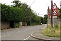
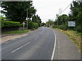
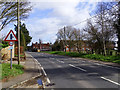
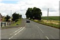
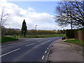
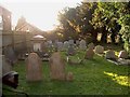
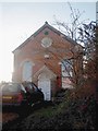
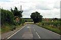
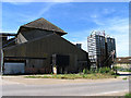
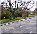
Please click the More button for more images, licensing and image copyright information.
Police
This area is policed by Thames Valley Police.
Thames Valley Police split their policing area into 108 separate neighbourhoods and this postcode is in the Bucklebury and Downlands neighbourhood.

Bucklebury and Downlands Neighbourhood Crime
Top 3 Categories
For full details of all categories together with more crime information, click on the Details button.
Member of UK Parliament
This postcode is in the Newbury parliamentary constituency.
Newbury is a constituency in the South East region of England. The seat has been held by Laura Farris (Conservative) since December 2019.

Most Recent House Sales for Ilsley Gardens, Ilsley Road, RG20 7PF
28 Jan 2011
26 Jul 2006
20 Oct 2004
Local Petrol Station Prices
Coordinates for RG20 7PF
Residents at RG20 7PF
Sunrise and Sunset at RG20 7PF
Traffic Emission and Congestion Zones
Historical Weather Summary
| Clear | 21.20% |
| Cloudy | 69.66% |
| Rain | 6.27% |
| Windy | 2.77% |
| Other | 0.10% |
Population
Deprivation Index
the more deprived the postcode
Average Energy Performance
Companies Registered at RG20 7PF
Postcode Details for RG20 7PF
Recent Updates
|
18 Apr 2024 Added Traffic Camera Views from Traffic Scotland to Roadworks within Scotland |
|
15 Apr 2024 Schools Data updated for April 2024 |
|
10 Apr 2024 Companies Data updated for March 2024 |
|
7 Apr 2024 New option to receive automatic updates to roadworks that affect you |
|
7 Apr 2024 Police and Crime data updated for February 2024 |
|
3 Apr 2024 Sold House Price data updated for February 2024 |
|
30 Mar 2024 Energy Performance Certificates (England and Wales) updated February 2024 |
|
28 Mar 2024 New feature to use Geolocating functions to detect your current location |
Random Postcodes
Want an idea of what is in our extensive website? Try somewhere completely random!
The Rural/Urban classification is based upon data collected during the 2011 Census and released in August 2013 and is categorised into 6 distinct classes.
[A] Urban Major conurbation: A built up area with a population of 10,000 (3,000 in Scotland) or more and is assigned to the major conurbation settlement category.
[B] Urban Minor conurbation: A built up area with a population of 10,000 (3,000 in Scotland) or more and is assigned to the minor conurbation settlement category.
[C] Urban City and town: A built up area with a population of 10,000 (3,000 in Scotland) or more and is assigned to the city and town settlement category.
[D] Rural Town and fringe
[E] Rural Village
[F] Rural Hamlet and isolated dwelling
The Index of Multiple Deprivation (IMD) is the official measure of relative deprivation.
The index is based on 39 separate indicators across seven distinct domains (Income; Employment; Health and Disability; Education, Skills and Training; Crime; Barriers to Housing and Services; Living Environment) to provide an overall measure of multiple deprivation and is calculated for every neighbourhood.
The index is relative rather than an absolute scale and so a neighbourhood with a score of 10 is more deprived than one rated 20, but this does not equate to being twice as deprived.
Please note: Different indices are used in England, Scotland, Wales and Northern Ireland and so comparison of scores from neighbourhoods in different countries should not be undertaken.
These figures report on incorporated UK companies only that are registered at this postcode and do not include sole-traders, partnerships or overseas organisations.
The population figure shown for your area are an estimate provided by the Office for National Statistics and is rounded to the nearest 1,000.
The estimates are derived from the Annual Population Survey (APS) which is the Labour Force Survey (LFS) plus various sample boosts.
There are 55 unitary authorities. They provide all local government services in their areas. These are mainly in the cities, urban areas and larger towns although there are now 6 shire county councils that are unitary (ie have no district councils beneath them).