Overview for St. Johns Road, SOUTHPORT, PR8 4JP
Introduction
Southport is a seaside town in the Metropolitan Borough of Sefton in Merseyside, England. At the 2021 census, it had a population of 94,421, making it the eleventh most populous settlement in North West England.
Southport lies on the Irish Sea coast and is fringed to the north by the Ribble estuary. The town is 17 miles (27 km) north of Liverpool and 15 miles (24 km) southwest of Preston.
Within the boundaries of the historic county of Lancashire, the town was founded in 1792 when William Sutton, an innkeeper from Churchtown, built a bathing house at what is now the south end of Lord Street. At that time, the area, known as South Hawes, was sparsely populated and dominated by sand dunes. At the turn of the 19th century, the area became popular with tourists due to the easy access from the nearby Leeds and Liverpool Canal. The rapid growth of Southport largely coincided with the Industrial Revolution and the Victorian era. Town attractions include Southport Pier, the second longest seaside pleasure pier in the British Isles, and Lord Street, an elegant tree-lined shopping street.
Extensive sand dunes stretch for several miles from Woodvale to Birkdale, the south of the town. The Ainsdale sand dunes have been designated as a national nature reserve and a Ramsar site. Local fauna include the natterjack toad and the sand lizard. The town contains examples of Victorian architecture and town planning, on Lord Street and elsewhere. A particular feature of the town is the extensive tree planting. This was one of the conditions required by the Hesketh family when they made land available for development in the 19th century. Hesketh Park at the northern end of the town is named after them, having been built on land donated by Rev. Charles Hesketh.
Southport today is still one of the most popular seaside resorts in the UK. It hosts various events, including an annual air show on and over the beach, the largest independent flower show in the UK (in Victoria Park) and the British Musical Fireworks Championship. The town is at the centre of England's Golf Coast and has hosted the Open Championship at the Royal Birkdale Golf Club.
Summary for St. Johns Road, SOUTHPORT, PR8 4JP
Roadworks near PR8 4JP
Road Safety near PR8 4JP
Details of personal injury accidents in and around St. Johns Road, PR8 4JP that have been reported to Merseyside Police over the past 20 years.
Traffic Levels near PR8 4JP
View traffic levels near St. Johns Road, PR8 4JP from official Department for Transport counts.
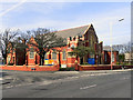
Images taken near to St. Johns Road, PR8 4JP and the surrounding area
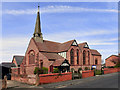
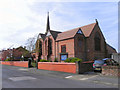

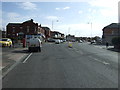
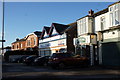
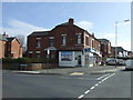
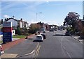
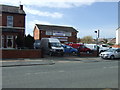
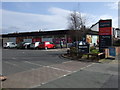
Please click the More button for more images, licensing and image copyright information.
Police
This area is policed by Merseyside Police.
Merseyside Police split their policing area into 139 separate neighbourhoods and this postcode is in the Birkdale neighbourhood.

Birkdale Neighbourhood Crime
Top 3 Categories
For full details of all categories together with more crime information, click on the Details button.
Member of UK Parliament
This postcode is in the Southport parliamentary constituency.
Southport is a constituency in the North West region of England. The seat has been held by Damien Moore (Conservative) since June 2017.

Most Recent House Sales for St. Johns Road, PR8 4JP
4 Aug 2023
23 Sep 2022
20 Jun 2022
28 Jan 2022
Local Petrol Station Prices
Coordinates for PR8 4JP
Residents at PR8 4JP
Sunrise and Sunset at PR8 4JP
Traffic Emission and Congestion Zones
Historical Weather Summary
| Clear | 18.02% |
| Cloudy | 58.26% |
| Rain | 7.83% |
| Windy | 15.86% |
| Other | 0.03% |
Population
Deprivation Index
the more deprived the postcode
Average Energy Performance
Companies Registered at PR8 4JP
Postcode Details for PR8 4JP
Recent Updates
|
18 Apr 2024 Added Traffic Camera Views from Traffic Scotland to Roadworks within Scotland |
|
15 Apr 2024 Schools Data updated for April 2024 |
|
10 Apr 2024 Companies Data updated for March 2024 |
|
7 Apr 2024 New option to receive automatic updates to roadworks that affect you |
|
7 Apr 2024 Police and Crime data updated for February 2024 |
|
3 Apr 2024 Sold House Price data updated for February 2024 |
|
30 Mar 2024 Energy Performance Certificates (England and Wales) updated February 2024 |
|
28 Mar 2024 New feature to use Geolocating functions to detect your current location |
Random Postcodes
Want an idea of what is in our extensive website? Try somewhere completely random!
The Rural/Urban classification is based upon data collected during the 2011 Census and released in August 2013 and is categorised into 6 distinct classes.
[A] Urban Major conurbation: A built up area with a population of 10,000 (3,000 in Scotland) or more and is assigned to the major conurbation settlement category.
[B] Urban Minor conurbation: A built up area with a population of 10,000 (3,000 in Scotland) or more and is assigned to the minor conurbation settlement category.
[C] Urban City and town: A built up area with a population of 10,000 (3,000 in Scotland) or more and is assigned to the city and town settlement category.
[D] Rural Town and fringe
[E] Rural Village
[F] Rural Hamlet and isolated dwelling
The Index of Multiple Deprivation (IMD) is the official measure of relative deprivation.
The index is based on 39 separate indicators across seven distinct domains (Income; Employment; Health and Disability; Education, Skills and Training; Crime; Barriers to Housing and Services; Living Environment) to provide an overall measure of multiple deprivation and is calculated for every neighbourhood.
The index is relative rather than an absolute scale and so a neighbourhood with a score of 10 is more deprived than one rated 20, but this does not equate to being twice as deprived.
Please note: Different indices are used in England, Scotland, Wales and Northern Ireland and so comparison of scores from neighbourhoods in different countries should not be undertaken.
These figures report on incorporated UK companies only that are registered at this postcode and do not include sole-traders, partnerships or overseas organisations.
The population figure shown for your area are an estimate provided by the Office for National Statistics and is rounded to the nearest 1,000.
The estimates are derived from the Annual Population Survey (APS) which is the Labour Force Survey (LFS) plus various sample boosts.
There are 36 metropolitan district councils which together cover 6 large urban areas: the counties of Greater Manchester, Merseyside, South Yorkshire, Tyne and Wear, West Midlands, and West Yorkshire.
Metropolitan districts are responsible for all services in their area, although certain conurbation wide services such as fire and civil defence, police, waste disposal and passenger transport are provided through joint authorities (the districts acting jointly).