Overview for Holker Close, PRESTON, PR5 0LS
Introduction
Preston is a city on the north bank of the River Ribble in Lancashire, England. The city is the administrative centre of the county of Lancashire and the wider City of Preston local government district. Preston and its surrounding district obtained city status in 2002, becoming England's 50th city in the 50th year of Queen Elizabeth II's reign. Preston has a population of 114,300, the City of Preston district 132,000 and the Preston Built-up Area 313,322. The Preston Travel To Work Area, in 2011, had a population of 420,661, compared with 354,000 in the previous census.
Preston and its surrounding area have provided evidence of ancient Roman activity, largely in the form of a Roman road that led to a camp at Walton-le-Dale. The Angles established Preston; its name is derived from the Old English meaning "priest's settlement" and in the Domesday Book is recorded as "Prestune". In the Middle Ages, Preston was a parish and township in the hundred of Amounderness and was granted a Guild Merchant charter in 1179, giving it the status of a market town. Textiles have been produced since the mid-13th century when locally produced wool was woven in people's houses. Flemish weavers who settled in the area in the 14th century helped develop the industry. In the early-18th century, Edmund Calamy described Preston as "a pretty town with an abundance of gentry in it, commonly called Proud Preston". Sir Richard Arkwright, inventor of the spinning frame, was born in the town. The most rapid period of growth and development coincided with the industrialisation and expansion of textile manufacturing. Preston was a boomtown of the Industrial Revolution, becoming a densely populated engineering centre, with large industrial plants. The town's textile sector fell into terminal decline from the mid-20th century and Preston has subsequently faced similar challenges to other post-industrial northern towns, including deindustrialisation, economic deprivation and housing issues.
Preston is the seat of Lancashire County Council, houses the main campus of the University of Central Lancashire (UCLan) and is home to Preston North End F.
C., a founder member of the Football League and the first English football champions.
The demonym for residents of the city is "Prestonian".
Summary for Holker Close, PRESTON, PR5 0LS
Roadworks near PR5 0LS
Road Safety near PR5 0LS
Details of personal injury accidents in and around Holker Close, PR5 0LS that have been reported to Lancashire Constabulary over the past 20 years.
Traffic Levels near PR5 0LS
View traffic levels near Holker Close, PR5 0LS from official Department for Transport counts.
Images taken near to Holker Close, PR5 0LS and the surrounding area
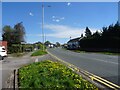
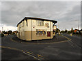
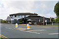
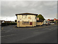
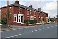
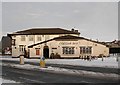
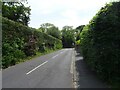
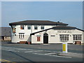
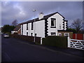
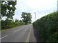
Please click the More button for more images, licensing and image copyright information.
Preston and nearby Videos From YouTube
Drone footage flying at sunset over the countryside
Flying at sunset over the countryside.
Channel: Simon Rosson (View Channel)
Published: 24 May 2023
Police
This area is policed by Lancashire Constabulary.
Lancashire Constabulary split their policing area into 236 separate neighbourhoods and this postcode is in the Coupe Green, Gregson Lane, Samlesbury, Walton neighbourhood.

Coupe Green, Gregson Lane, Samlesbury, Walton Neighbourhood Crime
Top 3 Categories
For full details of all categories together with more crime information, click on the Details button.
Member of UK Parliament
This postcode is in the Ribble Valley parliamentary constituency.
Ribble Valley is a constituency in the North West region of England. The seat has been held by Mr Nigel Evans (Conservative) since May 2010.

Most Recent House Sales for Holker Close, PR5 0LS
6 Apr 2023
7 Feb 2022
23 Apr 2019
15 Mar 2019
Local Petrol Station Prices
Coordinates for PR5 0LS
Residents at PR5 0LS
Sunrise and Sunset at PR5 0LS
Traffic Emission and Congestion Zones
Historical Weather Summary
| Clear | 16.03% |
| Cloudy | 52.16% |
| Rain | 8.63% |
| Windy | 23.08% |
| Other | 0.10% |
Population
Deprivation Index
the more deprived the postcode
Average Energy Performance
Companies Registered at PR5 0LS
Postcode Details for PR5 0LS
Recent Updates
|
18 Apr 2024 Added Traffic Camera Views from Traffic Scotland to Roadworks within Scotland |
|
15 Apr 2024 Schools Data updated for April 2024 |
|
10 Apr 2024 Companies Data updated for March 2024 |
|
7 Apr 2024 New option to receive automatic updates to roadworks that affect you |
|
7 Apr 2024 Police and Crime data updated for February 2024 |
|
3 Apr 2024 Sold House Price data updated for February 2024 |
|
30 Mar 2024 Energy Performance Certificates (England and Wales) updated February 2024 |
|
28 Mar 2024 New feature to use Geolocating functions to detect your current location |
Random Postcodes
Want an idea of what is in our extensive website? Try somewhere completely random!
The Rural/Urban classification is based upon data collected during the 2011 Census and released in August 2013 and is categorised into 6 distinct classes.
[A] Urban Major conurbation: A built up area with a population of 10,000 (3,000 in Scotland) or more and is assigned to the major conurbation settlement category.
[B] Urban Minor conurbation: A built up area with a population of 10,000 (3,000 in Scotland) or more and is assigned to the minor conurbation settlement category.
[C] Urban City and town: A built up area with a population of 10,000 (3,000 in Scotland) or more and is assigned to the city and town settlement category.
[D] Rural Town and fringe
[E] Rural Village
[F] Rural Hamlet and isolated dwelling
The Index of Multiple Deprivation (IMD) is the official measure of relative deprivation.
The index is based on 39 separate indicators across seven distinct domains (Income; Employment; Health and Disability; Education, Skills and Training; Crime; Barriers to Housing and Services; Living Environment) to provide an overall measure of multiple deprivation and is calculated for every neighbourhood.
The index is relative rather than an absolute scale and so a neighbourhood with a score of 10 is more deprived than one rated 20, but this does not equate to being twice as deprived.
Please note: Different indices are used in England, Scotland, Wales and Northern Ireland and so comparison of scores from neighbourhoods in different countries should not be undertaken.
These figures report on incorporated UK companies only that are registered at this postcode and do not include sole-traders, partnerships or overseas organisations.
The population figure shown for your area are an estimate provided by the Office for National Statistics and is rounded to the nearest 1,000.
The estimates are derived from the Annual Population Survey (APS) which is the Labour Force Survey (LFS) plus various sample boosts.
There are 26 county councils in 2-tier areas, providing services such as education, social services and waste disposal.
In 2-tier areas, each county council area is subdivided into districts, for which there is an independent district council. There are 192 district councils.
District councils are responsible for local services such as rubbish collection, housing and planning applications.