Overview for Havant Road, PORTSMOUTH, PO6 1DB
Introduction
Portsmouth (PORTS-məth) is a port city and unitary authority in Hampshire, England. Most of Portsmouth is located on Portsea Island, off the south coast of England in the Solent. This means Portsmouth is the only English city not located primarily on the mainland. Located 74 miles (119 km) south-west of London, 50 miles (80 km) west of Brighton and Hove, and 22 miles (35 km) south-east of Southampton; Portsmouth is part of the South Hampshire conurbation. It is the most densely populated city in the United Kingdom, with a population last recorded at 208,100.
Portsmouth's history can be traced to Roman times and has been a significant Royal Navy dockyard and base for centuries. Portsmouth was founded c. 1180 by Anglo-Norman merchant Jean de Gisors in the south-west area of Portsea Island, a location now known as Old Portsmouth. Around this time, de Gisors ordered the construction of a chapel dedicated to St Thomas Becket. This became a parish church by the 14th century. Portsmouth was established as a town with a royal charter on 2 May 1194. The city is home to the first drydock ever built. It was constructed by Henry VII in 1496.
Portsmouth was England's first line of defence during an attempted French invasion in 1545 at the Battle of the Solent, famously notable for the sinking of the carrack Mary Rose and witnessed by King Henry VIII of England from Southsea Castle. Portsmouth has the world's oldest dry dock, "The Great Stone Dock"; originally built in 1698, rebuilt in 1769 and presently known as "No.5 Dock". The world's first mass production line was established at the naval base's Block Mills which produced pulley blocks for the Royal Navy fleet. By the early-19th century, Portsmouth was the most heavily fortified city in the world, and was considered "the world's greatest naval port" at the height of the British Empire throughout Pax Britannica. By 1859, a ring of defensive land and sea forts, known as the Palmerston Forts had been built around Portsmouth in anticipation of an invasion from continental Europe.
In the 20th century, Portsmouth achieved city status on 21 April 1926. During the Second World War, the city was a pivotal embarkation point for the D-Day landings and was bombed extensively in the Portsmouth Blitz, which resulted in the deaths of 930 people. In 1982, a large Royal Navy task force departed from Portsmouth for the Falklands War. Her Majesty's Yacht Britannia was formerly based in Portsmouth and oversaw the transfer of Hong Kong in 1997, after which Britannia was retired from royal service, decommissioned and relocated to Leith as a museum ship.
HMNB Portsmouth is an operational Royal Navy base and is home to two-thirds of the UK's surface fleet. The base has long been nicknamed Pompey, a nickname it shares with the wider city of Portsmouth and Portsmouth Football Club. The naval base also contains the National Museum of the Royal Navy and Portsmouth Historic Dockyard; which has a collection of historic warships, including the Mary Rose, Lord Nelson's flagship, HMS Victory (the world's oldest naval ship still in commission), and HMS Warrior, the Royal Navy's first ironclad warship.
The former HMS Vernon shore establishment has been redeveloped into a large retail outlet destination known as Gunwharf Quays which opened in 2001. Portsmouth is among the few British cities with two cathedrals: the Anglican Cathedral of St Thomas and the Roman Catholic Cathedral of St John the Evangelist. The waterfront and Portsmouth Harbour are dominated by the Spinnaker Tower, one of the United Kingdom's tallest structures at 560 feet (170 m).
Southsea is Portsmouth's seaside resort, which was named after Southsea Castle. Southsea has two piers; Clarence Pier amusement park and South Parade Pier. The world's only regular hovercraft service operates from Southsea Hoverport to Ryde on the Isle of Wight. Southsea Common is a large open-air public recreation space which serves as a venue for a wide variety of annual events.
The city has several mainline railway stations that connect to London Victoria and London Waterloo amongst other lines in southern England. Portsmouth International Port is a commercial cruise ship and ferry port for international destinations. The port is the second busiest in the United Kingdom after Dover, handling around three million passengers a year. The city formerly had its own airport, Portsmouth Airport, until its closure in 1973. The University of Portsmouth enrols 23,000 students and is ranked among the world's best modern universities.
Portsmouth is the birthplace of notable people such as author Charles Dickens, engineer Isambard Kingdom Brunel, former Prime Minister James Callaghan, actor Peter Sellers and author-journalist Christopher Hitchens.
Summary for Havant Road, PORTSMOUTH, PO6 1DB
Roadworks near PO6 1DB
Road Safety near PO6 1DB
Details of personal injury accidents in and around Havant Road, PO6 1DB that have been reported to Hampshire Constabulary over the past 20 years.
Traffic Levels near PO6 1DB
View traffic levels near Havant Road, PO6 1DB from official Department for Transport counts.
Images taken near to Havant Road, PO6 1DB and the surrounding area
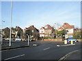
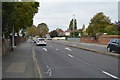
Please click the More button for more images, licensing and image copyright information.
Portsmouth and nearby Videos From YouTube
Southsea Esplanade (HD 1440 Drone Footage)
DJI Mini 2 1440 Drone footage of Southsea Esplanade, Hampshire. Contact me for stock footage enquiries. #dji #drone #mini2 ...
Channel: Simon Leslie (View Channel)
Published: 19 May 2021
Police
This area is policed by Hampshire Constabulary.
Hampshire Constabulary split their policing area into 95 separate neighbourhoods and this postcode is in the Cosham neighbourhood.

Cosham Neighbourhood Crime
Top 3 Categories
For full details of all categories together with more crime information, click on the Details button.
Member of UK Parliament
This postcode is in the Portsmouth North parliamentary constituency.
Portsmouth North is a constituency in the South East region of England. The seat has been held by Penny Mordaunt (Conservative) since May 2010.

Most Recent House Sales for Havant Road, PO6 1DB
29 Jun 2023
17 Aug 2018
12 Dec 2017
6 Nov 2015
Local Petrol Station Prices
Coordinates for PO6 1DB
Residents at PO6 1DB
Sunrise and Sunset at PO6 1DB
Traffic Emission and Congestion Zones
Historical Weather Summary
| Clear | 24.95% |
| Cloudy | 64.81% |
| Rain | 8.34% |
| Windy | 1.68% |
| Other | 0.22% |
Population
Deprivation Index
the more deprived the postcode
Average Energy Performance
Companies Registered at PO6 1DB
Postcode Details for PO6 1DB
Recent Updates
|
18 Apr 2024 Added Traffic Camera Views from Traffic Scotland to Roadworks within Scotland |
|
15 Apr 2024 Schools Data updated for April 2024 |
|
10 Apr 2024 Companies Data updated for March 2024 |
|
7 Apr 2024 New option to receive automatic updates to roadworks that affect you |
|
7 Apr 2024 Police and Crime data updated for February 2024 |
|
3 Apr 2024 Sold House Price data updated for February 2024 |
|
30 Mar 2024 Energy Performance Certificates (England and Wales) updated February 2024 |
|
28 Mar 2024 New feature to use Geolocating functions to detect your current location |
Random Postcodes
Want an idea of what is in our extensive website? Try somewhere completely random!
The Rural/Urban classification is based upon data collected during the 2011 Census and released in August 2013 and is categorised into 6 distinct classes.
[A] Urban Major conurbation: A built up area with a population of 10,000 (3,000 in Scotland) or more and is assigned to the major conurbation settlement category.
[B] Urban Minor conurbation: A built up area with a population of 10,000 (3,000 in Scotland) or more and is assigned to the minor conurbation settlement category.
[C] Urban City and town: A built up area with a population of 10,000 (3,000 in Scotland) or more and is assigned to the city and town settlement category.
[D] Rural Town and fringe
[E] Rural Village
[F] Rural Hamlet and isolated dwelling
The Index of Multiple Deprivation (IMD) is the official measure of relative deprivation.
The index is based on 39 separate indicators across seven distinct domains (Income; Employment; Health and Disability; Education, Skills and Training; Crime; Barriers to Housing and Services; Living Environment) to provide an overall measure of multiple deprivation and is calculated for every neighbourhood.
The index is relative rather than an absolute scale and so a neighbourhood with a score of 10 is more deprived than one rated 20, but this does not equate to being twice as deprived.
Please note: Different indices are used in England, Scotland, Wales and Northern Ireland and so comparison of scores from neighbourhoods in different countries should not be undertaken.
These figures report on incorporated UK companies only that are registered at this postcode and do not include sole-traders, partnerships or overseas organisations.
The population figure shown for your area are an estimate provided by the Office for National Statistics and is rounded to the nearest 1,000.
The estimates are derived from the Annual Population Survey (APS) which is the Labour Force Survey (LFS) plus various sample boosts.
There are 55 unitary authorities. They provide all local government services in their areas. These are mainly in the cities, urban areas and larger towns although there are now 6 shire county councils that are unitary (ie have no district councils beneath them).