Overview for Cecil Place, SOUTHSEA, PO5 3DL
Introduction
Southsea is a seaside resort and a geographic area of Portsmouth, Portsea Island in England. Southsea is located 1.8 miles (2.8 km) to the south of Portsmouth's inner city-centre. Southsea is not a separate town as all of Portsea Island's settlements (including Southsea) were incorporated into the boundaries of Portsmouth in 1904.
Southsea began as a fashionable 19th-century Victorian seaside resort named Croxton Town, after a Mr Croxton who owned the land. As the resort grew, it adopted the name of nearby Southsea Castle, a seafront fort constructed in 1544 to help defend the Solent and approaches to Portsmouth Harbour.
In 1879, South Parade Pier was opened by Princess Edward of Saxe-Weimar in Southsea. The pier began operating a passenger steamer service across the Solent to the Isle of Wight. This service gave rise to the idea of linking Southsea and its pier to Portsmouth's railway line, and for tourists to bypass the busy town of Portsmouth and its crowded harbour. East Southsea railway station, along with the Southsea Railway and Fratton railway station were jointly opened on 1 July 1885 by Lady Ada Mary Willis (née Neeld), wife of General Sir George Willis, the Lieutenant Governor of Portsmouth.
Southsea subsequently grew into a dense residential suburb and large, distinct commercial and entertainment area, separate from the town of Portsmouth up until Southsea and the whole of Portsea Island were incorporated into the town borough of Portsmouth in 1904.
Due to declining use and World War I, the Southsea Railway line and its East Southsea station were closed on 6 August 1914. To maintain Southsea's tourism, the Southsea station name was moved and merged with Portsmouth's main town centre railway station in 1925, officially becoming known as Portsmouth & Southsea railway station. A year later in 1926, Portsmouth was granted official city status, while its main railway station retained its "Portsmouth & Southsea" name, which has led many non-locals and visitors to wrongly assume that Southsea is still a separate town near to Portsmouth.
The areas of Southsea surrounding Albert Road, Palmerston Road, and Osborne Road contain many bars, restaurants and independent shops. Palmerston Road is the main High Street of Southsea and contains various shops and restaurants, as well as the local library, and Southsea Community Cinema and Arts Centre. Albert Road is a distinct street containing shopping and cultural venues, which include The Wedgewood Rooms, and the Kings Theatre, a regional theatre built in 1907.
Southsea retains its own post town status (PO4 and PO5), even though the actual town of Southsea was merged into Portsmouth in 1904.
Summary for Cecil Place, SOUTHSEA, PO5 3DL
Roadworks near PO5 3DL
Road Safety near PO5 3DL
Details of personal injury accidents in and around Cecil Place, PO5 3DL that have been reported to Hampshire Constabulary over the past 20 years.
Traffic Levels near PO5 3DL
View traffic levels near Cecil Place, PO5 3DL from official Department for Transport counts.
Images taken near to Cecil Place, PO5 3DL and the surrounding area
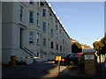
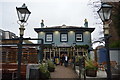
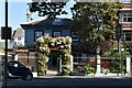
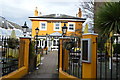
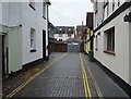
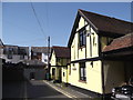
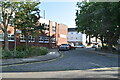
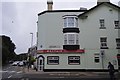
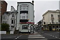
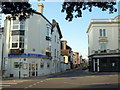
Please click the More button for more images, licensing and image copyright information.
Police
This area is policed by Hampshire Constabulary.
Hampshire Constabulary split their policing area into 95 separate neighbourhoods and this postcode is in the St Thomas neighbourhood.

St Thomas Neighbourhood Crime
Top 3 Categories
For full details of all categories together with more crime information, click on the Details button.
Member of UK Parliament
This postcode is in the Portsmouth South parliamentary constituency.
Portsmouth South is a constituency in the South East region of England. The seat has been held by Stephen Morgan (Labour) since June 2017.

Most Recent House Sales for Cecil Place, PO5 3DL
23 Jun 2017
2 Apr 2013
6 Sep 2010
28 Apr 2008
Local Petrol Station Prices
Coordinates for PO5 3DL
Residents at PO5 3DL
Sunrise and Sunset at PO5 3DL
Traffic Emission and Congestion Zones
Historical Weather Summary
| Clear | 20.77% |
| Cloudy | 48.00% |
| Rain | 7.26% |
| Windy | 23.65% |
| Other | 0.32% |
Population
Deprivation Index
the more deprived the postcode
Average Energy Performance
Companies Registered at PO5 3DL
Postcode Details for PO5 3DL
Recent Updates
|
18 Apr 2024 Added Traffic Camera Views from Traffic Scotland to Roadworks within Scotland |
|
15 Apr 2024 Schools Data updated for April 2024 |
|
10 Apr 2024 Companies Data updated for March 2024 |
|
7 Apr 2024 New option to receive automatic updates to roadworks that affect you |
|
7 Apr 2024 Police and Crime data updated for February 2024 |
|
3 Apr 2024 Sold House Price data updated for February 2024 |
|
30 Mar 2024 Energy Performance Certificates (England and Wales) updated February 2024 |
|
28 Mar 2024 New feature to use Geolocating functions to detect your current location |
Random Postcodes
Want an idea of what is in our extensive website? Try somewhere completely random!
The Rural/Urban classification is based upon data collected during the 2011 Census and released in August 2013 and is categorised into 6 distinct classes.
[A] Urban Major conurbation: A built up area with a population of 10,000 (3,000 in Scotland) or more and is assigned to the major conurbation settlement category.
[B] Urban Minor conurbation: A built up area with a population of 10,000 (3,000 in Scotland) or more and is assigned to the minor conurbation settlement category.
[C] Urban City and town: A built up area with a population of 10,000 (3,000 in Scotland) or more and is assigned to the city and town settlement category.
[D] Rural Town and fringe
[E] Rural Village
[F] Rural Hamlet and isolated dwelling
The Index of Multiple Deprivation (IMD) is the official measure of relative deprivation.
The index is based on 39 separate indicators across seven distinct domains (Income; Employment; Health and Disability; Education, Skills and Training; Crime; Barriers to Housing and Services; Living Environment) to provide an overall measure of multiple deprivation and is calculated for every neighbourhood.
The index is relative rather than an absolute scale and so a neighbourhood with a score of 10 is more deprived than one rated 20, but this does not equate to being twice as deprived.
Please note: Different indices are used in England, Scotland, Wales and Northern Ireland and so comparison of scores from neighbourhoods in different countries should not be undertaken.
These figures report on incorporated UK companies only that are registered at this postcode and do not include sole-traders, partnerships or overseas organisations.
The population figure shown for your area are an estimate provided by the Office for National Statistics and is rounded to the nearest 1,000.
The estimates are derived from the Annual Population Survey (APS) which is the Labour Force Survey (LFS) plus various sample boosts.
There are 55 unitary authorities. They provide all local government services in their areas. These are mainly in the cities, urban areas and larger towns although there are now 6 shire county councils that are unitary (ie have no district councils beneath them).