Overview for Arctic Road, COWES, PO31 7AG
Introduction
Cowes is an English seaport town and civil parish on the Isle of Wight. Cowes is located on the west bank of the estuary of the River Medina, facing the smaller town of East Cowes on the east bank. The two towns are linked by the Cowes Floating Bridge, a chain ferry.
Cowes has a population of 14,370 according to the 2021 Census.
Charles Godfrey Leland's 19th-century verses describe the towns poetically as "The two great Cowes that in loud thunder roar/This on the eastern, that the western shore".
Cowes has been seen as a home for international yacht racing since the founding of the Royal Yacht Squadron in 1815. It gives its name to the world's oldest regular regatta, Cowes Week, which occurs annually in the first week of August. Later, powerboat races are held.
Much of the town's architecture is still heavily influenced by the style of ornate building that Prince Albert popularised.
Summary for Arctic Road, COWES, PO31 7AG
Roadworks near PO31 7AG
Road Safety near PO31 7AG
Details of personal injury accidents in and around Arctic Road, PO31 7AG that have been reported to Hampshire Constabulary over the past 20 years.
Traffic Levels near PO31 7AG
View traffic levels near Arctic Road, PO31 7AG from official Department for Transport counts.
Images taken near to Arctic Road, PO31 7AG and the surrounding area
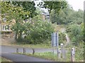
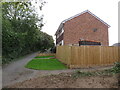
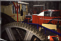
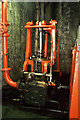
Please click the More button for more images, licensing and image copyright information.
Police
This area is policed by Hampshire Constabulary.
Hampshire Constabulary split their policing area into 95 separate neighbourhoods and this postcode is in the Cowes neighbourhood.

Cowes Neighbourhood Crime
Top 3 Categories
For full details of all categories together with more crime information, click on the Details button.
Member of UK Parliament
This postcode is in the Isle of Wight parliamentary constituency.
Isle of Wight is a constituency in the South East region of England. The seat has been held by Bob Seely (Conservative) since June 2017.

Most Recent House Sales for Arctic Road, PO31 7AG
1 Dec 2022
5 Apr 2022
17 Jan 2022
3 Oct 2014
Local Petrol Station Prices
Coordinates for PO31 7AG
Residents at PO31 7AG
Sunrise and Sunset at PO31 7AG
Traffic Emission and Congestion Zones
Historical Weather Summary
| Clear | 12.67% |
| Cloudy | 69.20% |
| Rain | 10.18% |
| Windy | 7.90% |
| Other | 0.05% |
Population
Deprivation Index
the more deprived the postcode
Average Energy Performance
Companies Registered at PO31 7AG
Postcode Details for PO31 7AG
Recent Updates
|
18 Apr 2024 Added Traffic Camera Views from Traffic Scotland to Roadworks within Scotland |
|
15 Apr 2024 Schools Data updated for April 2024 |
|
10 Apr 2024 Companies Data updated for March 2024 |
|
7 Apr 2024 New option to receive automatic updates to roadworks that affect you |
|
7 Apr 2024 Police and Crime data updated for February 2024 |
|
3 Apr 2024 Sold House Price data updated for February 2024 |
|
30 Mar 2024 Energy Performance Certificates (England and Wales) updated February 2024 |
|
28 Mar 2024 New feature to use Geolocating functions to detect your current location |
Random Postcodes
Want an idea of what is in our extensive website? Try somewhere completely random!
The Rural/Urban classification is based upon data collected during the 2011 Census and released in August 2013 and is categorised into 6 distinct classes.
[A] Urban Major conurbation: A built up area with a population of 10,000 (3,000 in Scotland) or more and is assigned to the major conurbation settlement category.
[B] Urban Minor conurbation: A built up area with a population of 10,000 (3,000 in Scotland) or more and is assigned to the minor conurbation settlement category.
[C] Urban City and town: A built up area with a population of 10,000 (3,000 in Scotland) or more and is assigned to the city and town settlement category.
[D] Rural Town and fringe
[E] Rural Village
[F] Rural Hamlet and isolated dwelling
The Index of Multiple Deprivation (IMD) is the official measure of relative deprivation.
The index is based on 39 separate indicators across seven distinct domains (Income; Employment; Health and Disability; Education, Skills and Training; Crime; Barriers to Housing and Services; Living Environment) to provide an overall measure of multiple deprivation and is calculated for every neighbourhood.
The index is relative rather than an absolute scale and so a neighbourhood with a score of 10 is more deprived than one rated 20, but this does not equate to being twice as deprived.
Please note: Different indices are used in England, Scotland, Wales and Northern Ireland and so comparison of scores from neighbourhoods in different countries should not be undertaken.
These figures report on incorporated UK companies only that are registered at this postcode and do not include sole-traders, partnerships or overseas organisations.
The population figure shown for your area are an estimate provided by the Office for National Statistics and is rounded to the nearest 1,000.
The estimates are derived from the Annual Population Survey (APS) which is the Labour Force Survey (LFS) plus various sample boosts.
There are 55 unitary authorities. They provide all local government services in their areas. These are mainly in the cities, urban areas and larger towns although there are now 6 shire county councils that are unitary (ie have no district councils beneath them).