Overview for Beach View Crescent, PLYMOUTH, PL9 0HL
Introduction
Plymouth is a port city and unitary authority in South West England. It is located on the south coast of Devon, approximately 36 miles (58 km) south-west of Exeter and 193 miles (311 km) south-west of London. It is bordered by Cornwall to the west and south-west.
Plymouth's early history extends to the Bronze Age when a settlement emerged at Mount Batten, which was a trading post for the Roman Empire. By the ninth century Mount Batten had been surpassed by the village of Sutton on the opposite side of the mouth of the River Plym. Sutton was granted a charter making it a market town in 1254. As Sutton grew it also became known as Plymouth, with the change of name being formalised in 1439 when it was made a borough.
In 1588, an English fleet based in Plymouth intercepted and defeated the Spanish Armada. In 1620, the Pilgrim Fathers departed Plymouth for the New World and established Plymouth Colony, the second English settlement in what is now the United States of America. During the English Civil War, the town was held by the Parliamentarians and was besieged between 1642 and 1646.
Throughout the Industrial Revolution, Plymouth grew as a commercial shipping port, handling imports and passengers from the Americas, and exporting local minerals (tin, copper, lime, china clay and arsenic). From 1690 onwards a new dock for the Royal Navy was built on the banks of the River Tamar, 2 miles (3.2 km) west of Plymouth, around which grew a town called "Plymouth Dock", renamed Devonport in 1824. In 1914 Devonport and the neighbouring town of East Stonehouse were absorbed into the borough of Plymouth. Plymouth was awarded city status in 1928.
During World War II, due to the city's naval importance, the German military targeted and partially destroyed the city by bombing, an act known as the Plymouth Blitz. After the war, the city centre was completely rebuilt. Subsequent expansion led to the incorporation of Plympton, Plymstock, and other outlying suburbs, in 1967.
The city is home to 264,695 (2021) people, making it the 30th-most populous built-up area in the United Kingdom and the second-largest city in the South West, after Bristol. It is governed locally by Plymouth City Council and is represented nationally by two MPs. Plymouth's economy remains strongly influenced by shipbuilding and seafaring but has tended toward a service economy since the 1990s. It has ferry links to Brittany (Roscoff and St Malo) and to Spain (Santander). It has the largest operational naval base in Western Europe, HMNB Devonport, and is home to the University of Plymouth. Plymouth is categorized as a Small-Port City using the Southampton System for port-city classification.
Summary for Beach View Crescent, PLYMOUTH, PL9 0HL
Roadworks near PL9 0HL
Road Safety near PL9 0HL
Details of personal injury accidents in and around Beach View Crescent, PL9 0HL that have been reported to Devon & Cornwall Police over the past 20 years.
Traffic Levels near PL9 0HL
View traffic levels near Beach View Crescent, PL9 0HL from official Department for Transport counts.
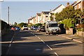
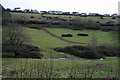
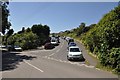
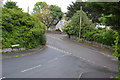
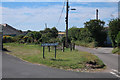
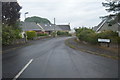
Images taken near to Beach View Crescent, PL9 0HL and the surrounding area
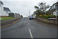
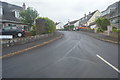
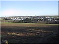
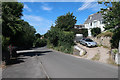
Please click the More button for more images, licensing and image copyright information.
Plymouth and nearby Videos From YouTube
Aerial footage of Drake's Island in Plymouth Sound by drone.
A short video of Drake's Island in Plymouth Sound. This a small island, a short distance from the town. It's had a really long history ...
Channel: Steve Ball (View Channel)
Published: 31 Jul 2023
Member of UK Parliament
This postcode is in the South West Devon parliamentary constituency.
South West Devon is a constituency in the South West region of England. The seat has been held by Sir Gary Streeter (Conservative) since May 2010.

Most Recent House Sales for Beach View Crescent, PL9 0HL
15 Dec 2023
6 May 2016
6 May 2014
29 Jan 2014
Local Petrol Station Prices
Coordinates for PL9 0HL
Residents at PL9 0HL
Sunrise and Sunset at PL9 0HL
Traffic Emission and Congestion Zones
Historical Weather Summary
| Clear | 8.92% |
| Cloudy | 34.13% |
| Rain | 11.57% |
| Windy | 45.37% |
| Other | 0.01% |
Population
Deprivation Index
the more deprived the postcode
Average Energy Performance
Companies Registered at PL9 0HL
Postcode Details for PL9 0HL
Recent Updates
|
18 Apr 2024 Added Traffic Camera Views from Traffic Scotland to Roadworks within Scotland |
|
15 Apr 2024 Schools Data updated for April 2024 |
|
10 Apr 2024 Companies Data updated for March 2024 |
|
7 Apr 2024 New option to receive automatic updates to roadworks that affect you |
|
7 Apr 2024 Police and Crime data updated for February 2024 |
|
3 Apr 2024 Sold House Price data updated for February 2024 |
|
30 Mar 2024 Energy Performance Certificates (England and Wales) updated February 2024 |
|
28 Mar 2024 New feature to use Geolocating functions to detect your current location |
Random Postcodes
Want an idea of what is in our extensive website? Try somewhere completely random!
The Rural/Urban classification is based upon data collected during the 2011 Census and released in August 2013 and is categorised into 6 distinct classes.
[A] Urban Major conurbation: A built up area with a population of 10,000 (3,000 in Scotland) or more and is assigned to the major conurbation settlement category.
[B] Urban Minor conurbation: A built up area with a population of 10,000 (3,000 in Scotland) or more and is assigned to the minor conurbation settlement category.
[C] Urban City and town: A built up area with a population of 10,000 (3,000 in Scotland) or more and is assigned to the city and town settlement category.
[D] Rural Town and fringe
[E] Rural Village
[F] Rural Hamlet and isolated dwelling
The Index of Multiple Deprivation (IMD) is the official measure of relative deprivation.
The index is based on 39 separate indicators across seven distinct domains (Income; Employment; Health and Disability; Education, Skills and Training; Crime; Barriers to Housing and Services; Living Environment) to provide an overall measure of multiple deprivation and is calculated for every neighbourhood.
The index is relative rather than an absolute scale and so a neighbourhood with a score of 10 is more deprived than one rated 20, but this does not equate to being twice as deprived.
Please note: Different indices are used in England, Scotland, Wales and Northern Ireland and so comparison of scores from neighbourhoods in different countries should not be undertaken.
These figures report on incorporated UK companies only that are registered at this postcode and do not include sole-traders, partnerships or overseas organisations.
The population figure shown for your area are an estimate provided by the Office for National Statistics and is rounded to the nearest 1,000.
The estimates are derived from the Annual Population Survey (APS) which is the Labour Force Survey (LFS) plus various sample boosts.
There are 26 county councils in 2-tier areas, providing services such as education, social services and waste disposal.
In 2-tier areas, each county council area is subdivided into districts, for which there is an independent district council. There are 192 district councils.
District councils are responsible for local services such as rubbish collection, housing and planning applications.