Overview for Ash Grove, IVYBRIDGE, PL21 0HX
Introduction
Ivybridge is a town and civil parish in the South Hams, in Devon, England. It lies about thirteen miles (twenty-one kilometres) east of Plymouth. It is at the southern extremity of Dartmoor, a National Park of England and Wales and lies along the A38 "Devon Expressway" road. There are two electoral wards in Ivybridge East and Ivybridge West with a total population of 11,851.
Mentioned in documents as early as the 13th century, Ivybridge's early history is marked by its status as an important crossing-point over the River Erme on the road from Exeter to Plymouth. In the 16th century mills were built using the River Erme's power. The parish of Saint John was formed in 1836. Ivybridge became a civil parish in 1894 and a town in 1977.
The early urbanisation and development of Ivybridge largely coincided with the Industrial Revolution. Stowford Paper Mill was built in 1787 and rebuilt again in the 1860s with extensive investment. In 1848 the South Devon Railway arrived on the northern edge of the village. The paper mill closed in 2013 after 226 years in Ivybridge and the buildings are being converted to homes and shops. Ivybridge is often referred to as a commuter town, although a small proportion of people work in the town itself, and agriculture continues to play an economic role for the surrounding area. The area surrounding Ivybridge is varied and complex, including river valleys, farmland and dense woodland.
While heavy industry diminished during the latter half of the 20th century, the population grew significantly from 1,574 people in 1921 to 12,056 in 2001.
Summary for Ash Grove, IVYBRIDGE, PL21 0HX
Roadworks near PL21 0HX
Road Safety near PL21 0HX
Details of personal injury accidents in and around Ash Grove, PL21 0HX that have been reported to Devon & Cornwall Police over the past 20 years.
Traffic Levels near PL21 0HX
View traffic levels near Ash Grove, PL21 0HX from official Department for Transport counts.
Images taken near to Ash Grove, PL21 0HX and the surrounding area


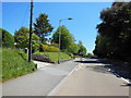
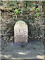
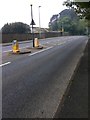
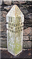
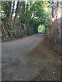
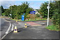
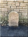
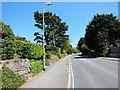
Please click the More button for more images, licensing and image copyright information.
Member of UK Parliament
This postcode is in the South West Devon parliamentary constituency.
South West Devon is a constituency in the South West region of England. The seat has been held by Sir Gary Streeter (Conservative) since May 2010.

Most Recent House Sales for Ash Grove, PL21 0HX
14 Nov 2023
7 Oct 2022
14 May 2021
6 Jan 2021
Local Petrol Station Prices
Coordinates for PL21 0HX
Residents at PL21 0HX
Sunrise and Sunset at PL21 0HX
Traffic Emission and Congestion Zones
Historical Weather Summary
| Clear | 7.52% |
| Cloudy | 57.86% |
| Rain | 14.45% |
| Windy | 18.62% |
| Other | 1.55% |
Population
Deprivation Index
the more deprived the postcode
Average Energy Performance
Companies Registered at PL21 0HX
Postcode Details for PL21 0HX
Recent Updates
|
18 Apr 2024 Added Traffic Camera Views from Traffic Scotland to Roadworks within Scotland |
|
15 Apr 2024 Schools Data updated for April 2024 |
|
10 Apr 2024 Companies Data updated for March 2024 |
|
7 Apr 2024 New option to receive automatic updates to roadworks that affect you |
|
7 Apr 2024 Police and Crime data updated for February 2024 |
|
3 Apr 2024 Sold House Price data updated for February 2024 |
|
30 Mar 2024 Energy Performance Certificates (England and Wales) updated February 2024 |
|
28 Mar 2024 New feature to use Geolocating functions to detect your current location |
Random Postcodes
Want an idea of what is in our extensive website? Try somewhere completely random!
The Rural/Urban classification is based upon data collected during the 2011 Census and released in August 2013 and is categorised into 6 distinct classes.
[A] Urban Major conurbation: A built up area with a population of 10,000 (3,000 in Scotland) or more and is assigned to the major conurbation settlement category.
[B] Urban Minor conurbation: A built up area with a population of 10,000 (3,000 in Scotland) or more and is assigned to the minor conurbation settlement category.
[C] Urban City and town: A built up area with a population of 10,000 (3,000 in Scotland) or more and is assigned to the city and town settlement category.
[D] Rural Town and fringe
[E] Rural Village
[F] Rural Hamlet and isolated dwelling
The Index of Multiple Deprivation (IMD) is the official measure of relative deprivation.
The index is based on 39 separate indicators across seven distinct domains (Income; Employment; Health and Disability; Education, Skills and Training; Crime; Barriers to Housing and Services; Living Environment) to provide an overall measure of multiple deprivation and is calculated for every neighbourhood.
The index is relative rather than an absolute scale and so a neighbourhood with a score of 10 is more deprived than one rated 20, but this does not equate to being twice as deprived.
Please note: Different indices are used in England, Scotland, Wales and Northern Ireland and so comparison of scores from neighbourhoods in different countries should not be undertaken.
These figures report on incorporated UK companies only that are registered at this postcode and do not include sole-traders, partnerships or overseas organisations.
The population figure shown for your area are an estimate provided by the Office for National Statistics and is rounded to the nearest 1,000.
The estimates are derived from the Annual Population Survey (APS) which is the Labour Force Survey (LFS) plus various sample boosts.
There are 26 county councils in 2-tier areas, providing services such as education, social services and waste disposal.
In 2-tier areas, each county council area is subdivided into districts, for which there is an independent district council. There are 192 district councils.
District councils are responsible for local services such as rubbish collection, housing and planning applications.